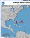
-
Hello, please take a minute to check out our awesome content, contributed by the wonderful members of our community. We hope you'll add your own thoughts and opinions by making a free account!
You are using an out of date browser. It may not display this or other websites correctly.
You should upgrade or use an alternative browser.
You should upgrade or use an alternative browser.
Tropical 2025 Tropical Thread
- Thread starter SD
- Start date
ya rolling stable air injections since mid august haven't been idealThe early cold fronts/shear
I will stress however that last year Helene and Milton were still to come
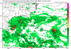
interesting times ahead. however very hard to bank on any solution with two storms in the mix- no model is going to have a handle on how their outflows could destructively interfere with one another (if a storm even forms)- sit and gawk at the fun runs but don't get too wrapped up in them eitherEPS is quite aggressive. Several hurricane landfalls. This is inside 10 days too View attachment 175017
Westerly shear decided to have a stay-cation there this summer.Question for you men. Why is the Gulf so quite this year?
The westerly shear is the biggest issue in what has been a quiet Gulf basin this year. Water temperatures are plenty warm and the MJO is supposed to shift into a more favorable phase for development soon which should lessen the shear so that the Gulf might finally get things going within the next couple of weeks.Question for you men. Why is the Gulf so quite this year?
Worst case scenario but least likely here as far as wind/surge is ull tucked over Birmingham, 94l dissolves, 93L has a semi free environment as it moves towards the EC
lexxnchloe
Member
12 Z models trending well east for both.
Stormsfury
Member
To add to Joaquin information. It was the outflow channel that fed directly into the upper level bowling ball that fed directly into strong divergence from the upper low, creating a channel of deep thunderstorms that trained across the region, dumping substantial amounts of unrelenting rainfall across SCThat major Carolina rainfall generated flooding, especially in the CHS-CAE corridor, was an amazingly strange setup:
Although Joaquin ultimately tracked far to the east of the United States, a non-tropical low over the Southeast tapped into the hurricane's moisture. An atmospheric river developed between the two systems, resulting in record-shattering rains and flooding across North and South Carolina. Several areas of South Carolina saw accumulations exceeding the threshold for a 1-in-1,000-year event. The subsequent floods inundated large areas of the state—with areas around Charleston and Columbia hardest-hit—and killed 19 people.

Hurricane Joaquin - Wikipedia
en.m.wikipedia.org
Ensembles actually went West on Euro. Gfs a tad East.12 Z models trending well east for both.
lexxnchloe
Member
lexxnchloe
Member
It's relentless.
Brent
Member
Oh now the GFS wants endless hurricanes /s
Downeastnc
Member
lexxnchloe
Member
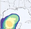
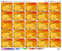
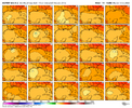
Per the latest Euro Weeklies: After Humberto and Imelda wind down ~10/4-5, there looks to be a brief break overall.
However, don’t get too comfortable as activity markedly picks up again to above normal on the run in the Gulf, NW Caribbean, and SW Atlantic (including Yucatan, Cuba, NC/NE US Gulf coast, FL/SE US coast, Bahamas, and Bermuda) with 140% of normal 10/13-19 and 160% of normal 10/20-26. This would be a 3rd peak of sorts for 2025 should it verify. This active period would resemble a somewhat toned down version of the freakishly active late seasons of 2020 and 2005 and similar to 1950, 1878, and 1870 for that area.
10/13-19:
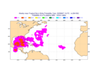
10/20-26:
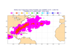
However, don’t get too comfortable as activity markedly picks up again to above normal on the run in the Gulf, NW Caribbean, and SW Atlantic (including Yucatan, Cuba, NC/NE US Gulf coast, FL/SE US coast, Bahamas, and Bermuda) with 140% of normal 10/13-19 and 160% of normal 10/20-26. This would be a 3rd peak of sorts for 2025 should it verify. This active period would resemble a somewhat toned down version of the freakishly active late seasons of 2020 and 2005 and similar to 1950, 1878, and 1870 for that area.
10/13-19:

10/20-26:

accu35
Member
Looks like some sort of a northern gulf low on the gfs next week?
Looks like some sort of a northern gulf low on the gfs next week?
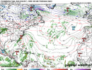
I wasn’t paying any attention to the Gulf at all due to Humberto and TD9 til just now. I just noticed on the most recent runs that just about all models have a weak but notable surface low/spin initialized in the C Gulf that then drifts SW to the Bay of Campeche, where it seems to stall just W of the Yucatan at ~hour 96. Interesting.
And lo and behold, there’s a TD on the UKMET (12Z) for the first time in the Bay of Campeche at hour 120 that then drifts N through the end of the run to a threatening position in the W central Gulf. I just saw new UK maps and this UK TD is from the same low that’s now in the C Gulf!
NEW TROPICAL CYCLONE FORECAST TO DEVELOP AFTER 120 HOURS
FORECAST POSITION AT T+120 : 20.7N 93.3W
LEAD CENTRAL MAXIMUM WIND
VERIFYING TIME TIME POSITION PRESSURE (MB) SPEED (KNOTS)
-------------- ---- -------- ------------- -------------
1200UTC 03.10.2025 120 20.7N 93.3W 1009 26
0000UTC 04.10.2025 132 21.1N 93.0W 1007 25
1200UTC 04.10.2025 144 22.3N 93.0W 1005 30
0000UTC 05.10.2025 156 22.8N 92.8W 1004 24
1200UTC 05.10.2025 168 24.4N 92.8W 1005 26
———————
12Z UKMET at 168 hours: this TD originates from the current C Gulf low and this becomes a TD on this run at 120, which moves N to this position at the end of the run (168):
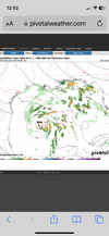
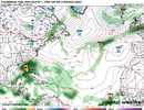
Also, as accu was referring to, check out the 12Z GFS at 168: there’s a TD that forms off of LA that then moves N into that state. That may or may not be directly related to the current C Gulf low, however, based on looking at vorticity maps.
Last edited:
Followup to my post above:
The 0Z UKMET (a model that tends to be a bit more stingy with TCG than the GFS) is the 2nd run in a row that develops a TC from the current C Gulf weak surface low after it moves S into the Bay of Campeche. This run actually has minimal TS winds early on. Whereas the prior run then moved it into a threatening position in the W-C Gulf, this run only moves it slowly back N to the end of the run:
NEW TROPICAL CYCLONE FORECAST TO DEVELOP AFTER 108 HOURS
FORECAST POSITION AT T+108 : 19.9N 94.7W
LEAD CENTRAL MAXIMUM WIND
VERIFYING TIME TIME POSITION PRESSURE (MB) SPEED (KNOTS)
-------------- ---- -------- ------------- -------------
1200UTC 03.10.2025 108 19.9N 94.7W 1009 36
0000UTC 04.10.2025 120 19.7N 93.9W 1008 31
1200UTC 04.10.2025 132 19.5N 93.9W 1006 31
0000UTC 05.10.2025 144 20.1N 94.2W 1005 29
1200UTC 05.10.2025 156 20.2N 94.0W 1005 26
0000UTC 06.10.2025 168 20.7N 94.5W 1004 27
@accu35
accu35
Member
Thank you Larry as always.Followup to my post above:
The 0Z UKMET (a model that tends to be a bit more stingy with TCG than the GFS) is the 2nd run in a row that develops a TC from the current C Gulf weak surface low after it moves S into the Bay of Campeche. This run actually has minimal TS winds early on. Whereas the prior run then moved it into a threatening position in the W-C Gulf, this run only moves it slowly back N to the end of the run:
NEW TROPICAL CYCLONE FORECAST TO DEVELOP AFTER 108 HOURS
FORECAST POSITION AT T+108 : 19.9N 94.7W
LEAD CENTRAL MAXIMUM WIND
VERIFYING TIME TIME POSITION PRESSURE (MB) SPEED (KNOTS)
-------------- ---- -------- ------------- -------------
1200UTC 03.10.2025 108 19.9N 94.7W 1009 36
0000UTC 04.10.2025 120 19.7N 93.9W 1008 31
1200UTC 04.10.2025 132 19.5N 93.9W 1006 31
0000UTC 05.10.2025 144 20.1N 94.2W 1005 29
1200UTC 05.10.2025 156 20.2N 94.0W 1005 26
0000UTC 06.10.2025 168 20.7N 94.5W 1004 27
@accu35
accu35
Member
Brent
Member
Wonder when we will have storms this close together in the Atlantic again? I’ll bet a decade +
View attachment 175278
I was about to say I know neither one is particularly exciting to some people but just to see them that close to each other is noteworthy for sure
Also not many years have had 2 category 5 hurricanes
The 30 year average (1991-2020) ACE as of Sept 30th is 94. 2025 is projected to get pretty close to that making it near the active era average for the end of Sept.
Looking ahead: the Euro Weeklies, weak La Niña, and recent active late seasons tell me that ending the season at least near the 30 year average of 122 is likely. Even my pre-season prog of 139 is in reach.
Looking ahead: the Euro Weeklies, weak La Niña, and recent active late seasons tell me that ending the season at least near the 30 year average of 122 is likely. Even my pre-season prog of 139 is in reach.
Last edited:
Noles1812
Member
I think Ace is dumb data but i get why they use it. No landfalls is all I look at and the gulf has been dead all yea, even in the spring it wasn't as active for severe weather.
i like it. it's satisfying that it gives a premium to upper echelon storms like humberto that otherwise wouldn't be recorded in raw statsI think Ace is dumb data but i get why they use it. No landfalls is all I look at and the gulf has been dead all yea, even in the spring it wasn't as active for severe weather.
Brent
Member
We'll never even know how strong Humberto was this weekend because they kept sending recon into Imelda but it was definitely a higher end 5 probably
It's really been historic just a few hundred miles off the east coast. A lot of years never even have one cat 5 and there's been two this year
It's really been historic just a few hundred miles off the east coast. A lot of years never even have one cat 5 and there's been two this year
lexxnchloe
Member
Exciting!!!Hey accu,
1. What is that from?
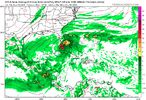
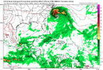
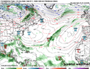
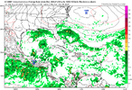
2. A notable number of 6Z EPS members at 144 (~1/3) have a surface low in the Gulf (mainly northern portion) from something:
View attachment 175279View attachment 175280
accu35
Member
I believe that’s from the BOC area but not sure just yet, because there’s an old frontal tail end that spins up towards the northern gulf. I believe we are seeing two different possibilities.Hey accu,
1. What is that from?
2. A notable number of 6Z EPS members at 144 (~1/3) have a surface low in the Gulf (mainly northern portion) from something:
View attachment 175279View attachment 175280
I believe that’s from the BOC area but not sure just yet, because there’s an old frontal tail end that spins up towards the northern gulf. I believe we are seeing two different possibilities.
I meant where is that rainfall from on your map? What model?
I was about to say I know neither one is particularly exciting to some people but just to see them that close to each other is noteworthy for sure
Also not many years have had 2 category 5 hurricanes
It’s hard to imagine true tropical enthusiasts not finding all of this fascinating. I’m not talking about storm chasers who are only interested in US landfalls. I mean pure tropical enthusiasts.
lexxnchloe
Member
Josh is NOT fascinated, lolIt’s hard to imagine true tropical enthusiasts not finding all of this fascinating. I’m not talking about storm chasers who are only interested in US landfalls. I mean pure tropical enthusiasts.
If you read the comments he gets the same thing i get here, lol
lexxnchloe
Member
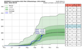
The 2025 ACE is now up to ~80, or near the 1951-2024 avg with it rising rapidly. I project it to reach ~88 as of the end of Sept, which compares to 94 for 1991-2020 and ~81.5 for 1951-2024. So, essentially 2025 will go in the books as NN through Sept.
Humberto and Imelda should get 2025 to ~95 in early Oct. (near normal for then per 1991-2020).
As of 9/30, 2025 will exceed 2024 and 2022 by 9-10 and be only ~2 under 2018. The 88 would move 2025 ahead of 1971 and 1981, which would then move 2025 up to 30th highest of the last 75 years. This chart’s avg. is based on 1951-2024, which is lower than 1991-2020. That’s why 2025 has already hit the avg line:

lexxnchloe
Member
The 12Z Icon, GFS, and CMC all have Gulf tropical activity by 192. So, the Gulf looks somewhat active (more active than most of the season so far in the up to day 8 output). However, the UKMET, which goes out only 168, did drop the Gulf TC per its textual output that it had on its prior 2 runs.
Last edited:
lexxnchloe
Member
lexxnchloe
Member
JHS
Member
Something like this is the US's only chance of a real hit from the tropics this year.

