-
Hello, please take a minute to check out our awesome content, contributed by the wonderful members of our community. We hope you'll add your own thoughts and opinions by making a free account!
You are using an out of date browser. It may not display this or other websites correctly.
You should upgrade or use an alternative browser.
You should upgrade or use an alternative browser.
Pattern Outside of the SE thread
- Thread starter SD
- Start date
Brent
Member
BufordWX
Member
Drizzle Snizzle
Member
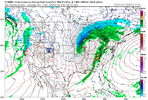
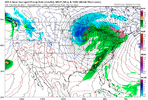
Ground temps may be an issue lolGFS has 70s and 80s next Friday, and then it shows this the next day. LolView attachment 171373
Brent
Member
GFS has 70s and 80s next Friday, and then it shows this the next day. LolView attachment 171373
That timeframe has had a signal since it was 2 weeks out
BufordWX
Member
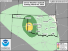
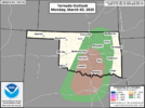
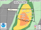
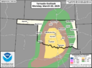
SPC added a 2% tornado risk in SW OK for tomorrow.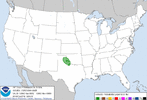
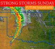
It is gonna be a cold core type set up, but could see a tornado or two in that area tomorrow afternoon. NAM sounding for the area shows some potential for low topped supercells with a chance for a tornado. Although, I’m not sure instability will get as high as shown here.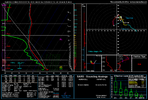
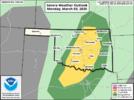
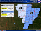
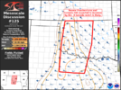
Also, watch that time period Monday night-Tuesday morning when the main system comes in. There could be a window for severe weather in central and especially eastern OK, as the line of storms develops. SPC did mention QLCS tornado potential could exist late in the day 3 outlook period.

It is gonna be a cold core type set up, but could see a tornado or two in that area tomorrow afternoon. NAM sounding for the area shows some potential for low topped supercells with a chance for a tornado. Although, I’m not sure instability will get as high as shown here.

Also, watch that time period Monday night-Tuesday morning when the main system comes in. There could be a window for severe weather in central and especially eastern OK, as the line of storms develops. SPC did mention QLCS tornado potential could exist late in the day 3 outlook period.
Brent
Member
BufordWX
Member
BufordWX
Member
Brent
Member
Brent
Member
BufordWX
Member
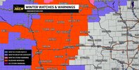
Heck of a storm system this week. NWS in Topeka, KS, is mentioning a chance for severe weather Tuesday morning and blizzard conditions Tuesday night in their area.
Brent
Member
Brent
Member
Brent
Member
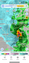
Ha today's storm completely fell apart... Not even any rain here
Brent
Member
BufordWX
Member
Brent
Member
GolfishardIknowit70
Member
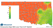
I ended up with 7.5 inches snow this past winter, which is good for us. Still shocked it was the coldest in a decade. That was with a central based niñaI'm really getting tired of overnight eventsView attachment 171439
Brent
Member
I ended up with 7.5 inches snow this past winter, which is good for us. Still shocked it was the coldest in a decade. That was with a central based niña
We finished above average with 10.3 inches shockingly. Most of that was the one storm in January that was supposed to be an inch or two. Like im way better this year than I was last year about how winter went
BufordWX
Member
GolfishardIknowit70
Member
Still surprised it was that far nw and north in general with a lp in gulfWe finished above average with 10.3 inches shockingly. Most of that was the one storm in January that was supposed to be an inch or two. Like im way better this year than I was last year about how winter went
Brent
Member
Still surprised it was that far nw and north in general with a lp in gulf
It was weird because the whole daytime it was barely sticking. All the news crews went south of here. The school buses were running and we had a light dusting and as soon as it got dark it started piling up and the snow didn't even end til the next morning. It was a very weird storm
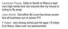
As for tonight... I really believe the major threat is gonna be strong winds. I mean there's strong winds everywhere with this thing
GolfishardIknowit70
Member
I think if we can get a less negative pdo, we should be good for next winter also imo.It was weird because the whole daytime it was barely sticking. All the news crews went south of here. The school buses were running and we had a light dusting and as soon as it got dark it started piling up and the snow didn't even end til the next morning. It was a very weird storm
As for tonight... I really believe the major threat is gonna be strong winds. I mean there's strong winds everywhere with this thing
Brent
Member
Still surprised it was that far nw and north in general with a lp in gulf
I think how borderline temps were was our biggest thing here... Remember half of DFW didn't get a flake after the Euro had a foot there
Conversely the storm the other week how cold it was squashed the snow amounts
Brent
Member
Brent
Member
BufordWX
Member
Brent
Member
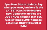
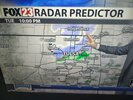
I think Mike Morgan was right?! Hasn't even been a single warning around OKC at all
Belle Lechat
Member
- Joined
- Aug 29, 2021
- Messages
- 1,529
- Reaction score
- 1,215
Texas

Belle Lechat
Member
- Joined
- Aug 29, 2021
- Messages
- 1,529
- Reaction score
- 1,215
Belle Lechat
Member
- Joined
- Aug 29, 2021
- Messages
- 1,529
- Reaction score
- 1,215
622 AM CST TUE MAR 4 2025
THE NATIONAL WEATHER SERVICE IN TULSA HAS ISSUED A
* TORNADO WARNING FOR...
CENTRAL MCINTOSH COUNTY IN SOUTHEASTERN OKLAHOMA...
NORTHEASTERN PITTSBURG COUNTY IN SOUTHEASTERN OKLAHOMA...
623 AM CST TUE MAR 4 2025
THE NATIONAL WEATHER SERVICE IN NORMAN HAS ISSUED A
* TORNADO WARNING FOR...
NORTHEASTERN ATOKA COUNTY IN SOUTHEASTERN OKLAHOMA...
Belle Lechat
Member
- Joined
- Aug 29, 2021
- Messages
- 1,529
- Reaction score
- 1,215
630 AM CST TUE MAR 4 2025
THE NATIONAL WEATHER SERVICE IN TULSA HAS ISSUED A
* TORNADO WARNING FOR...
NORTH CENTRAL MCINTOSH COUNTY IN SOUTHEASTERN OKLAHOMA...
SOUTHERN WAGONER COUNTY IN NORTHEASTERN OKLAHOMA...
NORTHERN MUSKOGEE COUNTY IN EAST CENTRAL OKLAHOMA...
NORTHEASTERN OKMULGEE COUNTY IN NORTHEASTERN OKLAHOMA...
THE NATIONAL WEATHER SERVICE IN TULSA HAS ISSUED A
* TORNADO WARNING FOR...
NORTH CENTRAL MCINTOSH COUNTY IN SOUTHEASTERN OKLAHOMA...
SOUTHERN WAGONER COUNTY IN NORTHEASTERN OKLAHOMA...
NORTHERN MUSKOGEE COUNTY IN EAST CENTRAL OKLAHOMA...
NORTHEASTERN OKMULGEE COUNTY IN NORTHEASTERN OKLAHOMA...
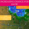
How much snow are you going to get?So close….View attachment 171479
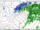
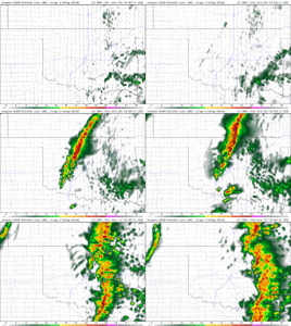
Funny you should ask! All week until today, it looked like flurries tomorrow as precip was drying up by the time it got to me! I was just fixing to post that models have picked up on the redevelopment of precip as the 850 low forms tomorrow! Looking for a solid 2-4” after an inch and a half of rain today and tonight! I’ll post yesterday’s runs of a dying precip field and what the NAM and other models have picked up on today!How much snow are you going to get?
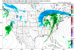
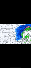
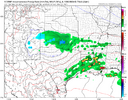
If you get under a snow band, you'll pick up a quick 1-2" in a short time. Strong frontogenesis and good moisture transport will make for 1-2"/hr rates. Potentially will see some thundersnow too!Funny you should ask! All week until today, it looked like flurries tomorrow as precip was drying up by the time it got to me! I was just fixing to post that models have picked up on the redevelopment of precip as the 850 low forms tomorrow! Looking for a solid 2-4” after an inch and a half of rain today and tonight! I’ll post yesterday’s runs of a dying precip field and what the NAM and other models have picked up on today!View attachment 171483View attachment 171484
Brent
Member
I'm telling you this wind is no joke almost 24 hours since the severe threat and even the rain OKC gusted to 67 mph!! I don't think I've ever seen so much wind after a storm. Even now I still hear it howling with not a cloud in the sky
Snow was only about 2 hours away too. Good luck Iowa dude
Snow was only about 2 hours away too. Good luck Iowa dude
Last edited:
Massive pileups all over central/western Iowa! The blizzard lived up to hype!I'm telling you this wind is no joke almost 24 hours since the severe threat and even the rain OKC gusted to 67 mph!! I don't think I've ever seen so much wind after a storm. Even now I still hear it howling with not a cloud in the sky
Snow was only about 2 hours away too. Good luck Iowa dude
Multi vehicle crashes on 35/20/80/
Just a 1/2 in in the blazing March sun angle here

