@Webberweather53 - curious if you plan on taking any pics/vids of dust storms if conditions are good for it? heard they can get rather intense in some areas.
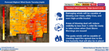


Wonder if the upper Plains will ever get tired of blizzard conditions?
"Rates will overcome..."The best part is places under that blizzard warning in Kansas are currently 80 degrees...
80s to snow in 7-8 hours is wild.Oh the winds come sweeping down the Plains
Unfortunately I smell wildfire smoke here
View attachment 171991
Fantasy land Euro has OKC in the triple digits during the first week of April. Out of curiosity, I looked it up, and the earliest 100-degree day in OKC is April 12, 1972.View attachment 172012
Fantasy land Euro had snow falling for us. Even crazier is that this frame is 18z as well.Lol apparently winter isn't over /s
If that gets any colder at the end it would be near record cold highs
View attachment 172071
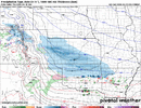
Fantasy land Euro had snow falling for us. Even crazier is that this frame is 18z as well.View attachment 172072
