• Hello, please take a minute to check out our awesome content, contributed by the wonderful members of our community. We hope you'll add your own thoughts and opinions by making a free account!

Tropical Major Hurricane Milton

GOES16-TAW-Sandwich-900x540.gif
 
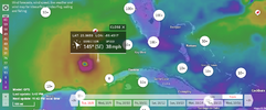
25N/85W will be a good checkpoint. NHC track has it going almost directly over top those coordinates. So in a few hours we’ll be able to tell if it’s still running SE of the forecast IMG_0597.jpegIMG_0596.png
 
25N/85W will be a good checkpoint. NHC track has it going almost directly over top those coordinates. So in a few hours we’ll be able to tell if it’s still running SE of the forecast View attachment 153002View attachment 153003
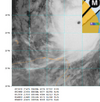
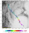
Purple dot new coordinates.

1728453001515.png

To interpret the numbers, the right column is pressure; the middle line shows the lowest pressure, the center; then using the coordinates to the left of it.


Edit: Recon satellite image just updated. The lowest pressure for this pass is above.


1728453409380.png


1728453880731.png
 
Last edited:
SOUTHEAST_loop.gif


Edit: In the 17 minutes since I posted this, the green eye wall solidified, and now has gained yellow in the upper half of the ring.
 
Last edited:
That center of lightning closer to land, I wonder whether it will continue all the way to shore, and to where.


GOES16-GM-EXTENT3-1000x1000.gif


Milton looks like a dome.

screenshot below

1728457248673.png

1728457118450.png
 
Last edited:
Latest readings

070100 2403N 08539W 6999 02382 9226 +132 +033 133103 132 158 026 00
070130 2402N 08541W 6967 02343 9100 +185 +034 144046 079 141 000 00

1728457712511.png

surface
 
314 AM EDT WED OCT 9 2024

THE NATIONAL WEATHER SERVICE IN MIAMI HAS ISSUED A

* TORNADO WARNING FOR...
SOUTHWESTERN COLLIER COUNTY IN SOUTHWESTERN FLORIDA...

* UNTIL 345 AM EDT.

* AT 312 AM EDT, A SEVERE THUNDERSTORM CAPABLE OF PRODUCING A TORNADO
WAS LOCATED NEAR CAPE ROMANO, OR 10 MILES SOUTH OF MARCO ISLAND,
MOVING NORTH AT 20 MPH.


* LOCATIONS IMPACTED INCLUDE...
MARCO ISLAND, CAPE ROMANO, KEY MARCO, AND GOODLAND.


1728459209202.png
 
Two more

1728459660732.png


337 AM EDT WED OCT 9 2024

THE NATIONAL WEATHER SERVICE IN MIAMI HAS ISSUED A

* TORNADO WARNING FOR...
SOUTH CENTRAL MIAMI-DADE COUNTY IN SOUTHEASTERN FLORIDA...

* UNTIL 400 AM EDT.

* AT 337 AM EDT, A SEVERE THUNDERSTORM CAPABLE OF PRODUCING A TORNADO
WAS LOCATED 8 MILES SOUTH OF ROYAL PALM RANGER, OR 15 MILES
NORTHWEST OF JEWFISH CREEK BRIDGE, MOVING NORTH AT 20 MPH.


* LOCATIONS IMPACTED INCLUDE...
ROYAL PALM RANGER.


338 AM EDT WED OCT 9 2024

THE NATIONAL WEATHER SERVICE IN MIAMI HAS ISSUED A

* TORNADO WARNING FOR...
CENTRAL MIAMI-DADE COUNTY IN SOUTHEASTERN FLORIDA...

* UNTIL 415 AM EDT.

* AT 338 AM EDT, A SEVERE THUNDERSTORM CAPABLE OF PRODUCING A TORNADO
WAS LOCATED NEAR PA-HAY-OKEE OVERLOOK, OR 11 MILES WEST OF
HOMESTEAD GENERAL AIRPORT, MOVING NORTH AT 20 MPH.


* LOCATIONS IMPACTED INCLUDE...
PA-HAY-OKEE OVERLOOK AND EVERGLADES NATIONAL PARK.
 
Looking better for Tampa but now Port Charlotte may be under the massive surge gun

View attachment 152978
4 am NHC

"The NHC track forecast is nudged a
little to the north of the previous one to be in better agreement
with the latest models. It should be noted that this forecast is
based on the model fields, not the interpolated models which
appear to be too far south. Users are urged not to focus on the
exact landfall point as the average error at 24 hours is about 40
miles."
 
Shear definitely effecting it this morning, honestly a little early from what I looked at last night. Now the million dollar question is how much weakening occurs and how much does it make a difference.
 
Euro all over Tampa, 06z ICON all over Tampa and 06z GFS maybe just a smidge south of Tampa (center) but eyewall still hits them hard. All these models did better with Helene track, makes sense track shifted north.
 
I know some folks who live in Florida and they didn't evacuate. Some of them are just east of Tampa in Plant City. I don't understand why people are so stubborn. It's not like staying is going to prevent anything bad from happening to your home.
 
Really feeling the shear now, still powerful storm but getting lopsided quick. If any dry air can penetrate it could see rapid weakening, could still be a Cat 4 at LF too, but hopeful it can weaken quickly on approach
 
Back
Top