Yes it matters, it's a big driver of our weather patterns.Does it really matter what phase the mjo is in anymore? Seriously, theres always an aurgument to handicap any posotive takeaways no matter what phase it is in. I dont even bother with it, it gets tiring. Never forecasted accurately, always an excuse well if we where in such an such pattern, or it was month x this would be good for SE, but because its xyz its not going to net the same result.
Just watch ensembles and use what your eyes show you pattern chasing. When i see a monster ridge going up the west coast up through western canada i get excited. Then fill in the pieces from there.
Now if one wants to dissect what makes that western ridge get so tall, go for it.
MJO chasing to me has become as fruitful as Judah Cohen snowcover chasing in the fall.
-
Hello, please take a minute to check out our awesome content, contributed by the wonderful members of our community. We hope you'll add your own thoughts and opinions by making a free account!
You are using an out of date browser. It may not display this or other websites correctly.
You should upgrade or use an alternative browser.
You should upgrade or use an alternative browser.
Pattern Jammin January 2024
- Thread starter SD
- Start date
I’ve tried to insert the charts that Webb posted on 1/6 in the Winter Discussion thread but I can get them to fit without them being too blurry to read. In terms of the daily percentage chance of a winter storm in NC, phase 6/7 in February is actually good in fact both are better than phase 1 and 2…and these numbers are roughly the same during El Niño. I know it goes against what I had understood about the MJO but the info is there in Winter Discussion and you’ll see where I questioned Webb about it and the response. It was really opening to see. Since then I’ve done some research and it was actually very eye opening the number of really good winter storms we’ve seen in phases 4-7. The EPS, GEPS, and GEFS have actually done very well at modeling the H5 pattern several weeks out of late and like has been noted their progression is following about dead on what Webb has been talking about the last 2 months. I think we’ve been so conditioned to focus so much on the MJO ever since that rug pull back in February 2021, but that did fit the climo for La Niña so it made since. We gotta remember though that the MJO is one of many indicies.But like you said day 15+ isn't to be believed. What we do know is the last week of Jan isn't a great pattern unless you like warm/wet. The 2 weeks after that the MJO will be in phase 6-7...is that a good pattern for snow/cold?
Everything is fine going forward
Makeitsnow
Member
Great post.Does it really matter what phase the mjo is in anymore? Seriously, theres always an aurgument to handicap any posotive takeaways no matter what phase it is in. I dont even bother with it, it gets tiring. Never forecasted accurately, always an excuse well if we where in such an such pattern, or it was month x this would be good for SE, but because its xyz its not going to net the same result.
Just watch ensembles and use what your eyes show you pattern chasing. When i see a monster ridge going up the west coast up through western canada i get excited. Then fill in the pieces from there.
Now if one wants to dissect what makes that western ridge get so tall, go for it.
MJO chasing to me has become as fruitful as Judah Cohen snowcover chasing in the fall.
Ok, maybe if it was in a good phase instead of on that favors hints of a SER this would be a winter storm east of the appsDoes it really matter what phase the mjo is in anymore? Seriously, theres always an aurgument to handicap any posotive takeaways no matter what phase it is in. I dont even bother with it, it gets tiring. Never forecasted accurately, always an excuse well if we where in such an such pattern, or it was month x this would be good for SE, but because its xyz its not going to net the same result.
Just watch ensembles and use what your eyes show you pattern chasing. When i see a monster ridge going up the west coast up through western canada i get excited. Then fill in the pieces from there.
Now if one wants to dissect what makes that western ridge get so tall, go for it.
MJO chasing to me has become as fruitful as Judah Cohen snowcover chasing in the fall.
tennessee storm
Member
Hope all y’all east of apps gets the next one and the next one lol. I got 6 inches and still snowing . I have had enough lol
24 hr total Fri: Fire up the Bus!


You got snow on snow coming again Thurs night /Fri:Hope all y’all east of apps gets the next one and the next one lol. I got 6 inches and still snowing . I have had enough lol
I'll just share a couple things. 1) In the past, I have figured out that where things usually get testy between me and other posters is when things aren't going well. Obviously, this is one of those times, so I'm going to refrain from posting all of my thoughts and honestly when I go quiet, you'll know it ain't looking good (to me). 2) However, to offer some hope (and perspective hopefully), I will share this....
Me and three of my meteorologist friends do something pretty nerdy every year: we've created a winter snowfall competition that is essentially fantasy draft picks. We break up the weeks from November through March into 4 or 5 day windows, and then have a draft. So your first round pick is the 4 or 5 day window you think is most likely to see snow (at RDU). I'll also add we make these picks independently with no prior discussions about what we are seeing.
Here were four meteorologists #1 picks for their window where they felt RDU was most likely going to snow based on what we analyzed back in November: 1/31 - 2/4, 2/5 - 2/9, 2/10 - 2/14 (me), 2/15 - 2/19. Take that for what you will. In our collective opinions, winter wasn't even going to really get started until February, and all four of us also predicted above-normal seasonal snowfall at RDU. There's nothing to change that thinking as of now.
I get the emotions and the frustrations. I will track anything that moves during winter, and yes I have had a pity party about TN and MS getting snow in a -NAO pattern that looks so good on static maps, but when I look at the placement and retrograding of the TPV westward, I do understand why (too far west, the same problem we've had for years now). In some regards, it is reassuring to know that meteorology still works the same way it always has, and it'll reward the same way it always has when we get just a little bit of atmospheric help.
Again though this continues the trend of more moisture east of the Apps with that system. I’ve looked at soundings and they are extremely close all around CLT metro back the SC UpstateView attachment 142473
lol this is just ridiculous man. ?
Don’t they say 30 day lag when it splits, puts us in mid February right? https://x.com/judah47/status/1746916157029060832?s=46&t=-gseGrINHozd-xDKV514Ww
Sent from my iPhone using Tapatalk
Sent from my iPhone using Tapatalk
- Joined
- Jan 23, 2021
- Messages
- 4,590
- Reaction score
- 15,178
- Location
- Lebanon Township, Durham County NC
I thought it was a two week lag myself but I could be wrongDon’t they say 30 day lag when it splits, puts us in mid February right? https://x.com/judah47/status/1746916157029060832?s=46&t=-gseGrINHozd-xDKV514Ww
Sent from my iPhone using Tapatalk
I heard that since the PV is already weak, the effects usually take less time to couple.Don’t they say 30 day lag when it splits, puts us in mid February right? https://x.com/judah47/status/1746916157029060832?s=46&t=-gseGrINHozd-xDKV514Ww
Sent from my iPhone using Tapatalk
ForsythSnow
Moderator
33 and rain. The upper levels just got warmer like the Euro despite the Euro being on an island 6 hours ago.
I know all the local TV mets here said we should get above average snow this winter because of the Nino, and I think most of them said we should get most of the snow in January. Doesn't look good so far.I'll just share a couple things. 1) In the past, I have figured out that where things usually get testy between me and other posters is when things aren't going well. Obviously, this is one of those times, so I'm going to refrain from posting all of my thoughts and honestly when I go quiet, you'll know it ain't looking good (to me). 2) However, to offer some hope (and perspective hopefully), I will share this....
Me and three of my meteorologist friends do something pretty nerdy every year: we've created a winter snowfall competition that is essentially fantasy draft picks. We break up the weeks from November through March into 4 or 5 day windows, and then have a draft. So your first round pick is the 4 or 5 day window you think is most likely to see snow (at RDU). I'll also add we make these picks independently with no prior discussions about what we are seeing.
Here were four meteorologists #1 picks for their window where they felt RDU was most likely going to snow based on what we analyzed back in November: 1/31 - 2/4, 2/5 - 2/9, 2/10 - 2/14 (me), 2/15 - 2/19. Take that for what you will. In our collective opinions, winter wasn't even going to really get started until February, and all four of us also predicted above-normal seasonal snowfall at RDU. There's nothing to change that thinking as of now.
I get the emotions and the frustrations. I will track anything that moves during winter, and yes I have had a pity party about TN and MS getting snow in a -NAO pattern that looks so good on static maps, but when I look at the placement and retrograding of the TPV westward, I do understand why (too far west, the same problem we've had for years now). In some regards, it is reassuring to know that meteorology still works the same way it always has, and it'll reward the same way it always has when we get just a little bit of atmospheric help.
Webberweather53
Meteorologist
You're back to looking at the 20-30 day prog again which is meaningless.
Wrong
You can count on severe weather in winter here more than winter storms now.Good news is…we probably got another severe thread or two coming to end January. ?
View attachment 142477
Yep. And we keep getting less and less lucky.Truth is I don’t think any one thing matters anymore. We’ve scored in crappy patterns. Maybe not many. And we’ve not scored in great patterns. Probably a lot. It’s all about luck and timing. Period.
I got trolled hard for saying the same thing this morning so look out.
I got trolled hard for saying the same thing this morning so look out.
I’m ready for it!

The good thing though, the cold will come back just hope it’s soon enough.
Sent from my iPhone using Tapatalk
Webberweather53
Meteorologist
Just how much promise does Feb hold ?? 2 weeks worth?I got trolled hard for saying the same thing this morning so look out.
I think the first 15-18 days personally look really good. After that you would expect to cycle back around to a milder pattern… perhaps the SSW that occurring right helps to keep us in a good pattern. Who knows on that one though?Just how much promise does Feb hold ?? 2 weeks worth?
Wouldn't a torch melt some of that snowpack to the north and northwest? Wasn't that the whole point of us "waiting our turn" in January? To let the snowpack build up around us to help filter in the cold? Why root for a torch to melt that?
NBAcentel
Member
So outdoor activities can be enjoyable againWouldn't a torch melt some of that snowpack to the north and northwest? Wasn't that the whole point of us "waiting our turn" in January? To let the snowpack build up around us to help filter in the cold? Why root for a torch to melt that?
Webberweather53
Meteorologist
Wouldn't a torch melt some of that snowpack to the north and northwest? Wasn't that the whole point of us "waiting our turn" in January? To let the snowpack build up around us to help filter in the cold? Why root for a torch to melt that?
Yes for folks in the Carolinas, we just wasted our opportunity to put one away. Still will be chances down the road in Feb
Even though it will be above normal, it will still be cold in the northern Plains over to the Great Lakes so yeah they’ll be keeping a good bit of there snow pack… keep in my mind how low the sun angle is and how much less daylight they still have. Also this won’t be like mid to late December when so much Pacific air was flooding Canada that it wiped out all the snowpack in the source regions… again those areas are still going to be keeping and building more snowpackWouldn't a torch melt some of that snowpack to the north and northwest? Wasn't that the whole point of us "waiting our turn" in January? To let the snowpack build up around us to help filter in the cold? Why root for a torch to melt that?
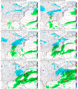
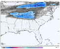
What if these blues could meet up across the deep south ?


Just wait til this PV gets coiled tight again over the Arctic and we have to start banking on the generational Judah Cohen sudden stratospheric warming event to maybe or maybe not get cold to come down off the pole again.
Cary_Snow95
Member
Little split flow action ??What if these blues could meet up across the deep south ?

NBAcentel
Member
Nashville NAMing at go timeWhat if these blues could meet up across the deep south ?

rburrel2
Member
Some would have you think that's an ugly look to start February off with.What if these blues could meet up across the deep south ?

Seriously though, dang, you can't ask for a more titillating end of run progression.


