-
Hello, please take a minute to check out our awesome content, contributed by the wonderful members of our community. We hope you'll add your own thoughts and opinions by making a free account!
You are using an out of date browser. It may not display this or other websites correctly.
You should upgrade or use an alternative browser.
You should upgrade or use an alternative browser.
Tropical Hurricane Lee
- Thread starter RBR71
- Start date
Downeastnc
Member
So many unknowns, like how Margot will affect the ridge, how much does Lee slow, how deep or shallow does the trough verify as....anyone that thinks this thing is locked in is nuts lol. Still very likely to miss but there are ways for this to change a lot
Henry2326
Member
Downeastnc
Member
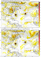
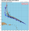
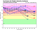
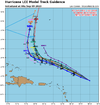
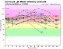
GEFS seem to be kind of following the 06Z Euro lead with some much more west running members so far....
12Z

06Z

12Z

06Z

NoSnowATL
Member
Same UK a few days ago....
Downeastnc
Member
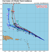
Some of the timing differences here are nuts, got one at the latitude of the VA capes and another down around the same latitude as Miami.


RDUHeatIsland
Member
That spaghetti plot does show a lot of variance in timing between the plots. Lee will slow down if the trough does not go as far east as advertised or is weaker than current prognostications. Some of those plots are also getting a little too close to the Outer Banks for comfort if they are extended out.Some of the timing differences here are nuts, got one at the latitude of the VA capes and another down around the same latitude as Miami.

And yet they all hockey stick right. The models are all going to have to sleepwalk through the upper air pattern if this is going to hit the US anywhere other than Maine. Anything can happen, I suppose, but it still looks like the vast majority of the eastern US is out of the woods.Some of the timing differences here are nuts, got one at the latitude of the VA capes and another down around the same latitude as Miami.

Shaggy
Member
There's been a consistent consensus for a turn around 70W. No reason to doubt it until they give us a reasonAnd yet they all hockey stick right. The models are all going to have to sleepwalk through the upper air pattern if this is going to hit the US anywhere other than Maine. Anything can happen, I suppose, but it still looks like the vast majority of the eastern US is out of the woods.
Snow_chaser
Member
Servers on systems everywhere going to bog down when this thing gets to 70°, everyone be logging on to see when the turn starts lolThere's been a consistent consensus for a turn around 70W. No reason to doubt it until they give us a reason
Brent
Member
There's been a consistent consensus for a turn around 70W. No reason to doubt it until they give us a reason
Right I just can't see so many models being so wrong in 2023. This isn't the 1990s. We've come a long way since Andrew
Itryatgolf
Member
Like I mentioned the other day, unless a ridge builds over the top and forces it w or wnw, it's a fish storm, except maybe in the ne. Apparently the ridge isn't going to be good enough imo
lexxnchloe
Member
Thru 126 the euro is south of 0z
today

last night

today

last night

lexxnchloe
Member
If it were to shift the same amount south tonight then PR and DR would be having some impacts
Draw a line N/S where Haiti and DR meet. At a minimum thats the benchmark line for NC coast. Until it crosses that point, no fret. That being said it inches closer each cycle.
lexxnchloe
Member
Euro ends up NW quite a bit and now has a landfall again


I don’t know a lot about hurricanes. Is this going to just stay at a cat 4-cat 5 or will it lose strength and then regain it?Euro ends up NW quite a bit and now has a landfall again


Brent
Member
I don’t know a lot about hurricanes. Is this going to just stay at a cat 4-cat 5 or will it lose strength and then regain it?
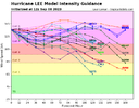
It will probably go up and down depending on if there's some shear or not like today
Also the ERC's are a natural way of going up and down in strength but they are random. That's why Idalia was unexpectedly weakening at landfall
lexxnchloe
Member
May make it back to a cat 5 north of PR but will weaken after that.I don’t know a lot about hurricanes. Is this going to just stay at a cat 4-cat 5 or will it lose strength and then regain it?
Snow_chaser
Member
Looking on tropical tidbits IR satellite loop, what does the pink represent near the center where the eye is now clouded over? On the loop, it was there briefly.
I think shear is throwing it off balance.Looking on tropical tidbits IR satellite loop, what does the pink represent near the center where the eye is now clouded over? On the loop, it was there briefly.
ForsythSnow
Moderator
That shear is really shredding this storm apart and I'm not sure how it's still a cat 4 despite looking like a 2
Tornadocane
Member
That shear is really shredding this storm apart and I'm not sure how it's still a cat 4 despite looking like a 2
It's not. We're just waiting for Recon to correct the incorrect designation by the NHC Office.
Downeastnc
Member
Looking kinda rough at the moment....seems like the shear is having more impact than the models anticipated.
Snow_chaser
Member
Guess that goes to show models are great tools but ya just have to wait and see. They didn’t expect the rapid blowup last night and the deterioration today.Looking kinda rough at the moment....seems like the shear is having more impact than the models anticipated.
Downeastnc
Member
Pressure up to around mid 950's it appears....
lexxnchloe
Member
Will be interesting to see if it weakens to 980-985 will it effect the track.Pressure up to around mid 950's it appears....
Tornadocane
Member
Guess that goes to show models are great tools but ya just have to wait and see. They didn’t expect the rapid blowup last night and the deterioration today.
Yeah. The models weren't bonkers enough to depict such a large swing in intensity in a mere 42 hours. From TS to Category 5 to Category 2. Then there's the matter of the COC moving due west if not a smidge N of W. The Freaking Steering Pattern is changed.
Guess that goes to show models are great tools but ya just have to wait and see. They didn’t expect the rapid blowup last night and the deterioration today.
They rarely do when it’s a double whammy of shear and then dry air into the core.
Henry2326
Member
NCHighCountryWX
Member
- Joined
- Dec 28, 2016
- Messages
- 675
- Reaction score
- 1,853
Brent
Member
Down to 120 mph on BT. Yeesh.
Can't believe we were talking about historic last night
Just goes to show that even though track forecasts have gotten a lot better intensity leaves a lot to be desired
Can't believe we were talking about historic last night
Just goes to show that even though track forecasts have gotten a lot better intensity leaves a lot to be desired
Snow_chaser
Member
On the IR loop, the west side looks alittle better. Looks more rounded and darker colors mixing in. ??
Takes more than "bath water"Down to 120 mph on BT. Yeesh.
Can't believe we were talking about historic last night
Just goes to show that even though track forecasts have gotten a lot better intensity leaves a lot to be desired
Henry2326
Member
Downeastnc
Member
966 last fix...up 10 mb since the recon got out there,
Crosses 72, ill be paying attn. Find out Monday into Tuesday I suppose.

