-
Hello, please take a minute to check out our awesome content, contributed by the wonderful members of our community. We hope you'll add your own thoughts and opinions by making a free account!
You are using an out of date browser. It may not display this or other websites correctly.
You should upgrade or use an alternative browser.
You should upgrade or use an alternative browser.
Pattern May Discussion
- Thread starter RBR71
- Start date
That's probably the best one yet. The 3k is like high clouds and mild
J1C1111
Member
Good research there. That pretty much tells the tell. I guess I just remember 2011-12 so fondly because it was snowless along with this winter. My 2nd snowless winter in my life living here since 82.Dec 2011 was +2.9, Jan 2012 was +2.9 and Feb 2012 was +2.1 at GSP. Dec 2022 was -1.5, Jan 2023 was +5.2 and Feb 2023 was +7.1 at GSP. Even though Dec was below average this winter it didn't erase the extreme warmth of Jan and Feb. So overall way warmer than 11-12 overall and just as snowless. This winter was a complete dumpster fire!
Shaggy
Member
3k nam has nothing for us despite mhx discussing potential NW flow storms
Avalanche
Member
MCS fell apart. 
Shaggy
Member
We use to get NW flow events use to be a thing. Watching them fall apart over the mountains and refire over Virginia as they dropped southeast a few hours before they hit. The old days were so much better weather wise. What happened?MCS fell apart.
NoSnowATL
Member
Them mountains are getting taller.We use to get NW flow events use to be a thing. Watching them fall apart over the mountains and refire over Virginia as they dropped southeast a few hours before they hit. The old days were so much better weather wise. What happened?
DCK
Member
Pretty good hail storm here in Spartanburg earlier. I started seeing a lot of white mix in on the radar returns and then it hit. I’ll have to check the cars and roof tomorrow.
Pretty good hail storm here in Spartanburg earlier. I started seeing a lot of white mix in on the radar returns and then it hit. I’ll have to check the cars and roof tomorrow.
Looks like we might get some action here in north Georgia tomorrow? See some up far northwest are getting a bit tonight.
If your roof is not super-new, definitely a good idea to have it checked out by a roofer you trust. If they spot any damage, probably worth using that insurance you're paying for every month. We had a brief but intense hail storm here just south of downtown in late March and there are a lot of new shingles flying around.
Never too early for a little next winter sneak peak.. really looks like El Niño type of pattern. Active southern jet but it’ll be hard to get the cold air this time. Good storm track and storm systems are usually plentiful in El Niño patterns.. let’s see how it holds up. (Peep the blocking over Greenland.. fun if we could also get some cold air with it)

Trust me, you don't watch that giant ridge over the NE. Zonal flow all the way.Never too early for a little next winter sneak peak.. really looks like El Niño type of pattern. Active southern jet but it’ll be hard to get the cold air this time. Good storm track and storm systems are usually plentiful in El Niño patterns.. let’s see how it holds up. (Peep the blocking over Greenland.. fun if we could also get some cold air with it)View attachment 135141View attachment 135142
"It'll be hard to get the cold this time." THIS TIME? LolNever too early for a little next winter sneak peak.. really looks like El Niño type of pattern. Active southern jet but it’ll be hard to get the cold air this time. Good storm track and storm systems are usually plentiful in El Niño patterns.. let’s see how it holds up. (Peep the blocking over Greenland.. fun if we could also get some cold air with it)View attachment 135141View attachment 135142
I don't think it much matters what ENSO state we're in. For whatever reason, something is preventing cold air from penetrating into the SE and hanging out long enough to team up with moisture. But I agree with you, it should be wet, at least.
Iceagewhereartthou
Member
Monday is going to be an interesting day depending on how strong the wave embedded in the NW flow is. If we can realize a steady rain some areas of nc may get stuck in the upper 50s low 60s with some severe weather along the wedge front
Downeastnc
Member
Monday is going to be an interesting day depending on how strong the wave embedded in the NW flow is. If we can realize a steady rain some areas of nc may get stuck in the upper 50s low 60s with some severe weather along the wedge front
I got all of next week off I need some fun weather and would love a good ole fashion storm chase day....my avatar is a tornado I chased way back in the early 2000's and only the second time I ever actually saw a tornado, the other time was this one that missed my house by 100 yrds....
The Pitt County Tornado that affected communities near Greenville was determined to be a low end EF1 with winds estimated from damage of 85 to 90 mph. This tornado struck a more populated area causing minor damage to approximately 40 homes. Shingles were off roofs, debris blown into roofs, siding taken off homes, and some small trees were down. This tornado started out at Dudleys Grant Road, crossed Firetower Road. moving northeast, and affected a subdivision along Ashcroft Drive. The tornado damage path was approximately 100 yards wide, and was on the ground for 1/4 to 1/2 mile. Damages were estimated at $200,000. There were no deaths or injuries.
LFCenc
Member
I lived in Dudley's Grant (townhomes) at the time and remember this event well.I got all of next week off I need some fun weather and would love a good ole fashion storm chase day....my avatar is a tornado I chased way back in the early 2000's and only the second time I ever actually saw a tornado, the other time was this one that missed my house by 100 yrds....
The Pitt County Tornado that affected communities near Greenville was determined to be a low end EF1 with winds estimated from damage of 85 to 90 mph. This tornado struck a more populated area causing minor damage to approximately 40 homes. Shingles were off roofs, debris blown into roofs, siding taken off homes, and some small trees were down. This tornado started out at Dudleys Grant Road, crossed Firetower Road. moving northeast, and affected a subdivision along Ashcroft Drive. The tornado damage path was approximately 100 yards wide, and was on the ground for 1/4 to 1/2 mile. Damages were estimated at $200,000. There were no deaths or injuries.
Downeastnc
Member
I lived in Dudley's Grant (townhomes) at the time and remember this event well.
I lived behind the White Bridge apts in those duplexes, walked out the front door looked towards the actual firetower and saw the tornado as it hit the tower, the air was full of those 40 ft long pieces of siding from Dudley Grant lol.....its a good thing they had removed the 300 trailers that use to call that property between Dudley and my house home....
Spicy
Shaggy
Member
Ill be back in Wilmington tomorrow night. Hope for a run at the coast
Like clockwork, with the humid nights, my tomatoes are exploding with growth
Avalanche
Member
I’m jealous!! I’ve had good tomato plants but my flowers keep breaking off before a tomato comes out. Something eats themLike clockwork, with the humid nights, my tomatoes are exploding with growth
I had that problem last year, I think it was heat related. I moved them to a diff location this year so that they only get sun from early morning until around 2 PM. Hope this does the trick.I’m jealous!! I’ve had good tomato plants but my flowers keep breaking off before a tomato comes out. Something eats them
Hasn't rained in May not looking great this week either
I was just about to say, definitely looking at the possibility of under an inch of rain for May.Hasn't rained in May not looking great this week either
I guess I've been lucky because I'm at 1.79" for the month with more heading this way from the looks of the radar. May does always seem to be a feast of famine month.I was just about to say, definitely looking at the possibility of under an inch of rain for May.
SPC has bumped a lot of us up to "Slight".

Rosie
Member
A whole .30 plus a few traces here???I guess I've been lucky because I'm at 1.79" for the month with more heading this way from the looks of the radar. May does always seem to be a feast of famine month.
I would say you are fortunate. I’ve had .45, and by the looks of it, that’s about it for May.I guess I've been lucky because I'm at 1.79" for the month with more heading this way from the looks of the radar. May does always seem to be a feast of famine month.
WRAL's model is showing this for tomorrow.

Overcast here right now. Have to see how much clearing we get to spark the storms this afternoon.
LickWx
Member
Going to be a good drizzly day … Bigfoot is more real than the chance of storms todayOvercast here right now. Have to see how much clearing we get to spark the storms this afternoon.
But WRAL says it's a weather alert day.Going to be a good drizzly day … Bigfoot is more real than the chance of storms today
The sun is actually coming out here. Might get some storms after all.
Cary_Snow95
Member
Interesting feature off the coast around Friday. Anyone have any thoughts on that? Just a lp riding a stalled front?
Definitely not tropical. If it could trend stronger, we could see some really cool temps (for mid/late May).Interesting feature off the coast around Friday. Anyone have any thoughts on that? Just a lp riding a stalled front?
Dew points Friday Morning:

NBAcentel
Member
A cool weekend with no pool time ? Pass.Definitely not tropical. If it could trend stronger, we could see some really cool temps (for mid/late May).
Dew points Friday Morning:
View attachment 135201
Not only that but this would basically have the pattern shot for storms for a good 4-5 days

Mesoscale Discussion 0802
NWS Storm Prediction Center Norman OK
0134 PM CDT Tue May 16 2023
Areas affected...Southwest VA...Northwest NC
Concerning...Severe potential...Watch possible
Valid 161834Z - 162030Z
Probability of Watch Issuance...60 percent
SUMMARY...Thunderstorm coverage and intensity may increase this
afternoon across southwest VA and northwest NC, and trends are being
monitored for potential watch issuance.
DISCUSSION...The air mass across southwest VA and northwest NC
continues to destabilize amid temperatures warming into the upper
70s amid dewpoints in the mid 60s. Multicellular thunderstorm
activity upstream across far southwest VA has modestly strengthened
over the past hour, likely a result of increasing buoyancy and
continued ascent along the southern/eastern periphery of the
convectively augmented shortwave moving through the middle OH
Valley. Dewpoints are expected to remain in the mid 60s, despite
modest downsloping and boundary-layer mixing. As such, the airmass
will likely remain uncapped, with the remaining buoyancy and modest
ascent contributing to increasing thunderstorm coverage.
Even with some expectation for increasing thunderstorm coverage,
convective evolution is uncertain, and the primary severe threat may
remain associated with the main convective line farther west.
Consequently, when a watch will be needed is also somewhat
uncertain. Convective trends will be monitored closely for earlier
development and sufficient severe thunderstorms coverage to merit a
watch.
..Mosier/Leitman.. 05/16/2023
SEVERE THUNDERSTORM WATCH OUTLINE UPDATE FOR WS 226
NWS STORM PREDICTION CENTER NORMAN OK
400 PM EDT TUE MAY 16 2023
SEVERE THUNDERSTORM WATCH 226 IS IN EFFECT UNTIL 1000 PM EDT
FOR THE FOLLOWING LOCATIONS
NCC001-003-005-009-011-021-023-027-033-035-037-057-059-063-067-
069-077-081-097-111-115-121-135-145-151-157-159-169-171-181-183-
185-189-193-197-199-170200-
/O.NEW.KWNS.SV.A.0226.230516T2000Z-230517T0200Z/
NC
. NORTH CAROLINA COUNTIES INCLUDED ARE
ALAMANCE ALEXANDER ALLEGHANY
ASHE AVERY BUNCOMBE
BURKE CALDWELL CASWELL
CATAWBA CHATHAM DAVIDSON
DAVIE DURHAM FORSYTH
FRANKLIN GRANVILLE GUILFORD
IREDELL MADISON MCDOWELL
MITCHELL ORANGE PERSON
RANDOLPH ROCKINGHAM ROWAN
STOKES SURRY VANCE
WAKE WARREN WATAUGA
WILKES YADKIN YANCEY
$$
Mike Maze at WRAL said the high resolution models have the bulk of the thunderstorm activity here from 9PM through about 1AM.
BHS1975
Member
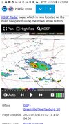
Getting some rotation near the VA border.
Sent from my iPhone using Tapatalk
Sent from my iPhone using Tapatalk