Shaggy
Member
It'll happen. I'll be at Disney that week and was hoping for 70s and 80s but will have 50s and 60sLooks like coldest air on the planet is over the East and SE! Better late than never!
It'll happen. I'll be at Disney that week and was hoping for 70s and 80s but will have 50s and 60sLooks like coldest air on the planet is over the East and SE! Better late than never!


This is just a slap in the face at this point. You get this look even just 2-3 weeks ago and we likely would be talking about how 2023 winter wasn't too bad of a winter after all.
Never underestimate the strength of a SER and how long it could hold on. I'd be hard pressed to bet against it to be honest with you.Pretty solidly BN. The GFS op is still on the struggle bus. It is just resistant to fully suppressing the SER for some reason. Seems to be slowly trending in the direction of the Euro.
Sent from my iPhone using Tapatalk
Never underestimate the strength of a SER and how long it could hold on. I'd be hard pressed to bet against it to be honest with you.

Honestly with the amount of blocking up too it’s more than likely the SER gets absolute muted .. same thing happened in December and it’ll probably happen here too as it’s what all model ensembles are now predictingNever underestimate the strength of a SER and how long it could hold on. I'd be hard pressed to bet against it to be honest with you.
All model ensembles had me getting a big snow around Xmas too in the long range.Honestly with the amount of blocking up too it’s more than likely the SER gets absolute muted .. same thing happened in December and it’ll probably happen here too as it’s what all model ensembles are now predicting
Actually back in December, the SER trended weaker the closer you got because of the strong blocking up top. That’s why the potential right after Christmas didn’t work out because everything ended up getting too suppressed. History has shown me that whenever we’re getting stronger periods of high latitude blocking, the Euro suite typically handles the overall pattern really well.All model ensembles had me getting a big snow around Xmas too in the long range.
Seasonal trends have been for a stronger SER. It may very well get muted but I'll only believe it when I see it
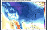
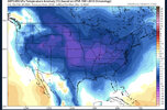
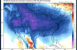
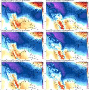
I'm just not sure that look is correct. It's never cold Coast to Coast 99% of the time.I could quote a million of my posts and say I told you so but there’s no need .. it’s been written on the wall for weeks and high amp phase 8 plus blocking is going to get cold to shift to the east week 2 of march through probably the entirety of March will be below average a good amount. Will we see snow? Who knows. It’s harder to get snow in March but it truly is a great pattern for at the very least cold. Cold is for sure. Will have to wait to see if anything wintry shows up in modeling. Cheers View attachment 133727View attachment 133728View attachment 133729View attachment 133730
Would be quite the feat for December let alone March. Don't get me wrong I see us transitioning to a cooler pattern but call me skeptical on a ridge crushing pattern change. I may be wrong hopefully I am wrong but the models have stunk so bad this season.I'm just not sure that look is correct. It's never cold Coast to Coast 99% of the time.
300hrs away. Lets go...I could quote a million of my posts and say I told you so but there’s no need .. it’s been written on the wall for weeks and high amp phase 8 plus blocking is going to get cold to shift to the east week 2 of march through probably the entirety of March will be below average a good amount. Will we see snow? Who knows. It’s harder to get snow in March but it truly is a great pattern for at the very least cold. Cold is for sure. Will have to wait to see if anything wintry shows up in modeling. Cheers View attachment 133727View attachment 133728View attachment 133729View attachment 133730

Tbh mid-March isn’t too late for us to be talking about how the 2023 winter wasn’t too bad of a winter, either. It’s harder and more on the edge, for sure, but let’s not write it off. There have been huge storms in mid- to late-March.
This is just a slap in the face at this point. You get this look even just 2-3 weeks ago and we likely would be talking about how 2023 winter wasn't too bad of a winter after all.
It's been 30 years since many of us have seen a huge storm in Mid to Late March, so I guess we are due.Tbh mid-March isn’t too late for us to be talking about how the 2023 winter wasn’t too bad of a winter, either. It’s harder and more on the edge, for sure, but let’s not write it off. There have been huge storms in mid- to late-March.
It's been 30 years since many of us have seen a huge storm in Mid to Late March, so I guess we are due.
This is the thing, March snow happens but most large storms have been within the first few days of March typically. We are getting about a good of an H5 pattern as you want to deliver really cold and well below average temps for a large junk of the month as it looks right now. But even with a large displacement of cold air in the eastern US and 15-20 degree below average temps, it's still going to be in the upper 30's and lower 40's more than likely outside of the mountains. So while yes we keep winter around, it's still not cold enough to snow in unless you get closer to record breaking type cold which is extremely tough to rely on.Tbh mid-March isn’t too late for us to be talking about how the 2023 winter wasn’t too bad of a winter, either. It’s harder and more on the edge, for sure, but let’s not write it off. There have been huge storms in mid- to late-March.
Union county is the NC jackpot outside of the mountains. Winning!The majority of the SE will go without even a trace of snow, I don't remember the last time Raleigh hasn't even seen a trace....maybe the 90's. Doesn't breed optimism for next winter. Soon just getting below freezing will be a win for us.
View attachment 133736
I think we're just gun shy since it has been soo long since most areas outside the mountains have had a big mid to late March snow. You have to remember though when looking at the possible upcoming cold for March pattern, not to just look and say that we are just 6 to 8 below average and it won't be cold enough to snow. It only takes one day of the big 20 degree departure average that many of us need by then to get it done. Is it Likely to happen? Probably not but it absolutely is not too late and could if all goes right. I saw snow in April in Central NC when I was a kid. Its happened before.This is the thing, March snow happens but most large storms have been within the first few days of March typically. We are getting about a good of an H5 pattern as you want to deliver really cold and well below average temps for a large junk of the month as it looks right now. But even with a large displacement of cold air in the eastern US and 15-20 degree below average temps, it's still going to be in the upper 30's and lower 40's more than likely outside of the mountains. So while yes we keep winter around, it's still not cold enough to snow in unless you get closer to record breaking type cold which is extremely tough to rely on.

And it's still going at 384. Good lordIf you want to see an absolute classic, textbook, ideal snowstorm setup just look at the long range gfs.

I believe we did see a trace with the Arctic front we got a bout of sleet and graupal which was regarded as a trace ..The majority of the SE will go without even a trace of snow, I don't remember the last time Raleigh hasn't even seen a trace....maybe the 90's. Doesn't breed optimism for next winter. Soon just getting below freezing will be a win for us.
View attachment 133736
Here in Pittsboro there was no trace of any damn thingI believe we did see a trace with the Arctic front we got a bout of sleet and graupal which was regarded as a trace ..
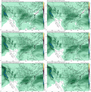
The GFS had a run a couple of days ago that if extrapolated at 5H would have yielded a similar outcome to today's 12Z run fwiw.The op gfs has a lot of things that go right and evolves into a near perfect pattern for the SE. At day 14+ it's likely going to end up wrong but it gives an idea of what could happen if things break perfectly. Looking at the 0z eps plumes we lost some of the higher end events but we still kept a lot of hits on the snow depth charts so we are more likely to potentially see enough marginal cold for a rain to snow snow to rain type scenario. As you can see below just after D10 the gefs has a decent qpf moving into BN 850sView attachment 133742
View attachment 133743
I personally think we still have a lot of demons and ghosts left in the hemispheric pattern that we will have to fight to get a late season snow event but I wouldn't completely call winter dead yet


