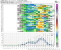
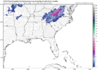
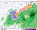
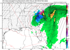
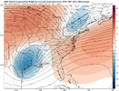
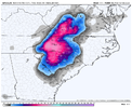
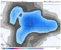
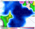
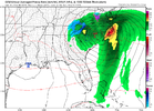
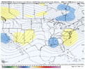
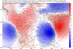
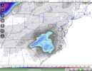
I also think we’re going to see more wobbles. We’re still in the longest range of short range models. They will wobble west and wobble east. There is time for others to get into the game but you gotta just expect with no cold air source available many across the board aren’t going to be in the game here. Don’t get hopes up too much
-
Hello, please take a minute to check out our awesome content, contributed by the wonderful members of our community. We hope you'll add your own thoughts and opinions by making a free account!
You are using an out of date browser. It may not display this or other websites correctly.
You should upgrade or use an alternative browser.
You should upgrade or use an alternative browser.
My bad, yeah that was 06z. More reason for me to hate the ICON as its output comes out weird across the various vendors (partial release and slow on some sites)6z, 12z on TT hasn't run yet for some odd reason
Even with the 6z it was painful watching that deform form and not be snow in GA until it exits. Might be rate driven and not detected because aloft it seemed cold enough.
LukeBarrette
im north of 90% of people on here so yeah
Meteorology Student
Member
2024 Supporter
2017-2023 Supporter
GFS gonna be another good run
Yeah I think you are about to get shellacked by the GFSGFS gonna be another good run
severestorm
Member
What's @bouncycorn 's model saying?
12z GFS


12z GFS


D
Deleted member 609
Guest
I've seen enough. I'm on team GFS.
WXinCanton
Member
Charlotte Bullseye


NBAcentel
Member
That transition would be very similar to the March 2009 ULL… rain transition to a short period of sleet and then heavy wet snowView attachment 132503
Put that in your pipe and smoke it.
Tokenfreak
Member
I hope we get a little snow near Charleston lol
WSNC
Member
Not buying .5" of freezing rain at GSO on GFS. This is a rain or heavy wet snow deal.
NBAcentel
Member
- Joined
- Jan 23, 2021
- Messages
- 4,595
- Reaction score
- 15,183
- Location
- Lebanon Township, Durham County NC
So I noted the same thing this morning. Something is off with those algorithms.Not buying .5" of freezing rain at GSO on GFS. This is a rain or heavy wet snow deal.
I hope I see a foot imby but history just doesn't err on big snows S and E of 85 in the Charlotte area. Period. Hasn't swung our way an 10+yrs. I've seen Ballantyne all sleet and Davidson 6"+. I'm not even cautiously optimistic atp.
NBAcentel
Member
Shaggy
Member
At this point the gfs has placed itself back on an island with such big totals over such a large area.CMC is rain for everyone except the mountains View attachment 132512
Son of a gun I get blanked again.
Ron Burgundy
Member
So looks like I’m road-tripping to {{checks notes}} Augusta?
This is more realistic. Maybe I40 gets in the game like you mentioned yesterday. Weekend washoutCMC is rain for everyone except the mountains View attachment 132512
The GFS definitely supports heavy rates with that kind of wave evolution. It's really strong with it. It's on the strong and south side of guidance unfortunately thoughCan’t unsee… over 1” per hour rates on the GFS, near 2” per hour. Why

- Joined
- Jan 23, 2021
- Messages
- 4,595
- Reaction score
- 15,183
- Location
- Lebanon Township, Durham County NC
Agreed…at this point I think it’s very possible that we see an area of accumulating snow outside the mountains, but I can’t imagine it being anywhere near the extent of what the GFS is showing right now. I would honestly expect an area maybe 60-80 miles wide where there is an actual changeover and rates heavy enough to see accumulation. I doubt we get a good hold on that exact location until 24 hours outAt this point the gfs has placed itself back on an island with such big totals over such a large area.
If you're in the Midlands of SC you want this thing to be modeled even further South.
Point is, the odds are against us. Do not let the GFS trick you into excitement.
Point is, the odds are against us. Do not let the GFS trick you into excitement.
GEFS shifts west. One things for sure whoever does get snow it’ll be the sloppiest biggest flakes you’ve ever seen
Would definitely be chicken feathersGEFS shifts west. One things for sure whoever does get snow it’ll be the sloppiest biggest flakes you’ve ever seen
- Joined
- Jan 2, 2017
- Messages
- 1,566
- Reaction score
- 4,279
Glad I won't be home to suffer through this one. Like burrel said earlier Oconee and Pickens been getting the shaft too much recently on these marginal set ups while watching folks over toward Inman get crushed.View attachment 132503
Put that in your pipe and smoke it.
NBAcentel
Member
GEFS big increase due to south/more amped tick
- Joined
- Jan 23, 2021
- Messages
- 4,595
- Reaction score
- 15,183
- Location
- Lebanon Township, Durham County NC
yeah bud it looks really goodGEFS big increase due to south/more amped tick
Looks legit. Maybe we can get a severe threatCMC is rain for everyone except the mountains View attachment 132512
packfan98
Moderator
Snowlove33
Member
I wonder what it would take for us folks in Alabama to see something probably shooting a dead horse asking this question

