AJ1013
Member
70F with clear skies here this morning.
Models look good but not holding my breath, need consistency till tomorrow night/Friday before I bite View attachment 125000View attachment 125001View attachment 125002View attachment 125003View attachment 125004View attachment 125005
Models look good but not holding my breath, need consistency till tomorrow night/Friday before I bite View attachment 125000View attachment 125001View attachment 125002View attachment 125003View attachment 125004View attachment 125005


I haven’t had a chance to look in detail but seeing those negative temp anamolies in the SW tells me that there might be a cut off upper low… would love to see it start throwing pieces of energy east.Models look good but not holding my breath, need consistency till tomorrow night/Friday before I bite View attachment 125000View attachment 125001View attachment 125002View attachment 125003View attachment 125004View attachment 125005
They looked decent for that time period. But later they drifted right back to a full western trough. Hate to see that. No 50/50 low off the Atlantic either, just ridging (weird tri-pole ridging the whole hemisphere). That's way out there and certainly could change, but I'd really like the ensembles to start pointing to the trough coming fully east after the 20th.


Do you ever post any maps under 300+ hours away?They looked decent for that time period. But later they drifted right back to a full western trough. Hate to see that. No 50/50 low off the Atlantic either, just ridging (weird tri-pole ridging the whole hemisphere). That's way out there and certainly could change, but I'd really like the ensembles to start pointing to the trough coming fully east after the 20th.


View attachment 125009
View attachment 125010
View attachment 125011
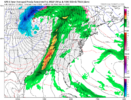
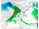
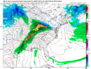
Last 3 runs of the GFS for the big time system coming up. Finally the model is understanding how hard it is to plow itself into a block. Another thing is the confluence is trending much stronger. Certainly a ways out but we could easily trend this to an onset ice event for favored CAD areas in Northern NC and upwards. Another thing, the CMC has been showing a more suppressed system as well. GFS is caving to that idea.
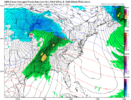
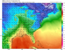
The most important thing about this system to me is that’s it the tablesetterView attachment 125012
View attachment 125013
Here is the CMC for reference, it’s definitely slightly overdone with how cold the sfc temps are. Still shows the potential for our first icing event.
It’s setting the table for a big ole slice of Western trough!The most important thing about this system to me is that’s it the tablesetter


Ah yes. The notorious CAD tree snapper run with a low bombing in the Great Lakes. ?? ?View attachment 125012
View attachment 125013
Here is the CMC for reference, it’s definitely slightly overdone with how cold the sfc temps are. Still shows the potential for our first icing event.
So, the only thing this massive -NAO did was pop a -PNA?
-EPO / +PNA is 100% better for cold than -NAO.
You know what they say, gotta hear the branches cracking to get the goods.Ah yes. The notorious CAD tree snapper run with a low bombing in the Great Lakes. ?? ?
The cyclone next week screams "big deal" for basically the western 2/3s of the country, how it evolves probably hides the skeleton key of how favorable the holidays will be for the SE/MA.The most important thing about this system to me is that’s it the tablesetter
Love Robert, was blessed to catch the tail end of his posting history on American. Appreciate his insight. However I think he can be a little too hype-y lately, feel like I've read a lot of "thing are about to get very interesting wink wink nudge nudge" type posts from him with patterns that end up disappointing. Not a knock on his expertise, rather just a disclaimer on this type of post.WxSouth
14m ·
https://www.facebook.com/#
The weather is warm across the South today and next few days, from Texas across the heart of the south to the eastern Carolinas, but cold air damming in Virginia, western Carolinas continues to thwart the warm...but even there it will warm up next couple of days. Clouds and periods of rain dominate though, many more systems are slated over the next week.
So, the weather now is gloomy, rather boring across a big chunk of the region. Normal December weather, except this long cloudy stretch is a bit much to take
What is showing up though is, atleast in my estimation, going to be spectacular. All the signals continue to be there for a cascade of sequential Meteorological events that will thrust the central and eastern US into hard core Winter Weather over the next few weeks. A blocking ridge will build toward Alaska (this got us cold several times in October and November). A strong block around Greenland is developing as we speak and will maintain for several weeks--another cold signal for the Southeast. It's rare to get both simultaneously. I believe things are going to get very interesting down South in the next few weeks.
WxSouth
Consulting agency
I don't think your second sentence is necessarily wrong, I'll maintain that the main benefit of -NAOs, to me, is how it slows things down, mucks things up, and creates storm tracks that are more apt to take advantage of any cold air.So, the only thing this massive -NAO did was pop a -PNA?
-EPO / +PNA is 100% better for cold than -NAO.
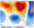
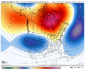
I absolutely agree with you. However we would’ve had 3 massive storms in January if we would’ve had a -NAO. But it just shows you. Even with a +NAO we got snow three straight snow events because of a +PNA
Sent from my iPhone using Tapatalk


Nah that ridiculously annoying Aluetian ridge that's been a thorn in our side for years popped a -PNA.So, the only thing this massive -NAO did was pop a -PNA?
-EPO / +PNA is 100% better for cold than -NAO.
All this needs is an appendectomy.This tall pacific ridge is entering day 5-6… View attachment 125024


