-
Hello, please take a minute to check out our awesome content, contributed by the wonderful members of our community. We hope you'll add your own thoughts and opinions by making a free account!
You are using an out of date browser. It may not display this or other websites correctly.
You should upgrade or use an alternative browser.
You should upgrade or use an alternative browser.
Pattern Dazzling December
- Thread starter Rain Cold
- Start date
starsfan68
Member
flip flops?GFS geez! Keep the flip-flops handy next week
Just needed the PNA to cooperate and it was going to get stupid cold with an active storm track. Oh well. Now we wait in the bathtub to slosh so we can try again at some point.
A type of open shoe you wear on your feet in warm weather but that's not important right nowflip flops?
L
Logan Is An Idiot 02
Guest
The pacific is soooo bad 

Sent from my iPhone using Tapatalk


Sent from my iPhone using Tapatalk
Oh Canada!
L
Logan Is An Idiot 02
Guest
One thing I’ve noticed with the gfs. Very active. Storms galore.

Sent from my iPhone using Tapatalk

Sent from my iPhone using Tapatalk
I think the progression right now is totally fine, if mjo propagates like grit posted, we already have the NAO cooperation, we should be sitting pretty by Christmas time. Would rather the best pattern come in prime climo instead of early December.
Living and dying with every Op GFS run is too stressful. If winter sucks we can’t change it, just have to hope for the best and right now things look pretty damn good!
Sent from my iPhone using Tapatalk
Living and dying with every Op GFS run is too stressful. If winter sucks we can’t change it, just have to hope for the best and right now things look pretty damn good!
Sent from my iPhone using Tapatalk
NBAcentel
Member
Brent
Member
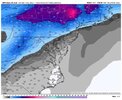
Man I want my split flow undercutting Baja wave this year. Jimmy been waiting too longPacific wave galore, at least we would get a lot of rain with this look View attachment 124726
NBAcentel
Member
Haha lol not happening anytime soon with that big -EAMT in the near future, now end of the December perhapsMan I want my split flow undercutting Baja wave this year. Jimmy been waiting too long
Met1985
Member
For the majority of yall late December into January you start to get into prime climo for cold and snow. You don't want a great pattern now. And originally the pattern was always supposed to change or start changing around the 15th... Patience is always needed especially east of the mountains. It's only December 4th....
L
Logan Is An Idiot 02
Guest
Start the thread

Sent from my iPhone using Tapatalk

Sent from my iPhone using Tapatalk
We’ve already come down to watching the CMC
It’s great on picking up on wedges, not sure about pattern changes
What about the stovepipe drop in low, from the +PN………..?Man I want my split flow undercutting Baja wave this year. Jimmy been waiting too long
And the GFS is a great model??We’ve already come down to watching the CMC
It’s great on picking up on wedges, not sure about pattern changes
NBAcentel
Member
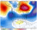
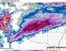
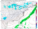
Weenier cmce run lol View attachment 124730
Couple big storms on the individual members.

Sent from my iPhone using Tapatalk
Hypsometric
Member
L
Logan Is An Idiot 02
Guest

Seems like the GEFS just keeps getting worse
Sent from my iPhone using Tapatalk
Who’s staying up for the Euro??
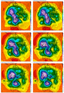
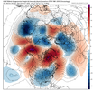
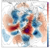
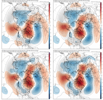
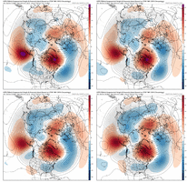
It’s almost like a big western based -NAO always mutes the SER given enough time ?View attachment 124737View attachment 124738
I mean, the overnight & morning runs weren't bad at all.
AJ1013
Member
70F here with mostly clear skies and a 62F dew. Nice summer morning ??
LukeBarrette
im north of 90% of people on here so yeah
Meteorology Student
Member
2024 Supporter
2017-2023 Supporter
Hypsometric
Member
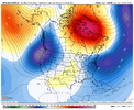
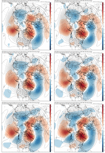
Trend changes with the NAO block are favorable. However, changes with the Aleutian ridging are not favorable, thus changes along the Pacific coast are also not favorable.
Whatever cold can make it into the US with that pattern should eventually spill east and south, as it modifies, into our region. But any sustained big cold is probably off the table for a good while.
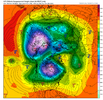
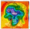
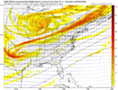
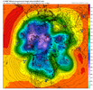
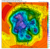
The Euro at 240 has the famous Left Foot pattern (aka crotch kick). The GFS is similar. Not the best.
NBAcentel
Member
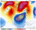
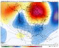
Gonna start dumping some legit cold in northwest Canada with that look, problem is initially we’re just gonna be fed 25%-50% of it behind pacific polar waves breaking off the main longwave trough over the west, but it’s better then what we were seeing I guess. It would be really cool if the Alaskan ridge could trend stronger and cutoff and ridge bridge to the Atlantic block
The good news with that look is that there is more cold buildings and we’re not flooding the source areas with Pacific air.Gonna start dumping some legit cold in northwest Canada with that look, problem is initially we’re just gonna be fed 25%-50% of it behind pacific polar waves breaking off the main longwave trough over the west, but it’s better then what we were seeing I guess. It would be really cool if the Alaskan ridge could trend stronger and cutoff and ridge bridge to the Atlantic block
Hypsometric
Member
Trend changes with the NAO block are favorable. However, changes with the Aleutian ridging are not favorable, thus changes along the Pacific coast are also not favorable.
Whatever cold can make it into the US with that pattern should eventually spill east and south, as it modifies, into our region. But any sustained big cold is probably off the table for a good while.
The Euro at 240 has the famous Left Foot pattern (aka crotch kick). The GFS is similar. Not the best.
View attachment 124747
View attachment 124748
Gonna start dumping some legit cold in northwest Canada with that look, problem is initially we’re just gonna be fed 25%-50% of it behind pacific polar waves breaking off the main longwave trough over the west, but it’s better then what we were seeing I guess. It would be really cool if the Alaskan ridge could trend stronger and cutoff and ridge bridge to the Atlantic block
It definitely appears (to me) as though we are trending towards a step-down, slower progression into a colder pattern. It does look like a lot of the ensembles and ops are beginning to more consistently show an evolution towards what some of those extended Euro runs were showing, but if we can hold the block I do think by the last week of December there could be an opportunity depending on how the undercutting energy evolves and manifests under the block and also what happens with the AK ridging (or lack thereof).
Overall, it's definitely a less-optimal version of what initially appeared with part of the TPV sliding under the block, but the Greenland blocking is a constant and is already trending stronger as we move forward in time (not unexpected), so future trends could continue to be positive towards a gradual 7-10 day step-down into a southern Mid-Atlantic / northern southeast wintry threat closer to Christmas or just after.
Last edited:
Something that would change things in a hurry would be to see a low pressure get wound up strongly up under the block tracking thru the Ohio Valley and off the NE coast....not implausible in this setupGonna start dumping some legit cold in northwest Canada with that look, problem is initially we’re just gonna be fed 25%-50% of it behind pacific polar waves breaking off the main longwave trough over the west, but it’s better then what we were seeing I guess. It would be really cool if the Alaskan ridge could trend stronger and cutoff and ridge bridge to the Atlantic block

