• Hello, please take a minute to check out our awesome content, contributed by the wonderful members of our community. We hope you'll add your own thoughts and opinions by making a free account!

Pattern Failbruary Thread

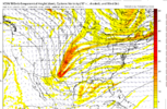
I think everyone needs to remember that the op and ensemble mean will differ quite a bit on temps because the Mean is a mean of many individual member runs. The OP showing a warm period and the mean showing a cold does not mean they don’t support each other because the mean(especially at longer range) is likely skewing the temps over several days due to the timing and strength of each member being different.

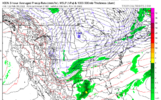
Looking at the prolonged pattern at H5 on the ensemble mean is much better than temps and will show you much better if the OP and the ensembles support each other.
 
bringing this out again because worth noting if we see forcing return to the maritime continent, this might slow down the return to a El Niño as maritime continent forcing typically aids in cooler water in the eq pac. Still a likely westerly wind burst would likely stop MJO progression into the Pac in March. For our sensible weather, this might mean morch if we can touch ph 6 esp, but phase 5 start to cool down the later you get into spring 8E734E51-FCCF-4328-94A5-E167ADC06115.png
 
Sorry warm weenies (including me) but your torch is denied, this isn’t your typical feb nina. Go to sleep A1C45F18-DC39-4291-AE31-23FEB5E4391C.png516AEED1-2422-4239-A9FC-EF3E6BD90389.png
And in fact the gefs is already adjusting mid feb to more eastern troughing, likely from how
Much the pacific jet keeps extending as we get closer. I’d say the only way we get warmer is due the how bad the Atlantic pattern is and how vulnerable it makes us

F9E39D5C-398F-4F6D-8452-2FDC1C11FBA5.png
25060B2B-3E26-4EEC-8AF2-BC32FC4FFA04.png
 
Also, with the MJO rambling around in and around the circle and lower amplitudes, it’s going to really put a damper on severe season, I hope not, because I love tracking huge kidneybeans with the best of them, but the cool, damp , March and April, will inhibit severe parameters! I really hope I’m wrong, but I think it’ll be a late start, maybe into May and June, we can score!
 
The overall strong + northern annular mode in the stratosphere should start to couple to the troposphere even more soon, we have gotten away with it with transient -AO especially, but it should start to make it’s mark known in late February
 
The overall strong + northern annular mode in the stratosphere should start to couple to the troposphere even more soon, we have gotten away with it with transient -AO especially, but it should start to make it’s mark known in late February
I remember you saying that in early January ? I’m sure it’ll end up biting us where it hurts but that PV argument was used a lot early on and it just kept stretching
 
I remember you saying that in early January ? I’m sure it’ll end up biting us where it hurts but that PV argument was used a lot early on and it just kept stretching
Well this +PNA pattern is starting to show signs of breaking towards mid Month with that big low on/north of AK, typically a precursor to a bad pattern, all fits the MJO, I’d say we have 2-2.5 more weeks or so of opportunity
 
Well this +PNA pattern is starting to show signs of breaking towards mid Month with that big low on/north of AK, typically a precursor to a bad pattern, all fits the MJO, I’d say we have 2-2.5 more weeks or so of opportunity
I guess we can’t have a perfect pattern forever I suppose
 
Well this +PNA pattern is starting to show signs of breaking towards mid Month with that big low on/north of AK, typically a precursor to a bad pattern, all fits the MJO, I’d say we have 2-2.5 more weeks or so of opportunity
I thought just a day ago everyone in here was saying the pattern was going to be great again mid month? Now it’s gonna turn to crap mid month?
 
I thought just a day ago everyone in here was saying the pattern was going to be great again mid month? Now it’s gonna turn to crap mid month?
You do know next weekend/the beginning of the week is around mid month right ? That’s still way in the 2.5 week window….. you good ? Haha
 
Well this +PNA pattern is starting to show signs of breaking towards mid Month with that big low on/north of AK, typically a precursor to a bad pattern, all fits the MJO, I’d say we have 2-2.5 more weeks or so of opportunity
Maybe we can pull together a big storm as the PNA breaks down
 
Looks lik the 12z ICON was about to go boom with a phase sparking a deep gulf low at 180hrs..
As depicted, that looks like an Alabama westward threat to me. There is no cold in place east of the Appalachians and the low would be moving NE from Louisiana it would seem. That said, it's good to see the potential for a big storm to continue to show up off and on in this period.
 
As depicted, that looks like an Alabama westward threat to me. There is no cold in place east of the Appalachians and the low would be moving NE from Louisiana it would seem. That said, it's good to see the potential for a big storm to continue to show up off and on in this period.
Eh debatable .. I think that high pressure is advancing fairly rapidly while the storm is developing I could see most of the SE getting in on that if it progressed forward .. phases are always weird and sloppy though so who knows
 
As depicted, that looks like an Alabama westward threat to me. There is no cold in place east of the Appalachians and the low would be moving NE from Louisiana it would seem. That said, it's good to see the potential for a big storm to continue to show up off and on in this period.
Meh, I dunno about that. The trough is still positive tilted and you've got nice confluence in the northeast and high pressure moving in tandem with the phasing trough/storm.

I'm not sure it gets Eastern NC involved but as depicted I don't think there's a chance the strengthening low is cutting west of the apps or anything. More likely it's a coastal of some sort, imo.
 
Colder vs prior runs coming in for midmonth on 12Z GFS? Let’s see! Two Arctic highs.

A65E6020-23A9-419E-A356-C8399454CFA4.png67FA883D-DBCD-4D1F-8301-2AC479F8DB94.png
 
??
gem_z500_vort_us_32.png
 
Back
Top