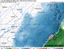
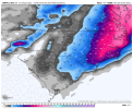
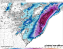
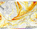
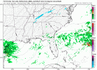
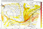
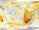
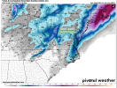
Our LP on the coast has remained same strength past 4 runs of Nam. This 12z is a little further north with placement, but fortunately still tucked in pretty tight, not out over or east of the gulf stream.
-
Hello, please take a minute to check out our awesome content, contributed by the wonderful members of our community. We hope you'll add your own thoughts and opinions by making a free account!
You are using an out of date browser. It may not display this or other websites correctly.
You should upgrade or use an alternative browser.
You should upgrade or use an alternative browser.
Wintry 01/28-29/2022 Winter Weather Potential
- Thread starter weather nerd
- Start date
NBAcentel
Member
crazy thing is that i think it can be better. both the nam and the rgem have this nonsense forming near bermuda
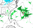
that really stunts the lp development/moisture transport in the early stages. funny thing is it still looks like it overcame things. stranger things have happen but i just.... don't think that convective mass will be there.

that really stunts the lp development/moisture transport in the early stages. funny thing is it still looks like it overcame things. stranger things have happen but i just.... don't think that convective mass will be there.
Still spitting light in NE NC at this frame


Yes. But, it is so close for us Ga. peeps. IDK if we can get the mean trough further west, but if that southern vort-max comes out even six hours sooner a deeper negatively tilted or even cut off southern lobe is on the table IMO.Good for the Carolina boys.... It just seems this thing won't tilt early enough and further west for anybody else it's just there winter
packfan98
Moderator
I was noticing that too. The end of the 3k Nam didn't have that.crazy thing is that i think it can be better. both the nam and the rgem have this nonsense forming near bermuda
View attachment 110621
that really stunts the lp development/moisture transport in the early stages. funny thing is it still looks like it overcame things. stranger things have happen but i just.... don't think that convective mass will be there.

SnowsWonderful
Member
Oh yeah, keep that baby trending positive next 2 1/2 days hopefully 975-980mb across Cape Hatteras. Smoked!
Especially since is goes from 1004mb at this frame you posted to like 996mb in the next one. Glad Nam is keeping the true surface Low in close to the coastcrazy thing is that i think it can be better. both the nam and the rgem have this nonsense forming near bermuda
View attachment 110621
that really stunts the lp development/moisture transport in the early stages. funny thing is it still looks like it overcame things. stranger things have happen but i just.... don't think that convective mass will be there.
NBAcentel
Member
NAM verbatim would probably be higher snow in those areas back west around 77, with DPVA and resulting lift associated with the northern stream entering in. Similar to last system. Typically underdone
LovingGulfLows
Member
- Joined
- Jan 5, 2017
- Messages
- 1,499
- Reaction score
- 4,100
Yes. But, it is so close for us Ga. peeps. IDK if we can get the mean trough further west, but if that southern vort-max comes out even six hours sooner a deeper negatively tilted or even cut off southern lobe is on the table IMO.
I don't see it. The NAM is currently the best case scenario for the SE and it's still not really there for us. Maybe far Eastern GA(like Augusta), but don't see it for many other places in GA. Could be wrong though...
Another thing is the Euro is catching western piedmont with those finger strips from NS energy flying by and crashing into the coastal forming. Its late with the phase compared to all other modeling. Why we don't see that on the nam as much to my untrained eye. Definitely think the Nam is they way to root for / go here. Get neutral and not be messing with that boogeyman reflection/convection wilm ross pointed out. Should/would have been more precip back into Carolinas imo.
Not 100% sure it's convective nonsense. That's the residual storm system and lingering boundary that'll be hanging around FL over the next few days. Could still be present as our storm gets going and could be a wildcard in how things end up forming along the coast depending on how long it lingers and disrupts moisture transportcrazy thing is that i think it can be better. both the nam and the rgem have this nonsense forming near bermuda
View attachment 110621
that really stunts the lp development/moisture transport in the early stages. funny thing is it still looks like it overcame things. stranger things have happen but i just.... don't think that convective mass will be there.
I'd imagine our storm will still end up pulling closer to the coast along the gulf stream and more general baroclinic zone though
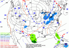
I was about to say the same thing. The sfc doesn't really match the mid and upper levels that well until it magically jerks the sfc low westcrazy thing is that i think it can be better. both the nam and the rgem have this nonsense forming near bermuda
View attachment 110621
that really stunts the lp development/moisture transport in the early stages. funny thing is it still looks like it overcame things. stranger things have happen but i just.... don't think that convective mass will be there.
Yeah,especially with the Low being that far east. If Phasing does happen like suggested on the NAM, The Low pressure system would be stronger and futher west and we would be looking at a even bigger storm for SC and NC than shown. I still can't get excited however becasue the NAM solution isn't being supported by other models and we know it performed with the last stormAnother thing is the Euro is catching western piedmont with those finger strips from NS energy flying by and crashing into the coastal forming. Its late with the phase compared to all other modeling. Why we don't see that on the nam as much to my untrained eye. Definitely think the Nam is they way to root for / go here. Get neutral and not be messing with that boogeyman reflection/convection wilm ross pointed out. Should/would have been more precip back into Carolinas imo.
SnowNiner
Member
crazy thing is that i think it can be better. both the nam and the rgem have this nonsense forming near bermuda
View attachment 110621
that really stunts the lp development/moisture transport in the early stages. funny thing is it still looks like it overcame things. stranger things have happen but i just.... don't think that convective mass will be there.
Yeah, looking at that just makes me sigh for clt area. No matter what the clown maps say, if a low forms that far east off the coast, I don't feel like anybody in the western/central piedmont is going to get anything other than maybe backside flurries. Really feel this is just too late of a tilt for us. Hoping it's not too late for eastern NC.
you're right and it's going to be a factor. that being said i don't see the convection having that much tug and influence on the whole complex. scanned as a little convective-feedbacky to me, there's a reason we don't really utilize these things that much when dealing with the tropicsNot 100% sure it's convective nonsense. That's the residual storm system and lingering boundary that'll be hanging around FL over the next few days. Could still be present as our storm gets going and could be a wildcard in how things end up forming along the coast depending on how long it lingers and disrupts moisture transport
I'd imagine our storm will still end up pulling closer to the coast along the gulf stream and more general baroclinic zone though
Heelyes
Member
When do we start to take the NAM serious? 24hrs from now? 24hrs before the storm or never?
Never unless it gets this storm correct. I have no faith in the NAM unless other models start following it’s footsteps .. I suppose the GFS looks similar which makes sense since they’re in the same camp but I would love to see more reliable models jump on board as well .. still lots of time for wiggle roomWhen do we start to take the NAM serious? 24hrs from now? 24hrs before the storm or never?
L
Logan Is An Idiot 02
Guest
Yeah, looking at that just makes me sigh for clt area. No matter what the clown maps say, if a low forms that far east off the coast, I don't feel like anybody in the western/central piedmont is going to get anything other than maybe backside flurries. Really feel this is just too late of a tilt for us. Hoping it's not too late for eastern NC.
Do you literally say that every storm we get. We were never going to get snow from the coastal low. It’s the upper level low that the Piedmont would get snow. I’ve seen upper level is produced 1 to 3 inches of snow several times.

Sent from my iPhone using Tapatalk
Honestly they both look very close even if the surface isn’t responding I’m sure we can improve that look over the next 48 hours
Cary_Snow95
Member
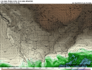
Not that I have much if any faith in the WRF models but this shows what the 5H might look like if the southern vort-max doesn't temporarily park itself on the SW. This model keeps it in phase the whole time and winds up looking like this:


Hey look that Jack Sillin guy who I don't know who he is is mentioning latent heat above...
Now isn't that what happened in Janurary of 2000? What the ETA failed to realize...? I see what you're doing there Jack... I'm onto you.
Now isn't that what happened in Janurary of 2000? What the ETA failed to realize...? I see what you're doing there Jack... I'm onto you.
SnowNiner
Member
Do you literally say that every storm we get. We were never going to get snow from the coastal low. It’s the upper level low that the Piedmont would get snow. I’ve seen upper level is produced 1 to 3 inches of snow several times.
Sent from my iPhone using Tapatalk
Haha, yes for the last two that were ridiculously off the coast to not benefit us. Interesting point about the trough through. I guess we'll see.
ATLwxfan
Member
I don't see it. The NAM is currently the best case scenario for the SE and it's still not really there for us. Maybe far Eastern GA(like Augusta), but don't see it for many other places in GA. Could be wrong though...
You won’t be wrong. It’s an outlier that still doesn’t deliver for most of GA. It’s almost 100% a coastal storm with some benefits to the Carolinas.
Sent from my iPhone using Tapatalk
- Joined
- Jan 23, 2021
- Messages
- 4,599
- Reaction score
- 15,193
- Location
- Lebanon Township, Durham County NC
Why is the RGEM not being discussed as a clear outlier in the way the NAM is being talked about? Just curious.
The RGEM did well with the last storm but that doesn't mean it is going to lead the way here. The two situations are different. It's still a good model, don't get me wrong.
For the NAM, it's probably best to view somewhere near the 48 hour mark as the delineation between good and grain of salt land. If there's anything to be gleaned trend-wise within the first 48 or so, I'd give that more weight than what happens after that period, particularly if it's arriving at different solutions than most other guidance.
We're really going to want the globals all stepping towards a better outcome pretty soon. Two steps back, one step forward is not what we want to see.
Gun to head, this ends up farther west than they're seeing right now.
LickWx
Member
Is the rgem an outlier ? Euro , cmc , uk haven’t been seen in the threads for a while either .Why is the RGEM not being discussed as a clear outlier in the way the NAM is being talked about? Just curious.
You can clearly see that the RGEM even at 700mb is dry vs other guidance when quickly taking a look. Something it did not look like for the last event.....
It's interesting how close the nam and rgem are but yet they are so far away
You realize none of those 12z models are out yet? LOL.Is the rgem an outlier ? Euro , cmc , uk haven’t been seen in the threads for a while either .
Yeah for real. Rgem nees to sharpen up. There's time.It's interesting how close the nam and rgem are but yet they are so far away
LickWx
Member
Yes and I dont recall seeing much of their overnight runs, or the cmc much at all no matter which run.You realize none of those 12z models are out yet? LOL.
Then post them and discuss it, nothing stopping you.... if you want to complain that it isn't being discussed do it in the whamby.Is the rgem an outlier ? Euro , cmc , uk haven’t been seen in the threads for a while either .

