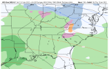
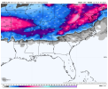
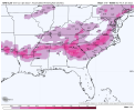
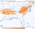
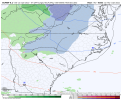
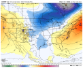
Feb 14 redux?GFS fanatsy storm: Massive Ice storm all they way down past macon,Savannah. Snow with sleet, ice on top carolinas, That ice accum was no joke if it ever happened. Lights out for weeks
-
Hello, please take a minute to check out our awesome content, contributed by the wonderful members of our community. We hope you'll add your own thoughts and opinions by making a free account!
You are using an out of date browser. It may not display this or other websites correctly.
You should upgrade or use an alternative browser.
You should upgrade or use an alternative browser.
Pattern Januworry
- Thread starter SD
- Start date
Something about the placement of that LP in the OV juxtaposed to NC doesn't look right for winter weather here.Southeast power in shambles.View attachment 101987
iGRXY
Member
The midlands, I20 corridor, and western pee dee regions of SC get crushed with freezing rain.
EDIT: just checked the soundings and it's definitely a ZR sounding with temps at the surface in the mid 20's. That would be crushing.
EDIT: just checked the soundings and it's definitely a ZR sounding with temps at the surface in the mid 20's. That would be crushing.
Cary_Snow95
Member
GRIT IS HERE. Now it’s really winter ? welcome grit, excited to have you over here.I am such a virgin, this is my first post......."but don't call it a comeback! I've been here for years!" ?
What I mean by that is...the very first post I made on a weather board back in Dec 2007 was on Talkweather where I barged into an ongoing thread and got into a debate with the legend himself, SD, over the ideal placement of western ridging lol, lol...which is ironic given the upcoming pattern.
Anyway, hopefully I can add to the discussion in here and not take away from it or be a distraction.
From a pattern standpoint, we've had a bit of a delay here in early Jan as the Pac Jet extension has trended stronger and farther east on the modeling. The dates I'm watching are Jan 17-18 as this is at the point where the pattern retrogrades off the E Coast a bit, and the + anomalies are at a point along the Rocky Mtn divide. I want to see how this changes over the next week (i.e. whether it moves up in time or is delayed). I don't anticipate a delay, but we'll see.

Sexy look here on Jan 19...Aleutian Low with high pressure lined up from Bismark to China

iGRXY
Member
whatalife
Moderator
Playing quite the dangerous game on the gfs. Trough axis starts its retrogression but a -nao builds over top. Miller B ice storm city
We’re definitely way passed due for an ice storm that is for sure I don’t remember the last time we had a decent onePlaying quite the dangerous game on the gfs. Trough axis starts its retrogression but a -nao builds over top. Miller B ice storm city
packfan98
Moderator
Decent setup at the end of the GFS too -


Get out of here with that talkWe’re definitely way passed due for an ice storm that is for sure I don’t remember the last time we had a decent one
^ Thanks all for the welcome and kind words, appreciate it!When you have a persistent Baja low good things happen, example : dec 2018 lol
Cutoff low in Baja / SW states that is kicked east by a northern stream / Gulf of AK wave dropping down isn't an uncommon setup for a winter storm in the SE. Feb 2015, Jan 2011, Jan 1982, early Feb 1979 all had it


I think it makes sense that we could make an attempt at a period of -NAO. As the Pac jet retracts after Jan 10, the jet will get wavy and slow down in the NE Pac and along with W Coast....and should also do the same in the N Atlantic. Also, we should see some easterly momentum in the high latitudes with the ongoing westerly momentum in the mid-latitudes via the current AAM processes. The strength of the lower stratosphere will fight back though (would be better if it were in a weakened state)


It’s a Miller B set up so it’s gonna hand off to a coastal. Where exactly that handoff occurs would determine how much snow before it switches to sleet/ice storm. One thing about that look is that the CAD looks to be quite strong and deep, which would argue for a handoff further south like February 2014. Ultimately we’re just looking for a signal in that time frame right now.Something about the placement of that LP in the OV juxtaposed to NC doesn't look right for winter weather here.
NBAcentel
Member
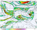
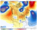
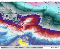
lots of potential in this upcoming pattern and retrogression phases
1. Get some SS energy with confluence in the NE US/off the coast and get a Miller B/CAD setup
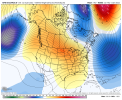
2. Get some energy to dig down from the western ridge and given lower heights in the ATL there would be some level of CAA/confluence, get a SS/Miller A setup
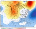
3. With a TPV in place under the -NAO block, get some S/S energy under this either from the Baja low or down from the PNA ridge
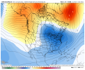 tons of potential with this pattern
1. Get some SS energy with confluence in the NE US/off the coast and get a Miller B/CAD setup

2. Get some energy to dig down from the western ridge and given lower heights in the ATL there would be some level of CAA/confluence, get a SS/Miller A setup

3. With a TPV in place under the -NAO block, get some S/S energy under this either from the Baja low or down from the PNA ridge
 tons of potential with this pattern
Also another thing to watch for in that type of set up would be development of a mesohigh in the mid-Atlantic that can help reinforce CAD….this is something that wouldn’t be picked up on until short range models, but with the snowpack that will be in place to our north, it certainly is a possibility. In February 2015, many on this board including myself were saved from a crippling ZR event by a mesohigh that formed just to our north. It turned what was headed to be a widespread .50-.75” ice accrual into a 1-2” sleet event with much lower ice.It’s a Miller B set up so it’s gonna hand off to a coastal. Where exactly that handoff occurs would determine how much snow before it switches to sleet/ice storm. One thing about that look is that the CAD looks to be quite strong and deep, which would argue for a handoff further south like February 2014. Ultimately we’re just looking for a signal in that time frame right now.
lots of potential in this upcoming pattern and retrogression phases
1. Get some SS energy with confluence in the NE US/off the coast and get a Miller B/CAD setup
View attachment 102004
2. Get some energy to dig down from the western ridge and given lower heights in the ATL there would be some level of CAA/confluence, get a SS/Miller A setup
View attachment 102005
3. With a TPV in place under the -NAO block, get some S/S energy under this either from the Baja low or down from the PNA ridge
View attachment 102006tons of potential with this pattern
smast16
Member
I measured on the roof of the car, and had 2" during the heavy stuff, and 1.5" at the end.I hope they don't measure on patio tables..?
Slacks annihilatedWow!

Stephenb888
Member
Why does the cold always retreat when the precipitation starts rolling in? What does it take to have cold move in and stay in place the entire duration of a storm without warming up?
An act of God...Why does the cold always retreat when the precipitation starts rolling in? What does it take to have cold move in and stay in place the entire duration of a storm without warming up?
You want blocking Stephen.
NBAcentel
Member
Lol what are you looking at models look greatWhy does the cold always retreat when the precipitation starts rolling in? What does it take to have cold move in and stay in place the entire duration of a storm without warming up?
He's been a little pessimistic today. Everything looks great like @Myfrotho704_ said. be patient, your ice will be in Anderson soon.Lol what are you looking at models look great
This may sound weird, but we have to work hard to earn a good winter storm in the SE. It's like trying to put together a team that can win the Super Bowl. I'm a Philadelphia Eagles fan even though I've lived in the Charlotte area almost all of my life. It took me 30 years of being a fan before I got to enjoy a Super Bowl win - makes it sweeter in the endWhy does the cold always retreat when the precipitation starts rolling in? What does it take to have cold move in and stay in place the entire duration of a storm without warming up?
Yea from anecdotal observation, it seems that most of the time CAD NC areas get saved from what could be considered crippling ice effects because precip type trends more IP than ZR as it gets closer to onset. That's why I don't get too concerned about heavy ZR until it's shown within 3 days or so.Also another thing to watch for in that type of set up would be development of a mesohigh in the mid-Atlantic that can help reinforce CAD….this is something that wouldn’t be picked up on until short range models, but with the snowpack that will be in place to our north, it certainly is a possibility. In February 2015, many on this board including myself were saved from a crippling ZR event by a mesohigh that formed just to our north. It turned what was headed to be a widespread .50-.75” ice accrual into a 1-2” sleet event with much lower ice.
Stephenb888
Member
Except I don’t want Ice I want SNOW ?He's been a little pessimistic today. Everything looks great like @Myfrotho704_ said. be patient, your ice will be in Anderson soon.
NBAcentel
Member
Then you have Charlotte and the Carolina panthers….This may sound weird, but we have to work hard to earn a good winter storm in the SE. It's like trying to put together a team that can win the Super Bowl. I'm a Philadelphia Eagles fan even though I've lived in the Charlotte area almost all of my life. It took me 30 years of being a fan before I got to enjoy a Super Bowl win - makes it sweeter in the end
Except I don’t want Ice I want SNOW ?
Misc - 2021-22 Fall/Winter Whamby Thread
Well folks, it’s already meteorological fall, the autumnal equinox is nearing, and the first GFS fantasy mountain snow has fallen. Time to transition!
southernwx.com
- Joined
- Jan 2, 2017
- Messages
- 1,566
- Reaction score
- 4,279
You gotta start learning a little on here. As been noted any times without perfect timing which rarely happens we need blocking in the northeast to keep the cold air from getting run out by low pressure systems.Why does the cold always retreat when the precipitation starts rolling in? What does it take to have cold move in and stay in place the entire duration of a storm without warming up?
Upper Level Lows sometimes work out when there's real cold to tap into but then it's track dependant for us.
Until we get High pressure in the northeast(it's being modeled after the 15th) we are 99% screwed here in the upstate.
- Joined
- Jan 2, 2017
- Messages
- 1,566
- Reaction score
- 4,279
Since I've been hear in the 70's we've always had more ice storms than snow storms. But over last decade or so even those are hard to come byExcept I don’t want Ice I want SNOW ?
JHS
Member
Way overdue in most of NC and SC. There is a better chance this year than we have had in a while too I think with this being a LaNina winter.. It has been since Dec 2005 that we had a major icestorm here. It is since Dec 2002 since most of us have seen a really serious icestorm. 2005 was really bad too but in a smaller area just outside of the mountains from northeast GA up through the foothills of NC.We’re definitely way passed due for an ice storm that is for sure I don’t remember the last time we had a decent one
- Joined
- Jan 23, 2021
- Messages
- 4,603
- Reaction score
- 15,199
- Location
- Lebanon Township, Durham County NC
I grew up about 4 hours up the road north from you and even there I can only remember 4 or 5 purely snow events that were big since 1980.Why does the cold always retreat when the precipitation starts rolling in? What does it take to have cold move in and stay in place the entire duration of a storm without warming up?
JHS
Member
I remember that very well. We were not even supposed to have ZR here, much less any sleet, but around 1 inch of sleet is what we got thankfully. That was going to be all of that ice too with temps around 28 for many of us like you said, but we got that sleet. Northern GA got the ice from it.Also another thing to watch for in that type of set up would be development of a mesohigh in the mid-Atlantic that can help reinforce CAD….this is something that wouldn’t be picked up on until short range models, but with the snowpack that will be in place to our north, it certainly is a possibility. In February 2015, many on this board including myself were saved from a crippling ZR event by a mesohigh that formed just to our north. It turned what was headed to be a widespread .50-.75” ice accrual into a 1-2” sleet event with much lower ice.
NBAcentel
Member
JHS
Member
It has been a while since the cold was in place before precip. The result was a nice sleet storm for many of us.You gotta start learning a little on here. As been noted any times without perfect timing which rarely happens we need blocking in the northeast to keep the cold air from getting run out by low pressure systems.
Upper Level Lows sometimes work out when there's real cold to tap into but then it's track dependant for us.
Until we get High pressure in the northeast(it's being modeled after the 15th) we are 99% screwed here in the upstate.
NBAcentel
Member
D
Deleted member 609
Guest
Snow here, rain in Ohio? Looks legit.
NBAcentel
Member
Way overdue in most of NC and SC. There is a better chance this year than we have had in a while too I think with this being a LaNina winter.. It has been since Dec 2005 that we had a major icestorm here. It is since Dec 2002 since most of us have seen a really serious icestorm. 2005 was really bad too but in a smaller area just outside of the mountains from northeast GA up through the foothills of NC.
ATL area had two major icestorms in 2005. Then came February of 2014, which had major impacts for the southern half of ATL metro eastward to Augusta and Columbia. This storm took down the famous Eisenhower tree at Augusta National.
Corrected for details about the tree
Antecedent 1040 High in New York can do it for us.Snow here, rain in Ohio? Looks legit.
Was that the storm when everybody got stranded on the interstates?
ATL area had two major icestorms in 2005. Then came February of 2014, which had major impacts for the southern half of ATL metro eastward to Augusta and Columbia. This storm killed the famous Eisenhower tree at Augusta National.


