iGRXY
Member
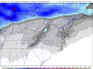
Agreed. Would doubt anyone outside of the mountains sees much, as these cold-air chasing scenarios never really pan too well for most of us.Along and west of the mountains that is fairly believable and a good output of what probably will happen if we can get the cold air rushing in fast enough. Personally I think the only places in NC that will have a chance at seeing flakes fly is along and east of 95. Cold air is always slower coming across the mountains than what the models show and its hard for anyone in the piedmont or upstate to score in these types of setups of cold chasing moisture.
Sweet - that will help keep our snowpack intact! ?View attachment 99510
Nothing but a 1046 high in prime CAD position with no moisture around.
Wake jackpots while Chatham gets rain. Lol. Must have been pre-configured in the model.
Thankfully we have massive CAD helping us stay quite cold with this lookDumpster fire View attachment 99513
That's why the ICON is my favorite, no need for anything past 180 or 120.View attachment 99514
Simply put, the GFS is ugly as you can get. Granted this model is hot garbage and has zero consistency.
Its all east of Greenville. Jackpot.
1 inch mean over me on COD.Im Convinced a mean over 0.5 here is impossible lol View attachment 99520View attachment 99521View attachment 99522

There was so much fantasy snow it couldn’t let anyone see what the rest of the run had to offer ?GEFS got stuck.at 144 an hour ago. No word from NCEP yet.
I think you said what has to happen for that GFS run to become a reality… we know that cold will be slower coming over the mountains, but if we can get strong enough dynamics in play to quickly crash the column then this could be something. I don’t give it a great chance of happening, but I am mildly intrigued since this showing inside 6 days now.IMO we are very close to getting something interesting with this system .. many gefs have some sort of break out of snow at the tail end of this system with cold air collapsing the column .. has the potential for dynamic snow with heavier rates which is great for lucky lollipop winners .. let’s see what the euro chooses
I've been waiting to get to hour 384 since late November.Kind of surprised the late hours of the gfs didn't even get a mention. About to make a run at a board wide event hereView attachment 99543
Hey just saying all I've seen for the past 30 days are day 13, 14, 15, 16 red maps with oof, crickets and golf emojis weird that when it looks decent it's quietI've been waiting to get to hour 384 since late November.
Kind of surprised the late hours of the gfs didn't even get a mention. About to make a run at a board wide event hereView attachment 99543
How do you see that 4 corners progressing out?Hey just saying all I've seen for the past 30 days is day 16 red maps with oof, crickets and golf emojis weird that when it looks decent it's quiet
That'll be back when Logan is backHey just saying all I've seen for the past 30 days is day 16 red maps with oof, crickets and golf emojis weird that when it looks decent it's quiet
Guess they will only be seen in whamby thenThat'll be back when Logan is back
Ah. That explains why I’m not seeing all the “ignored content” posts lately.That'll be back when Logan is back
Probably through tx into ark/la then turns ENE toward east TN. Eastern half of nc/sc likely has a complete meltdown as parts of Ar/La/ms/Al/Ga/TN/upstate/wnc get pummeledHow do you see that 4 corners progressing out?
Surprised you think it will turn that late. Id be happy if WNC cashed in.Probably through tx into ark/la then turns ENE toward east TN. Eastern half of nc/sc likely has a complete meltdown as parts of Ar/La/ms/Al/Ga/TN/upstate/wnc get pummeled
