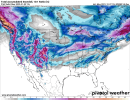
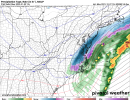
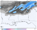
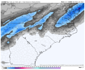
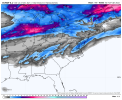
I really wonder if it’s a guaranteed thing here! Having a dusting of sleet and a dusting of snow so far, is kind of reminiscent of SC. Saturday looks like a monster storm , but I’m tiptoeing the rain mid snow line!Your winter was never in doubt my friend. Enjoy because you will always have more then us.
-
Hello, please take a minute to check out our awesome content, contributed by the wonderful members of our community. We hope you'll add your own thoughts and opinions by making a free account!
You are using an out of date browser. It may not display this or other websites correctly.
You should upgrade or use an alternative browser.
You should upgrade or use an alternative browser.
Pattern Januworry
- Thread starter SD
- Start date
Dewpoint Dan
Member
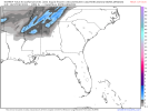
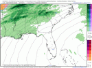
But would the ratio actually be 10:1 ?This has shown up for 2 runs in a row for this upcoming Sunday so there’s that.
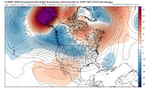
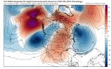
View attachment 99379View attachment 99380
There’s no doubt change is coming at least away from this god awful record setting warmth day in and day out. Weather or not it will stay for a while is obviously still up in the air. Either way the major warmth looks to be coming to an end starting this Sunday.
NoSnowATL
Member
More weenie
Now that I'm seeing the GEM, it explains why this thread has suddenly gone quiet...
EDIT: It's not GFS bad, but almost there...
EDIT: It's not GFS bad, but almost there...
Ron Burgundy
Member
Smdh
Wait…does this mean Brick was right all along?? ?
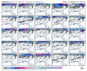
Euro looking pretty good for the weekend system.
Snowman63
Member
12Z Euro


Euro looking pretty good for the weekend system.
So we have GFs and Euro on board. Canadian was close to something also today. (Been showing it in past). Something definitely to track.12Z Euro

Your classic I59 north/west system.
Snowman63
Member
Dewpoint Dan
Member
1-2" in the western Atlanta suburbs. Do you really think thats realistic ?
Please have ensemble support ?
Pretty shocked to see both the euro and gfs both have similar outcomes with those 12z op runs
Pretty shocked to see both the euro and gfs both have similar outcomes with those 12z op runs
I am fully ready to accept zero support from the EPS.
I might storm chase this one ?. The wintry action possibilities are not that far from my location.So we have GFs and Euro on board. Canadian was close to something also today. (Been showing it in past). Something definitely to track.
NBAcentel
Member
In that setup on the euro? Yes. Still a good amount to iron out though. More phasing means less/no snow, more separation or attempting to cut off the trailer/srn stream may mean more snow.1-2" in the western Atlanta suburbs. Do you really think thats realistic ?
Last edited:
Ron Burgundy
Member
LukeBarrette
im north of 90% of people on here so yeah
Meteorology Student
Member
2024 Supporter
2017-2023 Supporter
At least we got something to track now
Snowman63
Member
D
Deleted member 609
Guest
Ron Burgundy
Member
From FFC’s overnight AFD. Be interesting to see if the 12Z runs make them more bullish on the snow potential in this afternoon’s disco:
GFS and EURO 0Z runs both show another shortwave kicking in over the
top of this cold front on Sunday and developing another low along
it. Timing and placement of this will be key, and will definitely
want to see it in place across a few more runs before buying in, but
this could keep enough moisture in place over the top of the cold
front to allow for some light winter precipitation over portions of
north GA. Have decided to add some very light snow and rain snow mix
and Sunday night as a result. Will continue to access through the
week, as there are many small adjustments to the players in this
scenario that could drastically change the forecast. Either way,
this cold front would finally bring an end to our run of record or
near record temps, and as stated above, would finally bring some
more seasonable air and subfreezing temperatures into the area.
Lusk
Yes definitely. The Pac ridge is being cutoff and pushed north. As Webber has stated anything but where it is now is an improvement.
Prestige Worldwide
Member
Maybe this will come to fruition
D
Deleted member 609
Guest
Well ---- GFS. All in on euro then.Yes definitely. The Pac ridge is being cutoff and pushed north. As Webber has stated anything but where it is now is an improvement.
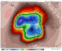
Both look pretty crappy, tbh. GFS probably supports more CAD than the Euro. Hopefully, they are both in process to transition to something better at that time.
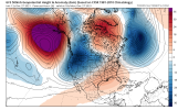
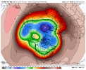
Love the 6 hr time stamp!Closed 591dm ridge in the north Pacific is ridiculous. No -NAO, -AO, MJO phase 8 or Judah Cohens model can save the SE from burning with that there. My opinion all you need to look at on models is the N Pac and if it doesn't change then don't bother looking downstream until it does.
View attachment 99383
Euro literally said i dont know wtf these other guys are predicting but I ain’t seeing none of that
The EURO was also the last to pick up on the "pattern change" the GFS initially showed, FWIW...
Of course the EPS sucks in regards to the snow for late weekend. Maybe they’ll come around
Yep that illustrates perfectly that that ridge is our main problem and why we're torching so hard today and the rest of the week.Love the 6 hr time stamp!
I think the Euro has a better shot to transition to something better a lot quicker. That GFS run is hideous and looks just like what we have now in the Pac. Like you said this is a very persistent stubborn pattern and will be hard to get out of. Hopefully the GFS proves it's the garbage we think it is and is wrong. But the Euro hasnt been great either.Both look pretty crappy, tbh. GFS probably supports more CAD than the Euro. Hopefully, they are both in process to transition to something better at that time.
Avalanche
Member
Give us 49 and we will all carpool to D.C.

