B
-
Hello, please take a minute to check out our awesome content, contributed by the wonderful members of our community. We hope you'll add your own thoughts and opinions by making a free account!
You are using an out of date browser. It may not display this or other websites correctly.
You should upgrade or use an alternative browser.
You should upgrade or use an alternative browser.
Pattern December to Remember
- Thread starter SD
- Start date
iGRXY
Member
Euro gives a bit more reassurance that hopefully the east coast ridging will last less than 10 days. I think we can bet on days of warmth and CAD until the 12th and 13th. After that I am curious to see the progression to see if we can start dumping some cold this way again. Luckily with these big east coast ridges you typically will get cutting storms that act as a 50/50 low and cause CAD and then typically can give you a progressive -NAO that can temper temps back to average or slightly below average for a couple days as well.
LickWx
Member
Why is it so hot out that way ? Nothing crazy here at all. Geez .
Cary_Snow95
Member
IMO the trough on the east coast will just be transient and the SER will flex again shortly after. Any cold shots will be very temporaryEuro gives a bit more reassurance that hopefully the east coast ridging will last less than 10 days. I think we can bet on days of warmth and CAD until the 12th and 13th. After that I am curious to see the progression to see if we can start dumping some cold this way again. Luckily with these big east coast ridges you typically will get cutting storms that act as a 50/50 low and cause CAD and then typically can give you a progressive -NAO that can temper temps back to average or slightly below average for a couple days as well.
Webberweather53
Meteorologist
Jessy89
Member

It’s a December to remember alright
Sent from my iPhone using Tapatalk
B
Brick Tamland
Guest
Remembered for all the wrong reasons.
Webberweather53
Meteorologist
12z EPS trending towards severe weather for most of the board beginning late next weekend


Webberweather53
Meteorologist
The Euro operational is still an outlier in the context of its own ensemble suite in the extended. Probably some timing differences amongst members smearing out the signal in the mean, but not super confident in a strong cold shot yet. Regardless, with the ridge over the Aleutians in the ensemble mean, it's honestly a matter of time before the SE ridge rears its ugly head again.


LickWx
Member
It was bound to happen , virtually every city in the south has hit 80 in December . Even all the cities in Virginia have hit 80 in December before .
It’s a December to remember alright
Sent from my iPhone using Tapatalk
Augusta is reporting 81F, Athens is reporting the same.
ATLwxfan
Member
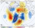
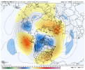
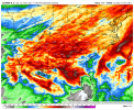
View attachment 96716Not everyday you see +20 anomalies on a ensemble View attachment 96717
If it’s going to be warm…let’s make it worth our while. #OpenTheDamnPools
Sent from my iPhone using Tapatalk
B
Brick Tamland
Guest
Today would have been perfect for some outdoor hoops.
Webberweather53
Meteorologist
Ouch


ATLwxfan
Member
Today would have been perfect for some outdoor hoops.
When life throws you lemons - and those lemons happen to be beautifully sunny warm days, go play outside.
Sent from my iPhone using Tapatalk
300 hour torch maps are as bad as 300 hour cold maps! ???
pcbjr
Member

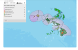
Hawaii under blizzard warning with 12 inches of snow and winds up to 100 mph expected
From Friday until Sunday, the Big Island of Hawaii is under a blizzard warning. A foot of snow and winds up to 100 mph are expected.
Hawaii under blizzard warning as 12 inches of snow and winds up to 100 mph expected
tennessee storm
Member
Really? Cold 300 hours will hardly verify , comes to torch watch it verify because we don’t want it … lol300 hour torch maps are as bad as 300 hour cold maps! ???
NBAcentel
Member
Oh you love it warm your not fooling nobody. Sooner or later we will have a cold spell.It doesn’t take but good week or 2 of cold and snow to make us that want it happy anyway. All this warm often brings our biggest snows here in Tennessee. Still optimistic about our chances down the road. In the meantime I will enjoy the nice weather.Really? Cold 300 hours will hardly verify , comes to torch watch it verify because we don’t want it … lol
Time to book a trip to Hawaii then.
Hawaii under blizzard warning with 12 inches of snow and winds up to 100 mph expected
From Friday until Sunday, the Big Island of Hawaii is under a blizzard warning. A foot of snow and winds up to 100 mph are expected.www.yahoo.com
Hawaii under blizzard warning as 12 inches of snow and winds up to 100 mph expected
View attachment 96729
NBAcentel
Member
78 here wow
Stephenb888
Member
Idc what anyone says there’s nothing enjoyable about 75-80 degree weather in December. We get this kind of weather 9 months out of the year. I’m not enjoying it.
olhausen
Member
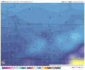
Enjoy the weekend because the cold will be back on Monday!Oh you love it warm your not fooling nobody. Sooner or later we will have a cold spell.It doesn’t take but good week or 2 of cold and snow to make us that want it happy anyway. All this warm often brings our biggest snows here in Tennessee. Still optimistic about our chances down the road. In the meantime I will enjoy the nice weather.
NBAcentel
Member
No we don’t, not the low humidity warm type of days, mostly in late September/early October and that’s itIdc what anyone says there’s nothing enjoyable about 75-80 degree weather in December. We get this kind of weather 9 months out of the year. I’m not enjoying it.
- Joined
- Jan 5, 2017
- Messages
- 3,779
- Reaction score
- 5,990
76 here now. Suns getting low on the horizon, so temp is dropping. Dewpoint is 39 so it's not too humid yet.
It’s almost like the fall we never have no smooth transition it’s always hot and humid and then one big cold front gets us chilly .. so now we just get the smooth transition type of weather just in December ??No we don’t, not the low humidity warm type of days, mostly in late September/early October and that’s it
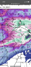
Sweet! At least we don't have to endure any Midwestern snow maps!Ouch


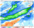
CMC agrees as well .. that will be a chilly couple days at this rate .. our first cold rain CAD yummy .. cmc actually has some snow flakes on the VA/NC border lol
There were a few eps members that did tooCMC agrees as well .. that will be a chilly couple days at this rate .. our first cold rain CAD yummy .. cmc actually has some snow flakes on the VA/NC border lol
bigstick10
Member
Let's move to Hawaii...lol
The National Weather Service has issued a blizzard warning until Sunday morning on the Big Island of Hawaii.
The warning remains in effect from 6 p.m. Friday until 6 a.m. Sunday as up to 12 inches or more of snow is expected on the island. NWS also warns residents to stay indoors as forecasters predict winds gusting over 100 mph.
"Travel could be very difficult to impossible. Blowing snow will significantly reduce visibility at times, with periods of zero visibility," NWS's weather warning reads.
Aside from the blizzard warning, a Kona low is expected near the islands starting on Saturday night. Kona storms are a type of seasonal cyclone in the Hawaiian Islands, usually formed in the winter from winds coming from the westerly "Kona" direction, according to N. Kona lows often bring about wet and "unsettled" weather.
Mr. Golf
Member
Mr. Golf
Member
LickWx
Member
Weren’t they touting big cold for December anyhow ? So now that it’s in jeopardy no surprise they are finessing any possible way to show it will still get cold . Lol.
StormWatch
Member
The 12z Euro from today actually looks good for later in the future this month - still currently thinking a colder pattern settling in within 2 - 2 and a half weeks. If you take a look upstream over the EPO (and part of the PNA) region, there's a deep trough that I beleive will transpire east of the Rockies between the 17th and 22nd (give or take) The waves from Russia would force the North Pacific blocking into the PNA region while some sections of the sinking air may become separated and go poleward. The blocking across the Central US I think would be a transitional warmth as the flow continues to propagate and that area of air I think would get forced over Greenland causing a possible strong -NAO signature.


Mr. Golf
Member
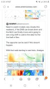
I still believe with the niña becoming more east based, the models and ensembles will be confused for a while imo. Not wishcasting, but if the mjo can propagate correctly into colder phases, we also should see models trend colder imo.
Avalanche
Member
Damn. We can't buy a flake, but Hawaii.Time to book a trip to Hawaii then.

