NBAcentel
Member
Twitter, AMWX, everywhereAnd there you go
Twitter, AMWX, everywhereAnd there you go
Yes. First half December 89 was torch
Wasn't you out grilling in a tee shirt in those below zero temperatures back in December 89?all i can remember first 10 days or so was above average here then the artic blast came mid december and after that winter pretty much done
all i can remember first 10 days or so was above average here then the artic blast came mid december and after that winter pretty much done
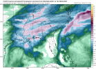
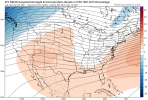
Look at that lobe ?
To your point that makes some sense. I think periods of big changes in pattern are always favorable for us. I still hold hope for late month and a flipOk hear me out...even when the pattern is somewhat favorable for us we still find a way to suck. What if things have changed so much that now in order for us to get snow it HAS to be warm. Obviously the cold doesn’t work around here either so let’s see what happens.
Anyone who got experience that coastal blizzard will always remember it vividly. My father was in construction and his company was working at Myrtle Beach that winter doing repairs from Hurricane Hugo. The hotel that they were working on allowed the construction workers to bring their families down for a few days for Christmas for free. We all stayed in the upper floors and it was amazing watching that storm. The drifts were amazing.I was a HS junior in 89 on the OBX. I have crystal clear memory of the Christmas blizzard and the torch the rest of winter after the New Year. Everything before Christmas is not so clear. Maybe it was Dec. ‘88 that was warm.
It’s every single winter and usually right around this time. It’s actually fun to watch at this point. Better to torch now then 30 days from now. I know we could of course torch all winter but even in the worst winters we get cold shots. I mean my area did just come out of basically a month long cold shot called November. I haven’t done the math yet but I know it was way below normal last month.What the heck are you talking about??? For Heaven's sake, it's only Dec 2nd. You folks are acting like winter is over already. Give it a chance....
Take the money raised, ship most of this board to the maritime continent and have y'all direct your hot air right at it, should easily break it down.View attachment 96675
How can we get that to happen?
Solid rain totalsFirst Beauty of the season ? “not 36 degree rain” “no serious CAD” View attachment 96676View attachment 96677

CMC also agreed on a fairly stout CAD and euro had CAD but not intense enough to keep the coast cold tooIcon going wedge crazy. Remember it was over wedgy last winter so I'd be skeptical until it gets supportView attachment 96681
I don't get the infatuation with the MJO. I mean, it's not unimportant, but it isn't operating in a vacuum, and there are certainly other factors influencing the atmosphere. If it was as easy as some Twitter jabronis would lead you to believe, we could ignore everything else and focus on nothing ever but the MJO.
It's funny because when the MJO is in the warm phases and it's actually warm, it gets all the credit. But when it's in the cool phases and it's warm, oh well it's because it's overwhelmed by something else.
The popular modern day approach is to distill a complex and chaotic system down to an index. Twitter people learn a new 3 letter acronym and go to town. At least the SAI has been largely put to bed.
CMC and ICON? Lol. Come on Nicky you aren’t new to the forum!CMC also agreed on a fairly stout CAD and euro had CAD but not intense enough to keep the coast cold too
Some thoughts about the large scale pattern that could lead to a colder pattern across the eastern US. I have done some observations and I'd say a colder pattern may return in about 2 - 2 and a half weeks. Weather systems will be cutting, tracking into eastern Canada and eventually out over the very far northern portion of the Atlantic - these storm systems would eventually lead to Greenland blocking because the systems would enhance sinking air (blocking) north of the storm systems. A -NAO maybe seen in the foreseeable future. A stationary high could get locked into place north of Europe over the Arctic Ocean due to blocking over Greenland and storm systems tracking across central/northern Russia keeping the high locked into place. This stationary high would be good, because it would help elongating the PV on a northwest to southeast axis. I think the stubborn blocking over the EPO region is what's going to be the biggest issue. However, the storm systems that track from Russia to the Bearing Sea towards AK is what could help force the North Pacific blocking to go poleward, being replaced with a trough. We'll see what plays out upstream over the Pacific within the next week or so. If everything comes together from what I have observed, we may very well see better setups at 500mb in the LR, concerning colder air. Any questions, feel free to ask!
CMC ICON EURO vs GFS I know what side usually loses here and CMC has been upgraded so maybe they actually made improvementsCMC and ICON? Lol. Come on Nicky you aren’t new to the forum!
Well, from what I have seen posted here, it looks like an utter nightmare.
I think you have the right general idea, but I honestly don't believe it'll occur quite as quickly as you're describing. At a minimum, given how this is being forced, it looks like it'll take us no less than 3 weeks to shake off this bad pattern, we'll probably still be right in the thick of it in about 2 weeks time (doesn't mean we can't get a transient cold shot here or there though, and I honestly expect at least one between now and then).
Big reason for that is it takes weeks for the extratropical circulation pattern to change and readjust after getting a large, slow moving MJO event like this one moves across the Maritime Continent and into the Western Pacific, as the planetary Rossby Waves forced by the slower-moving moist convective anomalies become exhibit higher growth rates/become amplified and are harder to break down, this is even more of an issue when you have La Nina and these circulation anomalies are already being enhanced in the lower frequency (90-120 day) means. Normally, the possibility of a -NAO in late December would be a decent bet, but that connection isn't quite as strong during La Nina (although it's more likely when an MJO event is slow moving such as this one, but you're still normally talking at least a week or two after we enter phase 7 for extratropical circulation anomalies to consistently resemble said -NAO, which at least puts us closer to the last week of Dec or so). It's also very possible we never even reach the coveted phase 8/W hem (not uncommon during La Nina when SSTs are too cold to support convection closer to the dateline), which would support more consistent cold in the eastern US.
Just my 2 cents tho.

I’ve been trying to say this most models other than the GFS try to bring bouts of relief in a dumpster fire pattern and it’s not going to be a full on torch constantly as GFS has been trying to point at although recent run is starting to follow suitI could certainly see a cold shot or two in the midst of this warm pattern. The typhoon curving out to sea in the west pac may shorten the wavelengths just enough temporarily to allow a trough in the east for a day or two. Unfortunately, it’s not the answer to consistent cold in the long run.
0z euro was a monster east coast trough around Dec 13th. Will be interesting to see today’s 12z run.I’ve been trying to say this most models other than the GFS try to bring bouts of relief in a dumpster fire pattern and it’s not going to be a full on torch constantly as GFS has been trying to point at although recent run is starting to follow suit
You can’t just not show us thisEuro control trying to pull out an island of cold in a sea of warm and blow up a coastal snow brings a tear to my eye. Close to the Jan 02 look but not quite there, 02 was a little more west with its features and the ridging was more in NW can
These are forecasts that are from one run and span over 2 weeks. You will see that change a 1000x. Also CAD typically starts getting depicted closer in the medium and short range so I doubt we will see it on models beyond a day 5 right now. But you start pumping a SE ridge and get cutting storms that will make it to the 50/50 region and you will see CAD showing up a lot more which is typical for this type of pattern. May not be a week long CAD event (although that does happen quite a bit) but at least a couple of days of cold and dreary weather in the midst of 60's and 70's is likely. Rarely do we get the SER, especially the one depicted on the GFS, and don't CAD quite a bit as well.The cooler 12z euro (still warm) only has 1-2 CAD days to several 60/70 degree daysView attachment 96666
the GFS has something similar as well with some dec 7-8th CADView attachment 96667
Doesn’t seem very “even” to me, the CAD is mad weak per current models. Everyone is getting the torch bud ain’t no escaping the dec weenie roast
