Webberweather53
Meteorologist
I just noticed the euro actually has 3 rain events with the 3rd firing up at D10. Wouldn't erase the dry anomalies but would certainly help recharge the water table and stream flows. This would likely be the highest 10 day rain totals for a good part of the state since probably early augustView attachment 96608
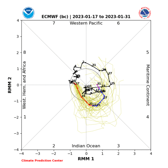
The good news is in the longer-term when you see big Pacific MJO events like this, the southern branch of the jet will temporarily get a nice momentum boost from all the convection in the west-central Pacific, yielding a wetter pattern overall once we get to phase 7-8. The one wrinkle may be how strong the SE US ridge is by that point, because it could mean the difference between heavier rains closer to coastal sections of the SE or more into the TN and lower MS valley.