smast16
Member
I thought we weren't going into a drought?
I thought we weren't going into a drought?
what makes lakes like that even produce snow.. I know almost no one can predict it and whenever it did happen randomly every so often I was always confused like what was different with one cold shot that produced vs all the rest that don’tThat would be too awesome


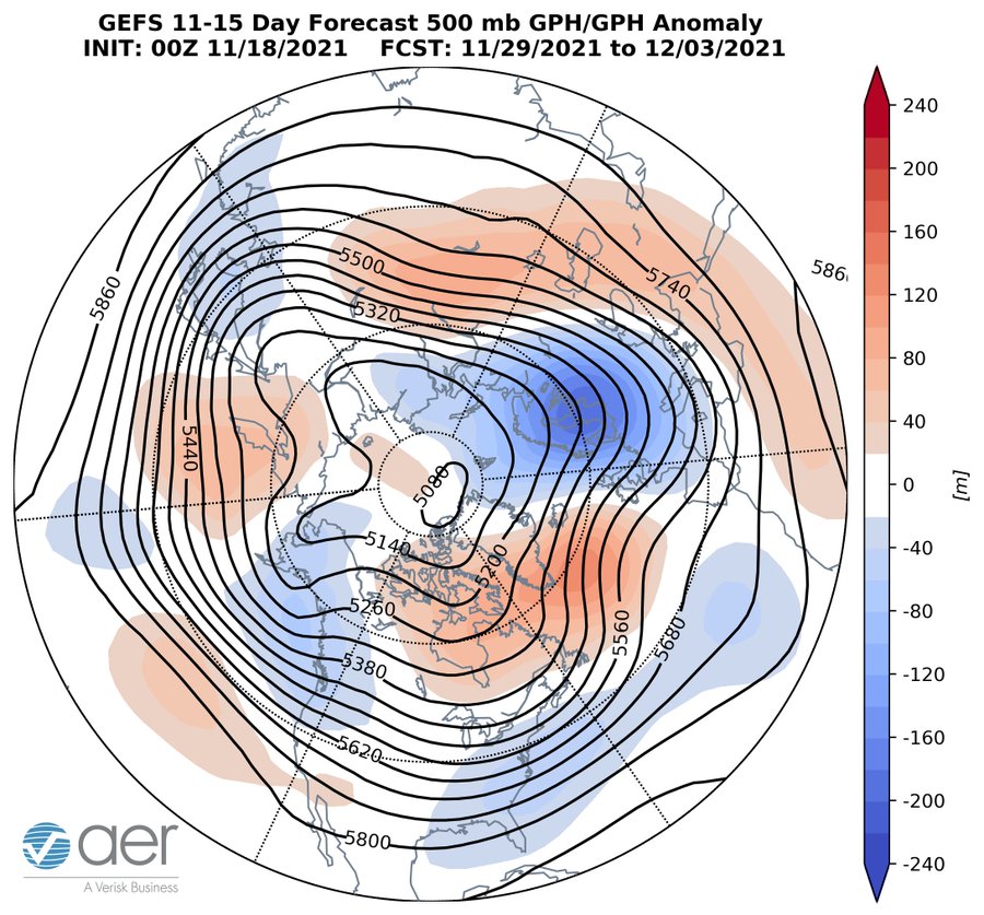
I stopped reading after Gfs week 2 forecastThis on the other hand, sounds down right FUGLY!
Judah Cohen
@judah47
·
1m
Blow torch alert! The GFS week-2 forecast of a deepening trough in the Gulf of Alaska and the tropospheric #polarvortex returning to near the North Pole is setting up a circulation pattern conducive to well above normal temperatures across the US east of the Rockies in December.

It all about getting the absolute perfect wind direction to take advantage of any rise in elevation to get the lift necessarywhat makes lakes like that even produce snow.. I know almost no one can predict it and whenever it did happen randomly every so often I was always confused like what was different with one cold shot that produced vs all the rest that don’t
You'd have to have wind blowing the perfect direction down the length of the lake and probably some type of 850mb disturbance to generate lift.what makes lakes like that even produce snow.. I know almost no one can predict it and whenever it did happen randomly every so often I was always confused like what was different with one cold shot that produced vs all the rest that don’t
Same here and we didn't get much rain in the summer. Yes, we need a good CAD rain. Or snow.I'm amazed at how quickly we returned to dry conditions here. We were running +15 inch surpluses over the summer but then .I'd August the faucet turned off and we have become very dry. There's a pond near work that had water a foot or so above normal bank full all summer and it's now a solid foot or so below bank full.
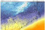
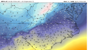
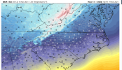
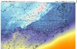
The GFS and the 12km NAM are pretty far apart on temps tomorrow afternoon.
View attachment 95291
NAM
View attachment 95292
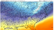
I'll elaborate on the "womp". Not that far off to be honest and that high latitude blocking is keeping the storm track suppressed, unfortunately pacific not cooperating and nothing to drag that cold air more south and southeast. Plus extremely early for this anyway, let's hope we can get something close to this later next month.

Have got to get rid of that trough in Alaska if we really want to funnel in the cold air here. Keep this look and we will likely be below average but not cold enough to get any winter weather.I'll elaborate on the "womp". Not that far off to be honest and that high latitude blocking is keeping the storm track suppressed, unfortunately pacific not cooperating and nothing to drag that cold air more south and southeast. Plus extremely early for this anyway, let's hope we can get something close to this later next month.

I stopped reading after Gfs week 2 forecast
Looks like generously birdmandoom onset sleetI'll elaborate on the "womp". Not that far off to be honest and that high latitude blocking is keeping the storm track suppressed, unfortunately pacific not cooperating and nothing to drag that cold air more south and southeast. Plus extremely early for this anyway, let's hope we can get something close to this later next month.

Is that last year ?
Feels like it. Can't wait to see what kind of heat the gfs pumps out toward the end of the runIs that last year ?
I need @GaWx to post that model bias map. I’ve heard too cold and too warm . I suspect it’s been too cold based on previous history .Classic NAM yesterday View attachment 95306
Pacific is gonna derail December. Nothing but mild air flooding in


Well on the bright side this type of setup only favors short duration warm ups but it also favors almost no cold. If you like highs 55-65 and lows 30-40 this is itPacific is gonna derail December. Nothing but mild air flooding in
I need @GaWx to post that model bias map. I’ve heard too cold and too warm . I suspect it’s been too cold based on previous history .
Going feel nice wearing shorts during Christmas. Ahhh.Pacific is gonna derail December. Nothing but mild air flooding in
Hell that's avg and before last year we all wanted avg temps. Ill take it and hope for a few shots but I never expect snow in December anyways.Well on the bright side this type of setup only favors short duration warm ups but it also favors almost no cold. If you like highs 55-65 and lows 30-40 this is it
Yeah it's not bad at all I'll take it. Maybe if someone gets a few flakes on the back/front of a system if the timing is right. Much better than a stacked SER or a unrelenting dry unproductive NW flow.Hell that's avg and before last year we all wanted avg temps. Ill take it and hope for a few shots but I never expect snow in December anyways.
Same comment applies but go off ?He’s talking about the GFS ensemble but go off
