.5-1.5 with some local 2-3 seems reasonableSo 10 inches or .5 inches … we’re way too close for this bs ?
-
Hello, please take a minute to check out our awesome content, contributed by the wonderful members of our community. We hope you'll add your own thoughts and opinions by making a free account!
You are using an out of date browser. It may not display this or other websites correctly.
You should upgrade or use an alternative browser.
You should upgrade or use an alternative browser.
Pattern October Thread
- Thread starter SD
- Start date
smast16
Member
They both show an area of Precip minimun within 20 miles of me. I bet that will verify on both.
In before someone give me the weenie emoji. Save it
NBAcentel
Member
Euro is following that trend of flattening it out west more, and not diving that trough into the pacific as much/as fast 
NBAcentel
Member
So close to - NAOing this 
NBAcentel
Member
That look still works on the euro, here comes a trough 
This has been one of the strangest weather events we've seen. Two big screw zones, if you want to call it that with all the flooding. Some might think the contrary.

NBAcentel
Member
That’s a massive trough in the pacific 
smast16
Member

But wait...
It's not raining!..
NBAcentel
Member
This pattern is just terrible, no arctic injection whatsoever 


What's the nhem h5 looking like at those time stampsThis pattern is just terrible, no arctic injection whatsoever View attachment 92287View attachment 92288View attachment 92289View attachment 92290
smast16
Member
Now that's what I'm used too

Certainly doesn’t look cold but at the same time doesn’t look warm .. average would be a nice change of pace around here and with these being 850 mb temps I assume ground temps would be average unless there’s a HIGH sitting to our north filtering some cooler air down. For mid- late October I’ll take itThis pattern is just terrible, no arctic injection whatsoever View attachment 92287View attachment 92288View attachment 92289View attachment 92290
tennessee storm
Member
Looks like parts of Tennessee hit 90 next week …
Brent
Member
Oh I can't wait for next week ? the will be about the tenth time the 90s were supposed to end
NBAcentel
Member


NBAcentel
Member
Terrible, what a disaster 


Lol that's so close to not sucking but yet it does. I mean good grief just dig into east Asia pump the ridge send a big trough into the US, not hard. Please and thanksPretty trash tbh View attachment 92302View attachment 92303
Will be good to see Siberia get some snowpack going. H5 is fine. Hopefully will flip when December gets here.
D-Ray
Member
6 inches in the rain gauge since Sunday night
Agreed. Also Alaska and the northwest Canada are starting to build snowpack as well. I’m not looking for anything from the Arctic this early… I just wanna see some lower dews so we can cool off at nightWill be good to see Siberia get some snowpack going. H5 is fine. Hopefully will flip when December gets here.
BufordWX
Member
Looks like my folks are finally gonna get something.
NBAcentel
Member
Wonder if this reflects on the HRRR, nice shift west 


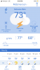
Current temps 
Current temps View attachment 92315
Dallas might have been the hottest big city in the country today.
The high was 92*F.
NBAcentel
Member
Wow. Quite a warm GEFS run for the 2nd half of oct, and a trend 


NBAcentel
Member
All in on November to remember 
NBAcentel
Member
Look similar ?
BufordWX
Member
This guy trying to go rouge?
BufordWX
Member
Might be about to go for it.This guy trying to go rouge?View attachment 92320

NBAcentel
Member


BufordWX
Member
Quite the storm structures in central Georgia.
Enhanced outlook issued for North Texas and SE Oklahoma on Sunday by the SPC.
Sod's law...


Sod's law...

Mr. Golf
Member
I think if November still advertises a warm pattern, then it may be time to give up the ghost. It's a second year niña. I will stay positive for a week of cold with enough moisture for a ice/sleet event for everyone, especially my area. ?
I've been alive a decent number of years and I have been through a lot of first and 2nd year Ninas. I have never seen a blowtorch pattern set in and sustain itself nonstop from September through March. That simply isn't going to happen. But it is frustrating to go through this much of Autumn so far with dew points in the upper 60s and low 70s for most of it.I think if November still advertises a warm pattern, then it may be time to give up the ghost. It's a second year niña. I will stay positive for a week of cold with enough moisture for a ice/sleet event for everyone, especially my area. ?
You are correct...I always tell my friends/family, "mother nature likes to balance" so I fully expect these warm temps will be counterbalanced by much cooler temps sometime. It might be a month from now, but mother nature will balance us out.I've been alive a decent number of years and I have been through a lot of first and 2nd year Ninas. I have never seen a blowtorch pattern set in and sustain itself nonstop from September through March. That simply isn't going to happen. But it is frustrating to go through this much of Autumn so far with dew points in the upper 60s and low 70s for most of it.
JHS
Member
This weather and now the forecast warmth maybe into November reminds me of 1985. November was warm that year and then things flipped completely for Dec and Jan. to a much colder but VERY DRY pattern. Not much precip at all that winter and little if any snow for most of us outside of the NC and Tenn mountains.
iGRXY
Member
Another thing to remember is these models are garbage outside of at most 5 days. The GFS is still trying to forecast near 90 degrees into the middle of and late october and that isn't going to happen no matter how much wishcasting you see here. That model has been TOO warm in the medium and extended ranges especially over in the western carolinas. Odds are it'll be above average but the "Hottest" days will be in the upper 70's and maybe low 80's for those in the eastern carolinas and south of I20. And a lot of these above average maps are due to the night time lows being well above average right now. Wall to wall cold or warmth isn't going to happen. Models keep pushing for around 10/17-10/18 when we get back to average with much lower DPs.
LickWx
Member
I can only speak for my area but the above has not been true so far at all. Think we got up to 88 a few days ago.Another thing to remember is these models are garbage outside of at most 5 days. The GFS is still trying to forecast near 90 degrees into the middle of and late october and that isn't going to happen no matter how much wishcasting you see here. That model has been TOO warm in the medium and extended ranges especially over in the western carolinas. Odds are it'll be above average but the "Hottest" days will be in the upper 70's and maybe low 80's for those in the eastern carolinas and south of I20. And a lot of these above average maps are due to the night time lows being well above average right now. Wall to wall cold or warmth isn't going to happen. Models keep pushing for around 10/17-10/18 when we get back to average with much lower DPs.