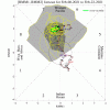
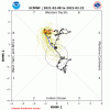
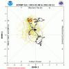
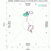
When are you going live!Well, I think the ICON shows the more potential and I tend to believe it with it being a strong (mid 1040's MB) high in there. EURO would be just as bad if in there 6-12 hours earlier.
-
Hello, please take a minute to check out our awesome content, contributed by the wonderful members of our community. We hope you'll add your own thoughts and opinions by making a free account!
You are using an out of date browser. It may not display this or other websites correctly.
You should upgrade or use an alternative browser.
You should upgrade or use an alternative browser.
Wintry King Kong Winter Storm Potential Feb 13th-16th
- Thread starter deltadog03
- Start date
Is all of this Freezing Rain or some sleet mixed in?
Since the high is retreating in THIS depiction, probably more ice for around our areas versus what the Icon would have been.
Is all of this Freezing Rain or some sleet mixed in?
Just Freezing Rain.
I am not buying the High retreating fast or building in slowlySince the high is retreating in THIS depiction, probably more ice for around our areas versus what the Icon would have been.
Downeastnc
Member
Really need the PV to flex more and keep that storm track further south and more ENE....but the clear trend for early next week is towards colder temps and lots of wet.....we just need the above to happen so we can cash in on a big dog SNOW storm versus the crippling icy mess the models currently have.
I mean if you think about it the ensembles show a super wide range of possibilities but almost all have something wintry from a Miller B .. the operstionals are going to be crazy
Cadi40
Member
Go figure I’m always fringed during snow events but of course manage to be right in the bullseye during a crippling ice storm...
Mr. Golf
Member
Hi guys. Does anyone have a fzr map for the euro for my area around jonesboro ar? Thank you
Mr. Golf
Member
Thanks buddy. If correct, its impressive.
Webberweather53
Meteorologist
Nah it’s probably sleet with sfc temps like that, even an extremely shallow cold layer with temps in the mid 20s could probably get the job doneIf that's ice, we are in BIG trouble if that happens.
Clem282340
Member
Is this a better look
It would most likely result in colder temps for the event, but I would be interested to see if it would have crushed the wave. Looks good though.Is this a better look
Downeastnc
Member
GFS has the big ice storm Mon-Wed next week at 06Z......
Webberweather53
Meteorologist
I noticed the GEFS looks worse yet again w/ the TPV lobe on the 6z vs the 0z run. Oth, I've noticed over the last several runs that the "worse" runs wrt TPV lobe location have usually been the 6z & 18z suites which don't include new RAOB data. I'm honestly more inclined to just pay attention to the 0z & 12z suites only at this juncture for that reason.
I full on expect models to start kicking the early week cold/East of the Apps for Sun/Mon/Tues down the road to mid-late next week or just disolve/kinda of burn out the TPV/Shuffle it to unfavorable position.
This has been happening repeatedly. All this TPV/Glory Pattern started showing up for today 2/9 as a deep south winter weather event/record Cold way back over a week-10 days ago. Then it kicked the can to the end of this week 2/13-2/14, then the can got kicked to early next week 2/15-2/16. We are getting inside the 5-7 day window of that time period ( 2/15-2/16). So I'm just sitting here waiting for Lucy to pull the football again today or tommorow. 6z GFS kinda hints at doing this outside the Carolina Ice storm . We will see /learn a lot from 12z today till 12z tommorow.
This has been happening repeatedly. All this TPV/Glory Pattern started showing up for today 2/9 as a deep south winter weather event/record Cold way back over a week-10 days ago. Then it kicked the can to the end of this week 2/13-2/14, then the can got kicked to early next week 2/15-2/16. We are getting inside the 5-7 day window of that time period ( 2/15-2/16). So I'm just sitting here waiting for Lucy to pull the football again today or tommorow. 6z GFS kinda hints at doing this outside the Carolina Ice storm . We will see /learn a lot from 12z today till 12z tommorow.
Webberweather53
Meteorologist
The ECMWF really struggles w/ shallow, low-level air masses almost as much as the GFS. Hopefully a lot of that precip over NC is sleet instead of ZR
The ECMWF completely botched the southern extent of the arctic front in the southern plains
Showmeyourtds
Member
I’ve only seen the surface maps & 2m maps for the 0z doc, but based on the temps, I’d have to believe a lot of the precip falling for folks below freezing (temps less than 28 or so) would be sleet.
The set up next week reminds me of Feb 2014 in a way where I absolutely think if we hold that same look, we will definitely end up having more of a frozen look more South.
I full on expect models to start kicking the early week cold/East of the Apps for Sun/Mon/Tues down the road to mid-late next week or just disolve/kinda of burn out the TPV/Shuffle it to unfavorable position.
This has been happening repeatedly. All this TPV/Glory Pattern started showing up for today 2/9 as a deep south winter weather event/record Cold way back over a week-10 days ago. Then it kicked the can to the end of this week 2/13-2/14, then the can got kicked to early next week 2/15-2/16. We are getting inside the 5-7 day window of that time period ( 2/15-2/16). So I'm just sitting here waiting for Lucy to pull the football again today or tommorow. 6z GFS kinda hints at doing this outside the Carolina Ice storm . We will see /learn a lot from 12z today till 12z tommorow.
Agreed. These fantasy ice storms never materialize...outside of the far N/W parts of the state. I expect at most a sleet pellet or two followed by heavy 35-40F rain.
iGRXY
Member
All models have this now and have anchored in a big HP in the perfect location. This isn’t like previous events where things are marginal and the feed source just isn’t either strong enough or not in the right location. You can expect some form or either sleet or freezing rain right nowAgreed. These fantasy ice storms never materialize...outside of the far N/W parts of the state. I expect at most a sleet pellet or two followed by heavy 35-40F rain.
Downeastnc
Member
So the 6z GFS shows two ice storms. The first one occurring on Saturday for central NC up into VA. Lots of 1/4 to maybe 1/2" type stuff. Then the second for Monday and Tuesday. This would be a little stronger with the CAD allowing parts of the upstate, south NC, and east NC to get freezing rain; while central NC gets sleet. Lets see what happens...
All models have this now and have anchored in a big HP in the perfect location. This isn’t like previous events where things are marginal and the feed source just isn’t either strong enough or not in the right location. You can expect some form or either sleet or freezing rain right now
Models have bee dreadful at this range. This will be no different. Yeah, the HP will have to slide east eventually but something will happen and this will turn into another rain event....hopefully.
NCHighCountryWX
Member
- Joined
- Dec 28, 2016
- Messages
- 699
- Reaction score
- 1,918
NBAcentel
Member
NBAcentel
Member
I would agree with this most times, however, the Arctic air is in the lower 48 now and it came down east of the Rockies. With blocking trending stronger the closer we get to verification all winter, that would argue for a more muted SE ridge (as we’ve seen repeatedly) and for that air to come east. As for storm chances... I personally think that we in the western 2/3 of the Carolinas and N GA will probably have a significant winter storm in the next week to 10 days. However, like I said, I don’t believe a specific storm will be latched onto by the models until around 72 hours out.I full on expect models to start kicking the early week cold/East of the Apps for Sun/Mon/Tues down the road to mid-late next week or just disolve/kinda of burn out the TPV/Shuffle it to unfavorable position.
This has been happening repeatedly. All this TPV/Glory Pattern started showing up for today 2/9 as a deep south winter weather event/record Cold way back over a week-10 days ago. Then it kicked the can to the end of this week 2/13-2/14, then the can got kicked to early next week 2/15-2/16. We are getting inside the 5-7 day window of that time period ( 2/15-2/16). So I'm just sitting here waiting for Lucy to pull the football again today or tommorow. 6z GFS kinda hints at doing this outside the Carolina Ice storm . We will see /learn a lot from 12z today till 12z tommorow.
NCHighCountryWX
Member
- Joined
- Dec 28, 2016
- Messages
- 699
- Reaction score
- 1,918
NBAcentel
Member
Yea eventually that TPV will move East due to the “boot” from the Aleutian low and a decaying -NAO ridge, really don’t like that look for CAD, that’s a cold looking CAD lolI would agree with this most times, however, the Arctic air is in the lower 48 now and it came down east of the Rockies. With blocking trending stronger the closer we get to verification all winter, that would argue for a more muted SE ridge (as we’ve seen repeatedly) and for that air to come east. As for storm chances... I personally think that we in the western 2/3 of the Carolinas and N GA will probably have a significant winter storm in the next week to 10 days. However, like I said, I don’t believe a specific storm will be latched onto by the models until around 72 hours out.
NBAcentel
Member
Snownut
Member
That ice storm next week looks to mean business. I'm trying to remember the last big ice storm us here in upstate was? I'm wanting to think 2005 but I'm not sure.
Sent from my SM-G955U using Tapatalk
Sent from my SM-G955U using Tapatalk
Snownut
Member
Yeah and an ice storm is the last sig storm we need!I would agree with this most times, however, the Arctic air is in the lower 48 now and it came down east of the Rockies. With blocking trending stronger the closer we get to verification all winter, that would argue for a more muted SE ridge (as we’ve seen repeatedly) and for that air to come east. As for storm chances... I personally think that we in the western 2/3 of the Carolinas and N GA will probably have a significant winter storm in the next week to 10 days. However, like I said, I don’t believe a specific storm will be latched onto by the models until around 72 hours out.
Sent from my SM-G955U using Tapatalk
NBAcentel
Member
Snownut
Member
We have both globals on board for a major winter storm next week and ccx we are 6 days out. I'm anxious to see what the short range models are going to show, if they start showing the ice storm then we may be in big trouble.
Sent from my SM-G955U using Tapatalk
Sent from my SM-G955U using Tapatalk


