Jessy89
Member
Soundings near CLT, interesting, was expecting to miss out on this one View attachment 39938View attachment 39939
Correct me If I’m wrong but that green line is supportive of large hail.
Sent from my iPhone using Tapatalk
Soundings near CLT, interesting, was expecting to miss out on this one View attachment 39938View attachment 39939

 sounding near CAE

hopefully this the the LR nam being the LR nam, but Man... View attachment 39951
sounding near clt View attachment 39950sounding near CAE View attachment 39952
Sounding near ATL View attachment 39953
don’t take this serious atm, it is the LR nam after all and often over do things, but this is something to watch, if this is still being shown by this time tomorrow, it’s time to start taking it a bit more serious

No rest for the weary in central Alabama from this system rain wise. WPC already placing a moderate risk for excessive rainfall over that area for day 3.View attachment 39959
Odds are Nam is overhyping this event. Probably will be severe weather Thursday evening damaging wind and hail being primary threats but of course isolated tornadoes can’t be ruled out.
Sent from my iPhone using Tapatalk
You're getting cad every weekend till june bc you said to open everything up ?Let’s hope she stays south like the last one. If I complain about a drought please punch me in September!
Sent from my iPhone using Tapatalk
You're getting cad every weekend till june bc you said to open everything up
We all will want cad by augustProbably, I feel like we have for months. I want some heat! I honestly don’t think the yard has been 100 % dry since October.
Sent from my iPhone using Tapatalk

Excuse me Nam but what the heck is this. Please tell me it’s overdoing things.View attachment 39960
The NAM is realible inside 48 hours.At this point how reliable is the NAM?
Sent from my iPhone using Tapatalk
The NAM is realible inside 48 hours.
Haven't really been paying attention, but damn the NAM isn't playing around for GA thursday.
The part I don’t like is that if any severe weather occurs timing looks to be late afternoon into the evening as opposed to the middle of the night like we normally see.Haven't really been paying attention, but damn the NAM isn't playing around for GA thursday.
Here is a sounding for Atlanta Thursday evening from the Nam. I would still take it with a grain of salt for now until we get closer.I haven’t but with you saying that i just might! What have you seen?
Sent from my iPhone using Tapatalk

Here is a sounding for Atlanta Thursday evening from the Nam. I would still take it with a grain of salt for now until we get closer.View attachment 39963
Yep. Pretty rare that we get events here during peak hours. Will be interesting to see how it all unfolds/develops.The part I don’t like is that if any severe weather occurs timing looks to be late afternoon into the evening as opposed to the middle of the night like we normally see.

It's very strange isn't it ? Why do most events happen at night or morning in GA ?Yep. Pretty rare that we get events here during peak hours. Will be interesting to see how it all unfolds/develops.
IF*** this is right...um...OUCH!!!
View attachment 39964


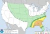
This event has really escalated quickly it feels like.Strong wording from the SPC already View attachment 39974
I was just thinking the exact same thing. Really has gone from a slight risk to something much more in 24 hours.This event has really escalated quickly it feels like.