B
Brick Tamland
Guest
Tornado hit at the worst time, too. I bet a lot of folks were caught off guard. There didn't seem to be that much hype for severe weather yesterday. What threat level were they under from the SPC?
Tornado hit at the worst time, too. I bet a lot of folks were caught off guard. There didn't seem to be that much hype for severe weather yesterday. What threat level were they under from the SPC?
They were under a slight risk for severe, the primary threat was hail however there were some signs yesterday that a tornado threat could exist into the overnight.


Okay. Sounds like they might have dropped the ball on this one.
Long sweeping curve hodo s not goodCan someone explain how to read a hodograph and what makes one “favorable”
death toll still climbing 2nd deadliest in Tennessee history now apparently
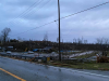
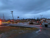
Its up to 22Strong large tornado hitting a highly populated area in the early morning hrs is recipe for high death tolls.....hopefully it stops at 19.
Strong large tornado hitting a highly populated area in the early morning hrs is recipe for high death tolls.....hopefully it stops at 19.
Maybe it is just me, but it feels like the tornadoes have decreased in the midwest and the famous tornado alley, and more and more have hit the southeast in the last 20 years.
There has been articles about tornado alley moving east
Certainly they are deadlier over there
https://www.purdue.edu/newsroom/rel...nd-south,-possibly-due-to-climate-change.htmlMaybe it is just me, but it feels like the tornadoes have decreased in the midwest and the famous tornado alley, and more and more have hit the southeast in the last 20 years.
Maybe it is just me, but it feels like the tornadoes have decreased in the midwest and the famous tornado alley, and more and more have hit the southeast in the last 20 years.
Deadlier due to tornadoes moving into more concentrated area's of people when the alley moves east. Out in the dust bowl, it seems like there are places you could go hours and not see another home/person.
Maybe it is just me, but it feels like the tornadoes have decreased in the midwest and the famous tornado alley, and more and more have hit the southeast in the last 20 years.
I feel like tornadoes are much harder to see in the South than the Plains and with better detection and more people trained with easy damage reporting the numbers of confirmed tornadoes have risen.
I don't exactly believe in the whole tornadoes are getting worse or more frequent idea.
I think that the world is overpopulated, and technology has allowed us to more accurately detect/find tornadoes. Like, of course tornadoes affect more people now. Does that make them worse? Or does that just expose an increasing population. Same with the number of tornadoes. There's more people to observe them and radar now.
From 1925, would that family of monster tornadoes be "deemed worse" now? Most likely because it affects many more people.


For the NC peeps there is this map which shows were Carolina Alley is.....there is also a hot spot near the Triad and Charlotte would be interesting to see if there is anything micro climate wise for that....
View attachment 36773
This was interesting as well
View attachment 36774
I guess from convection that develops/strengthens as they move East of the mountains + lee trough forcingFor the NC peeps there is this map which shows were Carolina Alley is.....there is also a hot spot near the Triad and Charlotte would be interesting to see if there is anything micro climate wise for that....
View attachment 36773
This was interesting as well
View attachment 36774
I guess from convection that develops/strengthens as they move East of the mountains + lee trough forcing
You nailed it. For that reason, Charlotte and the Triad get overlooked as a severe weather hotspot, but we really are. Granted people assume we aren't as tornado-prone when in reality we really are. We just haven't been hit directly (or recently) as the 2008 Atlanta tornado or the 2011 Raleigh one.