-
Hello, please take a minute to check out our awesome content, contributed by the wonderful members of our community. We hope you'll add your own thoughts and opinions by making a free account!
You are using an out of date browser. It may not display this or other websites correctly.
You should upgrade or use an alternative browser.
You should upgrade or use an alternative browser.
Pattern January 2020 - Operation Thaw Alaska
- Thread starter KyloG
- Start date

pcbjr
Member
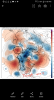
You see where that 540 is?View attachment 28887
Hey Phil! Congrats on the digital snow!
Appreciate it, but it's probably a beach day ...


NBAcentel
Member
The GFS has reached an all time low
NBAcentel
Member
low pressure?

Low scores, crazy fantasy storms, insane troughs, insane ULLs in the southwest that never move, we have a terrible weather model, GFS before the new one was at least a little better
pcbjr
Member
i wish I could find Webb's post from around this time last year (maybe a week ot two earlier) when the GFS Happy Hour did the same thing ... classic WebbYou should get to enjoy the GFS bias as much as the rest of us!
The pattern progression is not a disaster on the 18z GFS. Looks a million times better than the Weeklies. I'd probably rate them both equally as bad.
GeorgiaGirl
Member
i wish I could find Webb's post from around this time last year (maybe a week ot two earlier) when the GFS Happy Hour did the same thing ... classic Webb
I do believe that we had the GFS (this version even) give you fantasy snow at some point in December last year.
But anyway...the GFS...what a silly model. It's shown the possibility of a weather system happening around this time period but there's about no telling what it actually does. It's always had fantasy storms, but idk that it's ever been as terrible as this.
I would imagine in order for it to snow down at phils ,it would have to look something like this kind of set up?View attachment 28887
Hey Phil! Congrats on the digital snow!
pcbjr
Member
not necessarilyI would imagine in order for it to snow down at phils ,it would have to look something like this kind of set up?
among others, look at 1899 and 1989 (unfortunately, until Wiki is back up, I can't point you to 1899 resources)
That's going to change, guarantee!View attachment 28887
Hey Phil! Congrats on the digital snow!
I do believe that we had the GFS (this version even) give you fantasy snow at some point in December last year.
But anyway...the GFS...what a silly model. It's shown the possibility of a weather system happening around this time period but there's about no telling what it actually does. It's always had fantasy storms, but idk that it's ever been as terrible as this.
The GFS can be good at finding the storm signal time windows, but you're right, there's no telling what it does at this point. We've all seen this behavior many times from the GFS model. The models will get a better handle for that time window early next week. In the mean time, expect wild changing model runs.
A couple things to think about that I’ve noticed.. 1. When was the last time the euro weeklies were right .. and the euro weeklies if I do recall are always warmer and in some cases way warmer than what ends up happening. 2. It honestly looks like the euro and Gfs and even the Canadian at times want to try and do something with that system the wacky 18z Gfs shows .. it could be a legit signal of something we just don’t know details cause of volatile pattern
The pattern progression is not a disaster on the 18z GFS. Looks a million times better than the Weeklies. I'd probably rate them both equally as bad.
Exactly! Weeklies have be absolutely horrible for months. But saying that they will probably be close with the latest run!
Legit wintry pattern for the southeast is certainly delayed. Does that mean we can’t thread the needle on something in the meantime? Absolutely notA couple things to think about that I’ve noticed.. 1. When was the last time the euro weeklies were right .. and the euro weeklies if I do recall are always warmer and in some cases way warmer than what ends up happening. 2. It honestly looks like the euro and Gfs and even the Canadian at times want to try and do something with that system the wacky 18z Gfs shows .. it could be a legit signal of something we just don’t know details cause of volatile pattern
The more I look at the Euro/EPS toward the end of the run, the more interesting it appears. GEFS is also very interesting at H5.
NBAcentel
Member
Legit wintry pattern for the southeast is certainly delayed. Does that mean we can’t thread the needle on something in the meantime? Absolutely not
Yeah I said it on a weird Twitter thread, but if you somehow get a transient Canada vortex/bombing low near SE Canada and a southern wave/cut off wave just in time, things can happen, but those setups are the definition of threading the needle
NBAcentel
Member
And I don’t even wanna walk into the “the upper level low will make its own cold air” department
John1122
Member
If the weeklies start warm they tend to stay warm for their entire run. If they start cold they sometimes flip to warm too fast. GFS definitely has a bias towards cold. Euro towards warm in the east. All the models tend to have false starts flipping a pattern. They ended the November cold way earlier than it verified ending and have been doing the same with the December warmth. You can usually add 10 days to any pattern shift that starts showing up in the day 14-16 range.
Just to pick up some of the broken hearts. As I said earlier I really like where the Euro is headed. Even though it is more or less Pacific air, it is seeded by very cold air over Alaska. The Euro and to a lesser extent the EPS shows this. To be honest, I feel this pattern will definitely be better suited for western portions. That said the big block that formed over the pole two weeks ago, formed just like the one north of AK forms on the Euro. If we can get a repeat, it will push the PV southward possibly putting more in the game.
Attachments
Calling the ole punter in for December. That leaves about a 8 to 10 week window for most outside the hilltop regions. Good Luck. Right now it looks like it's gonna take some type of freak accident in the hemisphere to get the carpet white. Just dont see anything concrete to be optimistic about LR. We stayed below normal first 2/3rds of December, so I want complain. Gonna go swing the old golf clubs Thurs an Fri so that will take the sting out expierencing spring time temps instead of a white Christmas. Ive learn to just throw it back at mother nature experiencing these constant warm winters the past few years. Growing immune to being disappointed with crap patterns. Almost expect nothing else .
Calling the ole punter in for December. That leaves about a 8 to 10 week window for most outside the hilltop regions. Good Luck. Right now it looks like it's gonna take some type of freak accident in the hemisphere to get the carpet white. Just dont see anything concrete to be optimistic about LR. We stayed below normal first 2/3rds of December, so I want complain. Gonna go swing the old golf clubs Thurs an Fri so that will take the sting out expierencing spring time temps instead of a white Christmas. Ive learn to just throw it back at mother nature experiencing these constant warm winters the past few years. Growing immune to being disappointed with crap patterns. Almost expect nothing else .
Cross Creek? We need to get together for a round some day! Have fun and Merry Christmas!!! Can't believe this winter is looking and probably going to be horrible again. Will we ever have another great winter?
It could easily be just a sucker run, but very much fwiw, the 0Z GEFS has a better look than recent runs in the 11-15. Any predictions about the Euro and its ens?
Edit: The most recent GEFS with a better look in the 11-15 was the 6Z run of Sunday or seven runs ago.
Edit: The most recent GEFS with a better look in the 11-15 was the 6Z run of Sunday or seven runs ago.
Last edited:
John1122
Member
It could easily be just a sucker run, but very much fwiw, the 0Z GEFS has a better look than recent runs in the 11-15. Any predictions about the Euro and its ens?
Edit: The most recent GEFS with a better look in the 11-15 was the 6Z run of Sunday or seven runs ago.
For those of us west of the Apps the GEFS went below normal on temps at hour 162 and only had about 24-48 hours of AN temps from 162-384. We are entering the time of year when it only takes a small amount below normal to produce wintry weather for the upper South/40 corridor. Takes a bit more to get it done in the deep South obviously as we are still about 3.5 to 4 weeks from the heart of the season when temps are at their coldest on average.
Brent
Member
Do not look at the end of the 0Z Euro. Go directly to sleep. Night night.
looks like a nice squall line in Dixie to start January...
I’ll save everyone a click, but I cannot save you any heartbreakDo not look at the end of the 0Z Euro. Go directly to sleep. Night night.


Verbatim the euro has some hefty severe weather events for the coming week ... fairly ominous ... but also we’re clearly headed way colder after these powerful fronts u can see the cold about to drop in on the euro
ajr
Member
Looking back to what Masiello and a few others were talking about in December about serious cold coming in January.. are we still looking at the same overall picture or has the situation changed?
Nevermind, I give up. Whining, and verbatim long range models rule. I’m hibernating.
Last edited:
NCHighCountryWX
Member
- Joined
- Dec 28, 2016
- Messages
- 700
- Reaction score
- 1,921
Updated GEFS MJO now arcs wide into Phase 5

Yeah probably not good
Sent from my SM-G975U using Tapatalk
I don't know how we escape this mess...considerable amount of patience I guess. Consolidated tPV and warm MJO phases.
2015 had similar MJO path and back half of winter was really cold...but it didn't have the tPV parked over AK and we already had a strong -EPO. It was much easier to transition to a productive pattern.

Twas the night before Christmas, when all through the east
Not a snowflake was stirring, not one in the least.
The snow boots were stored in the closet with care
And the shovel was hung on the wall in despair.
The cold it was nestled, all snug near the pole
A gift far much worse than a big lump of coal.
And the only small token that winter brought forth
Came from a cool front, slipping in from the north.
I laid there awake as I heard the rain splatter
Another good winter turning into a ratter.
When what to my wondering ears did I hear?
An alert that the new European was here.
The cold GFS had given me snow
Would the Euro confirm? I just had to know.
Away to the laptop, I flew like a flash
Threw open the website and cleared all the cache.
But even as over the time stamps I flew
My eyes soon confirmed what my heavy heart knew
There was only bright red where there should have been blue
The Euro had spoken, “There is no snow for you!”
My head hung in sadness while I sat there and pondered
Would ensembles be worth staying up for, I wondered?
Would a miracle await, would Christmas some through?
Could the wintriest of all wintry wishes come true?
But soon to my senses I came with a bound
Closed out the window and shut the site down.
Then off to the bedroom, I turned with a jerk
Three hours of sleep was the night’s only perk.
As I pillowed my head and tucked in the sheet
Distressed that the Euro is so hard to beat
I knew in my heart that this snowstorm was done
At least until dawn and the next 6z run.


MERRY CHRISTMAS!!
Not a snowflake was stirring, not one in the least.
The snow boots were stored in the closet with care
And the shovel was hung on the wall in despair.
The cold it was nestled, all snug near the pole
A gift far much worse than a big lump of coal.
And the only small token that winter brought forth
Came from a cool front, slipping in from the north.
I laid there awake as I heard the rain splatter
Another good winter turning into a ratter.
When what to my wondering ears did I hear?
An alert that the new European was here.
The cold GFS had given me snow
Would the Euro confirm? I just had to know.
Away to the laptop, I flew like a flash
Threw open the website and cleared all the cache.
But even as over the time stamps I flew
My eyes soon confirmed what my heavy heart knew
There was only bright red where there should have been blue
The Euro had spoken, “There is no snow for you!”
My head hung in sadness while I sat there and pondered
Would ensembles be worth staying up for, I wondered?
Would a miracle await, would Christmas some through?
Could the wintriest of all wintry wishes come true?
But soon to my senses I came with a bound
Closed out the window and shut the site down.
Then off to the bedroom, I turned with a jerk
Three hours of sleep was the night’s only perk.
As I pillowed my head and tucked in the sheet
Distressed that the Euro is so hard to beat
I knew in my heart that this snowstorm was done
At least until dawn and the next 6z run.
MERRY CHRISTMAS!!
At least they look to be trending in the right direction in the first couple days of JanuaryTwas the night before Christmas, when all through the east
Not a snowflake was stirring, not one in the least.
The snow boots were stored in the closet with care
And the shovel was hung on the wall in despair.
The cold it was nestled, all snug near the pole
A gift far much worse than a big lump of coal.
And the only small token that winter brought forth
Came from a cool front, slipping in from the north.
I laid there awake as I heard the rain splatter
Another good winter turning into a ratter.
When what to my wondering ears did I hear?
An alert that the new European was here.
The cold GFS had given me snow
Would the Euro confirm? I just had to know.
Away to the laptop, I flew like a flash
Threw open the website and cleared all the cache.
But even as over the time stamps I flew
My eyes soon confirmed what my heavy heart knew
There was only bright red where there should have been blue
The Euro had spoken, “There is no snow for you!”
My head hung in sadness while I sat there and pondered
Would ensembles be worth staying up for, I wondered?
Would a miracle await, would Christmas some through?
Could the wintriest of all wintry wishes come true?
But soon to my senses I came with a bound
Closed out the window and shut the site down.
Then off to the bedroom, I turned with a jerk
Three hours of sleep was the night’s only perk.
As I pillowed my head and tucked in the sheet
Distressed that the Euro is so hard to beat
I knew in my heart that this snowstorm was done
At least until dawn and the next 6z run.
View attachment 28922
View attachment 28923
MERRY CHRISTMAS!!
pcbjr
Member
FWIW, anyway ...


tennessee storm
Member
Not goodAt least they look to be trending in the right direction in the first couple days of January
Jon
Member
...

Sent from my iPhone using Tapatalk
 ...
...

Thank god the weeklies are trash!
Sent from my iPhone using Tapatalk
whatalife
Moderator
Thank god the weeklies are trash!
Sent from my iPhone using Tapatalk
Yep. Pretty much anything outside of 5 days is trash regardless of which model you are looking at...
Sent from my iPhone using Tapatalk
This made my day.Twas the night before Christmas, when all through the east
Not a snowflake was stirring, not one in the least.
The snow boots were stored in the closet with care
And the shovel was hung on the wall in despair.
The cold it was nestled, all snug near the pole
A gift far much worse than a big lump of coal.
And the only small token that winter brought forth
Came from a cool front, slipping in from the north.
I laid there awake as I heard the rain splatter
Another good winter turning into a ratter.
When what to my wondering ears did I hear?
An alert that the new European was here.
The cold GFS had given me snow
Would the Euro confirm? I just had to know.
Away to the laptop, I flew like a flash
Threw open the website and cleared all the cache.
But even as over the time stamps I flew
My eyes soon confirmed what my heavy heart knew
There was only bright red where there should have been blue
The Euro had spoken, “There is no snow for you!”
My head hung in sadness while I sat there and pondered
Would ensembles be worth staying up for, I wondered?
Would a miracle await, would Christmas some through?
Could the wintriest of all wintry wishes come true?
But soon to my senses I came with a bound
Closed out the window and shut the site down.
Then off to the bedroom, I turned with a jerk
Three hours of sleep was the night’s only perk.
As I pillowed my head and tucked in the sheet
Distressed that the Euro is so hard to beat
I knew in my heart that this snowstorm was done
At least until dawn and the next 6z run.
View attachment 28922
View attachment 28923
MERRY CHRISTMAS!!
Boy the gfs doesn't look bad the first few days of January
Sent from my SM-G975U using Tapatalk
Sent from my SM-G975U using Tapatalk