Shaggy
Member
When thunder roars get the hell outsideSevere Marginal Risk out for Thursday north of i40 including Wilkes and Boone. Slight Risk further north. Watch out and when thunder roars go INDOORS

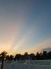
Fro just went full ?Some pics
 ️
️ 
Looks like someone tried to draw a mouse on the radar. LOLStill dry!View attachment 21034
Storm knocked out my power not long agoJackpotting here again with a very heavy shower. Its stalled and developing. I'm expecting probably 2 inches total from this. Already up to 1.
Nice! Been coming down here as well.Already up to 1.5 here now. It just keeps coming.
Can you send some of that rain my direction? All I’m getting is lightning flashes outside. I would love to get in on some of the action. I haven’t even hit half an inch on the month yet.Already up to 1.5 here now. It just keeps coming.

Therea actually some coming up from the south, so be patient and it'll start eventually. Just checked again and now I'm at 2.25".Can you send some of that rain my direction? All I’m getting is lightning flashes outside. I would love to get in on some of the action. I haven’t even hit half an inch on the month yet.
Thank you, starting to rain here now. I am happy.Therea actually some coming up from the south, so be patient and it'll start eventually. Just checked again and now I'm at 2.25".

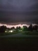
Rock em’ sock em’
View attachment 21037

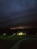
Rainfall rates here are now at 3 inches per hour. So much for my complaints earlier lol.Big win here tonight!!!
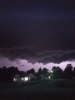
My monthly rainfall total has already doubled in the last half hour!View attachment 21038


Rain has ended here now. Final total from tonight’s storms is 1.68”. Overall I’m thrilled with tonight’s haul. Went from less then half an inch on the month to over 2 inches. Had quite a bit of thunder and lightning as well.Big win here tonight!!!
My monthly rainfall total has already doubled in the last half hour!View attachment 21038

It rained a lot last night. That was nice.It took half the summer but finally a jackpot
Sent from my SM-G975U using Tapatalk
Glad I could finally share with y'all..... I only picked up .28 and that was more than enough.It rained a lot last night. That was nice.
That is awesome. I love nighttime thunderstorms. It's been a long time since I've seen a cluster like that.I did not see lastnight coming. It literally thundered for 8 hours. Not right on top thunder but that post storm stratiform sky lightning then new storms would move in amd restart the process.
That is awesome. I love nighttime thunderstorms. It's been a long time since I've seen a cluster like that.
July 12-16 marks the anniversary of the infamous midwestern heat wave of 1995 that killed a lot of people. Appleton, WI had a dp of 90 and a heat index close to 150 !

Gonna be a few prolific rain makers again too with those 2"+ PWBeefy

Sent from my iPhone using Tapatalk