accu35
Member
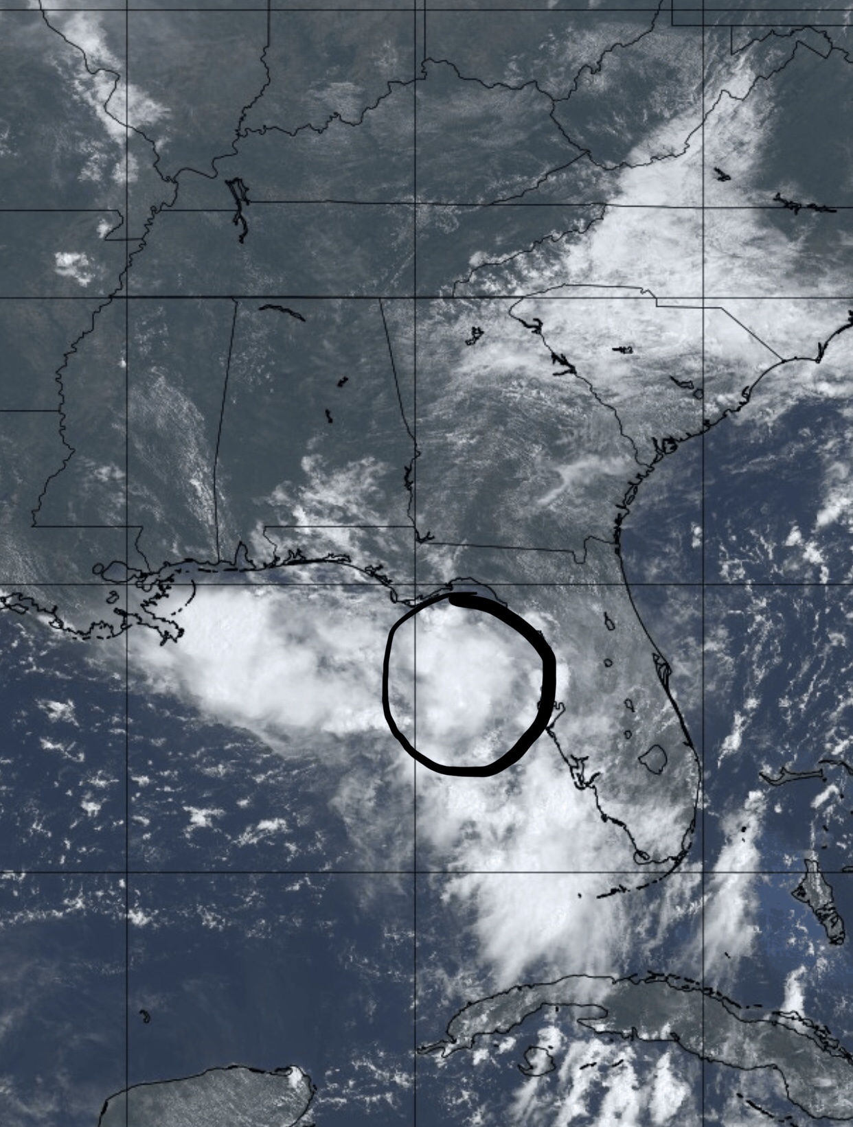
Gfs looks south and stronger


How strong are the models showing the system to be when it makes landfall?
It's a tug-of-war between low-level frictional convergence & strong horizonal shear near the FL panhandle plus the already somewhat prominent surface trough extending all the way into GA vs diabatically-forced surface pressure falls underneath the sheared convection out over the Gulf of Mexico. Both are competing for surface vorticity generation and upward motion and I'm not sure who will win although I'd lean ever so slightly to the Euro camp given its performance thus far (GFS didn't even have the low into the Gulf into a few days ago & kept taking the system out to the NE, the ECMWF in earlier suites was effectively showing what consensus is now). The GFS didn't have the convection that's now firing over the Gulf while the Euro was underselling the surface trough to the NE. Tough call really, I personally would like the northern solution to pan out to give more of the board some much needed rain and diminish the severity of direct impacts. Comes down to mesoscale processes that are exceptionally difficult to forecast and ones we have limited understanding of.
the UKMET came in way stronger than a weak hurricane apparently
946 mb could easily be a major

the UKMET came in way stronger than a weak hurricane apparently
946 mb could easily be a major
into SW LA Saturday
UKMET looks bad.
NEW TROPICAL CYCLONE FORECAST TO DEVELOP AFTER 42 HOURS
FORECAST POSITION AT T+ 42 : 28.2N 87.6W
LEAD CENTRAL MAXIMUM WIND
VERIFYING TIME TIME POSITION PRESSURE (MB) SPEED (KNOTS)
-------------- ---- -------- ------------- -------------
1200UTC 11.07.2019 48 28.1N 88.8W 1005 32
0000UTC 12.07.2019 60 27.8N 90.0W 995 43
1200UTC 12.07.2019 72 28.3N 91.6W 982 68
0000UTC 13.07.2019 84 28.6N 92.6W 966 75
1200UTC 13.07.2019 96 29.8N 93.6W 946 82
0000UTC 14.07.2019 108 31.5N 94.2W 975 40
1200UTC 14.07.2019 120 33.2N 94.5W 980 39
0000UTC 15.07.2019 132 34.8N 95.2W 988 28
1200UTC 15.07.2019 144 36.2N 95.7W 994 28

Yeah it could go either way, with some of the changes to the GFS and Euro since last season it's tough to know what biases they have right now and how they are going to handle this. 12z GFS did come in stronger and similar to it's 00z run. Should be interesting to see what the UK and Euro do later today. If this gets far enough south it should have plenty of warm water to work with and a good chance at a cane. If it hugs the coast it won't do much.
Yeah, close to a cat 2.

If the circulation is already beginning to coalesce over water, when should we expect Hurricane Hunters to fly over to investigate?
Sent from my SM-G950U using Tapatalk
They're scheduled for tomorrow at 2 PM etIf the circulation is already beginning to coalesce over water, when should we expect Hurricane Hunters to fly over to investigate?
Sent from my SM-G950U using Tapatalk
I've heard there are going to investigate tomorrow.If the circulation is already beginning to coalesce over water, when should we expect Hurricane Hunters to fly over to investigate?
Sent from my SM-G950U using Tapatalk
Yeah, close to a cat 2.
This upcoming 12z ECMWF run is going to be a big one esp now that the stubborn GFS is finally onboard w/ the idea for a stronger, further south, more vertically stacked system which the Euro has shown for the past several days on end.
This upcoming 12z ECMWF run is going to be a big one esp now that the stubborn GFS is finally onboard w/ the idea for a stronger, further south, more vertically stacked system which the Euro has shown for the past several days on end.
Depending on the size of the cane, which in most cases w/ storms like this of mid-latitude origin in environments w/ higher background MSLP they tend to be smaller & more unpredictable, 946 could actually be a cat 4.

Pop up cat 5s? I've seen no such thing. There's a thing called time and a lot of energy they need to become a cat 5. I think this will be no more than a cat 3 if it can even get there. Likely going for a weak cat 2 IMO.Wouldn’t surprise me if this thing blows up with the pop up cat 5s we have these days.
Sent from my iPhone using Tapatalk


