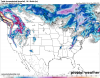
Pattern December - Deal or No Deal?

  • Hello, please take a minute to check out our awesome content, contributed by the wonderful members of our community. We hope you'll add your own thoughts and opinions by making a free account!
Question is...is it a 3 week tunnel or a 5 week tunnel. People lost there minds yesterday on the prospects of a 5 week tunnel. Hopefully we can get some positive short term changes that translate to a quicker flip.
My guess will be 3-4 weeks so around Jan 15-20th. The good news is their at least going to back a flip and not a flop.
 
  • Like
Reactions: Kylo

This was something I briefly alluded to yesterday morning.
Screen Shot 2018-12-16 at 4.54.39 PM.png

The ECMWF has trouble propagating the MJO across the Maritime Continent due to a wet bias there and its rather poor handling of local air-sea interactions and topographically forced convection over Indonesia among other things. Intriguingly, the Climate Forecast System (CFS) actually performs better than most major models with MJO propagation and predictability thru the Maritime Continent (phases 4-5) for the wrong reasons of course because its convection within the MJO's envelope is too intense.
 
He said this wasn’t happening either the day before he got stuck https://m.youtube.com/watch?v=1_Tahv7raKk

I’m not saying it’s gonna snow Friday , it’s just funny . He’s. Great severe weather guy probably one of the best in the southeast . But he is horrible when it comes to winter weather


Sent from my iPhone using Tapatalk
At least he is honest about his mistakes. That's what I like about Spann. Glenn Burns would never admit when he is wrong.
 
This was something I briefly alluded to yesterday morning.
View attachment 9241

The ECMWF has trouble propagating the MJO across the Maritime Continent due to a wet bias there and its rather poor handling of local air-sea interactions and topographically forced convection over Indonesia among other things. Intriguingly, the Climate Forecast System (CFS) actually performs better than most major models with MJO propagation and predictability thru the Maritime Continent (phases 4-5) for the wrong reasons of course because its convection within the MJO's envelope is too intense.
Whatever it is, Ph 8 puhleezeeee ... then get stuck there until March ... o_O
 
Whatever it is, Ph 8 puhleezeeee ... then get stuck there until March ... o_O

I'm honestly not sure entirely why (& yea I realize the Jan phase 7 composite mean in the N hem looks amazing, not sure wrt its significance tho which is more important) and there's a lot of room for statistical artifacts, issues w/ sample size, and a pretty pronounced bifurcation point after 2000, but the last 11 of 13 years since 2000 wherein the MJO entered phase 7 during January, a winter storm came knocking in NC. If you extrapolate the current MJO event forward in time this would put us somewhere in the vicinity of mid January for getting phase 7 event this year. I wouldn't be the least bit surprised if the MJO becomes strong or very strong over the WP if a sudden stratospheric warming comes to fruition near the end of December.
 
Last edited:
  • Like
Reactions: Kylo and pcbjr
I'm honestly not sure entirely why (& yea I realize the Jan phase 7 composite mean in the N hem looks amazing, not sure wrt its significance tho which is more important) and there's a lot of room for statistical artifacts, issues w/ sample size, and a pretty pronounced bifurcation point after 2000, but the last 11 of 13 years since 2000 wherein the MJO entered phase 7 during January, a winter storm came knocking in NC. if you extrapolate the current MJO event forward in time this would put us somewhere in the vicinity of mid January for getting phase 7 event this year. I wouldn't be the least bit surprised if the MJO becomes strong or very strong over the WP if a sudden stratospheric warming comes to fruition near the end of December.
Webb,
You as much as anyone know I love weather, of all kinds (except 'Canes, of course). But this time of year, weather's a passion for an old Curmudgeon. IMBY, in a great season it's 6 weeks of winter; 8 weeks constitutes a coup. By Valentine's Day, we're usually knocking on 80's. So please understand the desire for a favorable MJO, PNA AO, NAO, WPO, EPO and anything else that might do the trick ... in December and January ... ;)
Best, Man!
Your Friend,
Phil
 
Take the model with the lowest snow total for your location multiply that by 0 and expect that

Sent from my SM-G955U using Tapatalk
Yea, then you won’t be disappointed.
We should have gave you the snow blower off the 12 days of Christmas. Because you been burned a lot by the models. ❄️❄️❄️
 
  • Like
Reactions: pcbjr
I know alot of people are waiting for the Gfs model yo be thrown out, but I'll take the gfs over the fv3 any day. The clown maps on the fv3 are crazy, if that's our new replacement and we have those maps to look at over the years, than people are going to be deceived by what they are seeing. Im just not that thrilled for the change over.
 
I know alot of people are waiting for the Gfs model yo be thrown out, but I'll take the gfs over the fv3 any day. The clown maps on the fv3 are crazy, if that's our new replacement and we have those maps to look at over the years, than people are going to be deceived by what they are seeing. Im just not that thrilled for the change over.
for the thousandth time... this should be pinned.. its tropical tidbits problem not FV3...
EDIT: PICS 12z PIVOTAL VS TIBITS
 

Attachments

  • sn10_acc.conus.png
    sn10_acc.conus.png
    351.5 KB · Views: 38
  • fv3p_asnow_us_24.png
    fv3p_asnow_us_24.png
    136.8 KB · Views: 39
Based on this, I'm too all in favor once into January of a long phase 8, a long phase 7 prior to it, and even a long phase 1-2 following it, but would prefer it is on the weaker side when it gets to these phases as this research of over 1,200 days of January data covering 40 years (1975-2014) suggested to me a few years ago:

https://blog.southernwx.com/2017/01...phase-inside-the-left-side-of-circle-coldest/

Although far from a perfect correlation and certainly not an end all be all just as is the case for any index with polar opposite exceptions, many of our greatest SE Jan cold waves 1975-2014 were during weaker versions of the left phases, especially from just outside to inside the circle. Furthermore, every one of the 8 phases averaged at least 3 F colder when comparing inside the circle with outside the circle over these 40 Jans. So, I highly doubt this was due to randomness. In addition, I discussed this with a met at Radiant last winter and he backed me up on the idea then from a met. standpoint. I think he told me it had to do with the idea that a stronger MJO may tend to bring in more warming from the tropics than a weaker version.

The following are many of the closest examples I could find to this optimal path….note that all of them resulted in anywhere from a 10 to 19 day period of solid cold domination in the SE (follow the red lines):


1. 1/10-28/1977:


http://www.bom.gov.au/climate/mjo/graphics/archive/MJO_phase/197701.phase.90days.gif


2. 1/6-15/1988:


http://www.bom.gov.au/climate/mjo/graphics/archive/MJO_phase/198801.phase.90days.gif


3. 1/8-19/1994:


http://www.bom.gov.au/climate/mjo/graphics/archive/MJO_phase/199401.phase.90days.gif


4. 1/4-14/1996:


http://www.bom.gov.au/climate/mjo/graphics/archive/MJO_phase/199601.phase.90days.gif


5. 1/20-31/2000:


http://www.bom.gov.au/climate/mjo/graphics/archive/MJO_phase/200001.phase.90days.gif


6. 1/13-27/2003:


http://www.bom.gov.au/climate/mjo/graphics/archive/MJO_phase/200301.phase.90days.gif


7. 1/1-10/2014:


http://www.bom.gov.au/climate/mjo/graphics/archive/MJO_phase/201401.phase.90days.gif
 
I'm not giving up yet with the wrap around precip. with the late week system. Reasons: 1.) The timing of the wrap around precip. is still over 100 hrs out. 2.) Evidence of colder surface temps. (on previous runs) can trend colder again on future model runs. 3.) Dynamic cooling is very possible.

Something shouldn't be counted off when there has been evidence of something occuring. Also, the storm system hasn't even developed yet. It's not even in the full 84 hr time frame to confirm what the GFS, Euro, FV3, etc. has been showing. By then, there could be some changes, big or small. You never know, there could be hefty wrap around snow showing up on the models within the next 48 hrs.
 
Based on this, I'm too all in favor once into January of a long phase 8, a long phase 7 prior to it, and even a long phase 1-2 following it, but would prefer it is on the weaker side when it gets to these phases as this research of over 1,200 days of January data covering 40 years (1975-2014) suggested to me a few years ago:

https://blog.southernwx.com/2017/01...phase-inside-the-left-side-of-circle-coldest/

Although far from a perfect correlation and certainly not an end all be all just as is the case for any index, many of our greatest SE cold waves 1975-2014 were during weaker versions of the left phases, especially from just outside to inside the circle. Furthermore, every one of the 8 phases averaged at least 3 F colder when comparing inside the circle with outside the circle over these 40 Jans. So, I highly doubt this was due to randomness. In addition, I discussed this with a met at Radiant last winter and he backed me up on the idea then from a met. standpoint. I think he told me it had to do with the idea that a stronger MJO may tend to bring in more warming from the tropics than a weaker version.

The following are many of the closest examples I could find to this optimal path….note that all of them resulted in anywhere from a 10 to 19 day period of solid cold domination in the SE (follow the red lines):


1. 1/10-28/1977:


http://www.bom.gov.au/climate/mjo/graphics/archive/MJO_phase/197701.phase.90days.gif


2. 1/6-15/1988:


http://www.bom.gov.au/climate/mjo/graphics/archive/MJO_phase/198801.phase.90days.gif


3. 1/8-19/1994:


http://www.bom.gov.au/climate/mjo/graphics/archive/MJO_phase/199401.phase.90days.gif


4. 1/4-14/1996:


http://www.bom.gov.au/climate/mjo/graphics/archive/MJO_phase/199601.phase.90days.gif


5. 1/20-31/2000:


http://www.bom.gov.au/climate/mjo/graphics/archive/MJO_phase/200001.phase.90days.gif


6. 1/13-27/2003:


http://www.bom.gov.au/climate/mjo/graphics/archive/MJO_phase/200301.phase.90days.gif


7. 1/1-10/2014:


http://www.bom.gov.au/climate/mjo/graphics/archive/MJO_phase/201401.phase.90days.gif
Wiki?