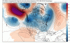
• Hello, please take a minute to check out our awesome content, contributed by the wonderful members of our community. We hope you'll add your own thoughts and opinions by making a free account!

Pattern December - Deal or No Deal?

D10 ensembles look like this and folks are fretting. I'm confused.

gfs-ens_z500a_nhem_41.png


gfs-ens_T850a_nhem_40.png


ecmwf-ens_z500a_nhem_11.png


ecmwf-ens_T850a_nhem_11.png

You and me both. Its been a cold November and Ive already seen snow which is already more than some winters.
 
I mean my goodness, that's just a few adjustments away from being pure gold and with lots of cold on our side of the pole....in early December!
No kidding. Folks are looking at the weeklies and day 16 18Z GFS and lamenting the winter going to pot and not paying attention to wintry looking op runs and ensembles within day 10. LOLZ
 
I mean my goodness, that's just a few adjustments away from being pure gold and with lots of cold on our side of the pole....in early December!
All of our best storms need a FEW adjustments! I’m all in!
 
Thats ugly? Boy our expectations are through the roof crazy.

Well Xmas week has +EPO/+AO/+NAO. First week of Jan has a GOA ridge and SER. That’s fairly ugly. It’s the weeklies so it will probably be wrong but let’s see how it ends up.
 
Well Xmas week has +EPO/+AO/+NAO. First week of Jan has a GOA ridge and SER. That’s fairly ugly. It’s the weeklies so it will probably be wrong but let’s see how it ends up.

I see higher heights anomoly wise on the east coast, but the country is still doninated by a broad trough centered in the Midwest. Even with the smoothing you can still see a west coast ridge. To be honest, that looks seasonal at worst.
 
This is what EPS had 3 days ago for 5 day period ending Dec 8th.

55AC1174-9B56-48AF-9BD8-9D5B081D0A2C.png

Today’s 12z run has this. So yeah, EPS is struggling big time with the pac. Still 7 days away but GEFS had a better handle.

F943AED4-F1F6-47DA-8E46-2AB3D91D3997.png
 
Not a bad trend at all in the longer range. Alutian low trending stronger along with the western ridge.
 

Attachments

  • gfs_z500a_namer_fh252_trend.gif
    gfs_z500a_namer_fh252_trend.gif
    1.1 MB · Views: 39
CF06CC05-2EC2-4BC3-9B2E-6633DA4BDA68.png It’s baaaaaaaaack!
 
The 6z GEFS is cold and it stays cold well into voodoo land. Western ridge signal is there until the very end of the run. Trough looks favorable for a stormy pattern. Probably a lot of borderline events because it doesn't scream bone crushing cold, which is a good thing. The SE will score if we hold this pattern into late December/Early Jan with good snow pack to the NW.
 
The 6z GEFS is cold and it stays cold well into voodoo land. Western ridge signal is there until the very end of the run. Trough looks favorable for a stormy pattern. Probably a lot of borderline events because it doesn't scream bone crushing cold, which is a good thing. The SE will score if we hold this pattern into late December/Early Jan with good snow pack to the NW.
I like the 8th-10th time frame for someone on here to get an early Christmas gift.... 6z GEFS didn't look bad at all
 
Back
Top