• Hello, please take a minute to check out our awesome content, contributed by the wonderful members of our community. We hope you'll add your own thoughts and opinions by making a free account!

Tropical Major Hurricane Florence

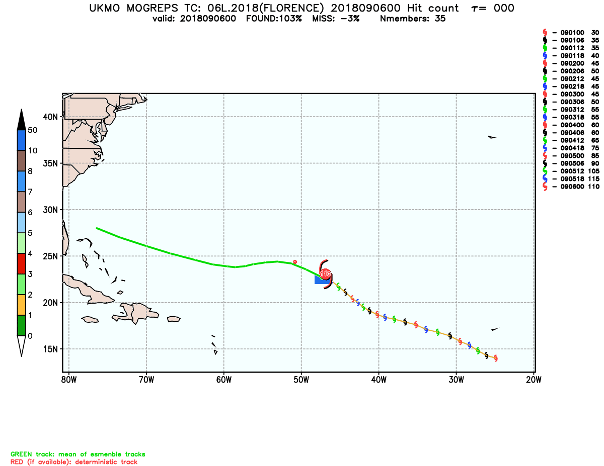
Based on a quick Google search the use of the Beta Advection Model does cover beta drift, but I'm not 100% on how or where that data is incorporated into the overall model sets.
Do the models account for beta drift?


Sent from my iPhone using Tapatalk

Sent from my Pixel 2 XL using Tapatalk
 
Florence has become a hurricane again, it also lost a little more latitude.
AL, 06, 2018090912, , BEST, 0, 244N, 561W, 65, 987, HU, 34, NEQ, 100, 50, 40, 100, 1012, 200, 10, 0, 0, L, 0, , 0, 0, FLORENCE, D, 0, , 0,
 
Last edited:
Florence has become a hurricane again, it also a little more latitude.
AL, 06, 2018090912, , BEST, 0, 244N, 561W, 65, 987, HU, 34, NEQ, 100, 50, 40, 100, 1012, 200, 10, 0, 0, L, 0, , 0, 0, FLORENCE, D, 0, , 0,

5am advisory had Florence at 24.5N so didn't it actually lose latitude?

EDIT: Meanwhile, it appears Florence is trying to develop/re-establish an eyewall.
 
Florence has become a hurricane again, it also a little more latitude.
AL, 06, 2018090912, , BEST, 0, 244N, 561W, 65, 987, HU, 34, NEQ, 100, 50, 40, 100, 1012, 200, 10, 0, 0, L, 0, , 0, 0, FLORENCE, D, 0, , 0,
Looking good on satellite and may be trying to form an eye as it wraps storms around the south side of the circulation.

Sent from my SM-G955U using Tapatalk
 
Right now
goes16_vis_06L_201809091250.jpg

goes16_ir_06L_201809091250.jpg
 
Looking good on satellite and may be trying to form an eye as it wraps storms around the south side of the circulation.

Sent from my SM-G955U using Tapatalk

Yep, eye visible on IR now. Now maybe we have something to really gauge motion.
 
The FV3 and the regular GFS were faster on their latest runs especially the FV3 which gets Florence in and out in two days . Both runs are speeding up the income by trough . Hopefully that ends up being case and Florence gets out of dodge sooner vs meandering for days on end


Sent from my iPhone using Tapatalk
 
As mentioned Florence probably about to go beast mode and if so she's most likely as far south as she us going to go. Expect some poleward motion soon.... really wish it would be enough to miss wide right but that door basically closed

Sent from my SM-G920V using Tapatalk
 
A NOAA 49 research aircraft is currently descending into Florence to assess its current intensity & overall structure. Glad we have some low level recon to work from today. Florence is already trying to make her case to be a 70-75 KT hurricane before the 11am advisory.

Screen Shot 2018-09-09 at 9.49.07 AM.png
 
Looks like Flo is starting to get a bit more organized and it could be time for take off today. She does still appear to be moving W or even very slight south of due West right now.
 
I know a lot can change but numerous models have TS force wind gust for over 24 hours here, no not Cat 3 or 4 winds but I vividly remember Irene and the duration of those gust, coupled with heavy rains (a la Floyd) and it can wreak havoc. I'm stocking up today and taking some extra precautions to secure my animals (yes my dairy goats). Sharping up the chain saw, filling the gas cans.... I lost 6 trees with Irene and winds never peaked over hurricane force. I am as worried about this system as I have ever been.... and not just for me but for all on here. Pray it turns north soon!
 

Not saying it will happen or the model is saying it will happen, but this ensemble brings up an interesting idea. But I've seen hurricane jog west quite a big during an ERC. Just food for thought, but it could easily make an 100 mile difference in landfall location and ERCs are not modeled correctly.
 
nam_mslp_pcpn_watl_8.png
since the Nam is good for short range, it's more south west so far
 
I don't think the back and forth shifts in the models is over, in fact wouldn't be surprised to see it shift south then back north, heck even back south..... going to be some long nights ahead. Tracking winter storms sure are less stressful
 
A NOAA 49 research aircraft is currently descending into Florence to assess its current intensity & overall structure. Glad we have some low level recon to work from today. Florence is already trying to make her case to be a 70-75 KT hurricane before the 11am advisory.

It seems almost unanimous that the various ensemble runs’ means have recently been south of the respective operationals. Why would that be the case and is that due to a too far south bias that means a northward adjustment to the ensemble means is recommended?

My guess per satellite looos is that she’s back to moving due west last couple of hours but that’s just an educated guess. 24.4N now, which is vs the 24.5N of 5AM NHC, looks about right.
 
At least we are still 5 days out? There aren't a lot of ways to polish this turd. The euro track couldn't get much worse for the I40 corridor from ILM to RDU. 111 just to my east and to the S of rain cold.

I don't find a lot of comfort in anything on the models this morning. The OTS window that was cracked at 0z seemed to have been closed a little at 6z. The 0z eps being south is great for my personal interests but does no favors to the carolinas.

I'm not sure the variables are showing themself right now that would prevent a major hurricane from hitting the Carolina coast line. I feel like these north to south adjustments are within the standard deviation of model error at the lead time we are. But again it's still 5 days out
4131e949d2592e5c3cb96d55e38c2fe8.jpg


Sent from my SM-G955U using Tapatalk
That would be pure devastation... no other words to describe that disaster if that were to verify.
 
I'd assume the members being South of the operationals may be stronger with the ridge and slightly weaker with the storm/ramp up time.
 
Yep. Florence is only moving at about 5-7 mph, losing even a tenth or two of latitude at its current pace of forward motion is more significant than it would be for a hurricane moving closer to 15-20 mph.
Eric maybe I'm an idiot but why would the loss of latitude at a slower pace be more significant than if it were moving faster? I would think if it was moving faster there would be less time for it to turn north and be more significant....
 
It seems almost unanimous that the various ensemble runs’ means have recently been south of the respective operationals. Why would that be the case and is that due to a too far south bias that means a northward adjustment to the ensemble means is recommended?

My guess per satellite looos is that she’s back to moving due west last couple of hours but that’s just an educated guess. 24.4N now, which is vs the 24.5N of 5AM NHC, looks about right.

Trochoidal wobbles aren't easy to forecast I suspect that may have had a lot to do with it.
 
Eric maybe I'm an idiot but why would the loss of latitude at a slower pace be more significant than if it were moving faster? I would think if it was moving faster there would be less time for it to turn north and be more significant....

The loss of 0.1 latitude for a storm moving at 5-7 mph vs 20 mph means its net heading is further south of west, if a storm were moving at 100 mph for example and lost 0.1 degree of latitude it would be closer to a due W heading. That's actually what I'm saying
 
The loss of 0.1 latitude for a storm moving at 5-7 mph vs 20 mph means its net heading is further south of west, if a storm were moving at 100 mph for example and lost 0.1 degree of latitude it would be closer to a due W heading. That's actually what I'm saying
Ahhh.... got'cha. Thanks.
 
I don't think the back and forth shifts in the models is over, in fact wouldn't be surprised to see it shift south then back north, heck even back south..... going to be some long nights ahead. Tracking winter storms sure are less stressful

That’s debatable. lol. On a more serious note, just woke up and saw the EPS clusters trying to huddle up in SC. I don’t like the looks of this.
 

Just to clarify, this is a UKMET ensemble run from 3 days ago. But I’m glad you posted it because it shows its projected 9/9 8AM EDT mean position to be down to near 23.8N and all the way west to near 59.0W vs the actual near 24.4N, 56.1W! Note also that that run like many of the other earlier ones had her initialized too far SW vs the actual at the time.
 
First recon pass thru the center of Florence has found an extrapolated MSLP of 983 hPa w/ 65 KT (75 mph) winds in the NE quad, it's clearly intensifying. This MSLP is fairly low for a minimal category 1 hurricane, the winds will eventually catch up.

recon_NOAA2-WB06A-FLORENCE_timeseries.png recon_NOAA2-WB06A-FLORENCE_zoom.png
 
Yep very low pressure and winds always lag behind, it's full steam ahead now
First recon pass thru the center of Florence has found an extrapolated MSLP of 983 hPa w/ 65 KT (75 mph) winds in the NE quad, it's clearly intensifying. This MSLP is fairly low for a minimal category 1 hurricane, the winds will eventually catch up.

View attachment 6043 View attachment 6044

Sent from my SM-G920V using Tapatalk
 
Back
Top