Tropical Hurricane Jose
- Thread starter Webberweather53
- Start date
-
Hello, please take a minute to check out our awesome content, contributed by the wonderful members of our community. We hope you'll add your own thoughts and opinions by making a free account!
You are using an out of date browser. It may not display this or other websites correctly.
You should upgrade or use an alternative browser.
You should upgrade or use an alternative browser.
18z gfs is ESE of the 12z run and well south of the euro. Just to be funny that's a step toward the UK
Sent from my SM-G955U using Tapatalk
Sent from my SM-G955U using Tapatalk
LMAO Brian Norcross on TWC just said something along the lines of
"But we have the UKMET model sending it to Florida"
"Normally we wouldn't care about it, but it was first with Irma on the Western track".
"Something is wrong with the UKMET but we don't know what".
Made my freakin' day!
"But we have the UKMET model sending it to Florida"
"Normally we wouldn't care about it, but it was first with Irma on the Western track".
"Something is wrong with the UKMET but we don't know what".
Made my freakin' day!
Sucks we don't know what's happening under the hood here with Jose right now w/o recon regarding its intensity and internal structure. As I mentioned a few days ago, in a case like this with a marginal, small TC and inherently unstable vortex, it's not out of the ordinary for a storm like Jose to relocate it's LLC downshear, further to the south, underneath the deeper convective canopy and higher cyclonic potential vorticity and if this somehow comes to pass, would put a massive wrench in the models... This might seem like a minor detail in the short term, but it matters a lot for the long term future of Jose...


Very informative, and quite spot on (of course), Webb!Sucks we don't know what's happening under the hood here with Jose right now w/o recon regarding its intensity and internal structure. As I mentioned a few days ago, in a case like this with a marginal, small TC and inherently unstable vortex, it's not out of the ordinary for a storm like Jose to relocate it's LLC downshear, further to the south, underneath the deeper convective canopy and higher cyclonic potential vorticity and if this somehow comes to pass, would put a massive wrench in the models... This might seem like a minor detail in the short term, but it matters a lot for the long term future of Jose...

Thanks for the update (though personally I'm sick of, and could do without, any more) ...
Despite being a huge western outlier at the moment, it's worth mentioning that the UKMET is beating all other NWP models with the track of Jose thus far at day 5, even the ECMWF....
View attachment 1208
This graphic is bound to change a lot over the next couple days once Jose completes his loop so take these skill scores thus far w/ a grain of salt.
and an Advil or three ...This graphic is bound to change a lot over the next couple days once Jose completes his loop so take these skill scores thus far w/ a grain of salt.
That is a big worry. Seeing it beating the other models 120 hours out is never a good sign when you want to see a system go OTS. Meanwhile, the HWRF is a bit SW and Jose almost looks like it's moving south per satellite.Despite being a huge western outlier at the moment, it's worth mentioning that the UKMET is beating all other NWP models with the track of Jose thus far at day 5, even the ECMWF....
View attachment 1208
Is tonight the night the ukie joins the other models OR does one of the big boys join the ukie
Sent from my SM-J320VPP using Tapatalk
Sent from my SM-J320VPP using Tapatalk
Something that gets me is how off from the others the UKMET is. We aren't talking about it going into N.Carolina. Either something is messed up or its about to score big time. There will be a crazy reaction if the Euro folds.
Something has to give soon I agree it's amazing to see the euro especially so far apart from the ukmet
I mean at least the gfs and cmc have it getting close to hitting the us well north of florida the euro is just a weak nothing that recurves
I mean at least the gfs and cmc have it getting close to hitting the us well north of florida the euro is just a weak nothing that recurves
I know we can't really see where the center is on sat loop but it sure looks to be moving south at a good clip and south of forecast points by a good bit too.
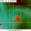
Jose's low and mid level centers are currently separated by nearly 1 degree of latitude according to the latest microwave pass. As I've been mentioning the past few days, if a new LLC forms further south underneath the convective canopy and higher cyclonic potential vorticity downshear (to the south), it's going to throw a sizable wrench into this already convoluted forecast & probably increase the risk of impacts to landmasses adjacent to the SW Atlantic down the road and vis versa if the LLC further to the north hangs on. (even though the risk in either case still may not be terribly great)...
Let's all hope an LLC doesn't form or relocate further to the south underneath this robust mid level center....

Let's all hope an LLC doesn't form or relocate further to the south underneath this robust mid level center....


