I have been here for 4 winters and probably 25-30 events. I track every one like it’s my first one ever ! And watch for and get excited for the first flakes EVERYTIME! So maybe it’s stupid, but whatever! People like what they like! Like the weirdo at American that loved wind! I don’t judge, but I can make wind everyday!Snow up north is like rain in the south. You see it all the time so it’s not much fun.
-
Hello, please take a minute to check out our awesome content, contributed by the wonderful members of our community. We hope you'll add your own thoughts and opinions by making a free account!
You are using an out of date browser. It may not display this or other websites correctly.
You should upgrade or use an alternative browser.
You should upgrade or use an alternative browser.
Misc Winter Weather Support Group
- Thread starter RBR71
- Start date
W
WSW
Guest
That's awesome! I go on every once in a while to watch Jonas from 2016.I still go on YouTube and watch this storm news coverage...sigh!!
W
WSW
Guest
Not stupid at all! Dude, there is nothing like a blanket of white covering everything as far as the eye can see. I hate brown ground in the Winter--and pine trees. Too damn many of them this far south.?I have been here for 4 winters and probably 25-30 events. I track every one like it’s my first one ever ! And watch for and get excited for the first flakes EVERYTIME! So maybe it’s stupid, but whatever! People like what they like! Like the weirdo at American that loved wind! I don’t judge, but I can make wind everyday!
Drizzle Snizzle
Member
You're still relatively new to the north. Give it a few more years and you'll be ready to move south again.I have been here for 4 winters and probably 25-30 events. I track every one like it’s my first one ever ! And watch for and get excited for the first flakes EVERYTIME! So maybe it’s stupid, but whatever! People like what they like! Like the weirdo at American that loved wind! I don’t judge, but I can make wind everyday!
Drizzle Snizzle
Member
I must say I think snow makes the landscape look much less depressing.Not stupid at all! Dude, there is nothing like a blanket of white covering everything as far as the eye can see. I hate brown ground in the Winter--and pine trees. Too damn many of them this far south.?
No kink shaming here. We like what we likeI have been here for 4 winters and probably 25-30 events. I track every one like it’s my first one ever ! And watch for and get excited for the first flakes EVERYTIME! So maybe it’s stupid, but whatever! People like what they like! Like the weirdo at American that loved wind! I don’t judge, but I can make wind everyday!
W
WSW
Guest
I would totally disagree with this statement.You're still relatively new to the north. Give it a few more years and you'll be ready to move south again.
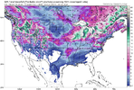
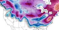
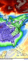
Dang pretty soon i might get lucky enough to see one of these with everything having snow cover except SC. Its actually kind of impressive. It even knows the outline of the state.
W
WSW
Guest
SC is really disappointing when it comes to snow.Dang pretty soon i might get lucky enough to see one of these with everything having snow cover except SC. Its actually kind of impressive. It even knows the outline of the state.
My first daughter was born on the 6th. Had to get her grandma to go get groceries before it started. Let me tell you that first “well visit “ after she was born was interesting as a new parent. Snow still on the bridges in Birmingham, I was a nervous wreck.
EastmanGAWX
Member
The NWS has highs for Houston, TX on Monday/Tuesday as being 36/38, my location has highs from this same "front" as 49/46 Tuesday/Wednesday. It's amazing that we've reached the point of where locations in semi tropical climates on the Gulf Coast can get colder than Central Georgia. However, that's sadly been a fact of life at times for the past decade.
Check that one out @Stevo24Dang pretty soon i might get lucky enough to see one of these with everything having snow cover except SC. Its actually kind of impressive. It even knows the outline of the state.
W
WSW
Guest
Only 31 and 32 at KIAD. Not exactly cold imo. 20s in Winchester. Teens for highs above 3k.The NWS has highs for Houston, TX on Monday/Tuesday as being 36/38, my location has highs from this same "front" as 49/46 Tuesday/Wednesday. It's amazing that we've reached the point of where locations in semi tropical climates on the Gulf Coast can get colder than Central Georgia. However, that's sadly been a fact of life at times for the past decade.
Drizzle Snizzle
Member
Dang, its going to be colder in Dallas than Northern Virginia ?Only 31 and 32 at KIAD. Not exactly cold imo. 20s in Winchester. Teens for highs above 3k.
EastmanGAWX
Member
Yeah, the high in Dallas is going to be 27 on Monday. The models today have suggested that GA might actually be colder with the secondary front that looks to slide through at the end of next week, but we all know how that tends to go for points east of the Appalachians lately from a verification standpoint.Dang, its going to be colder in Dallas than Northern Virginia ?
severestorm
Member
Florida desperately needs this for their python problem.I just realized how far south the 12z EURO pushes the cold air next week. It has Orlando with a low of 28 next Saturday
W
WSW
Guest
Sure, it happens. 25 and 28 at Cross Junction where i lived last. Higher elevations won't get out of the mid teens or lower.Dang, its going to be colder in Dallas than Northern Virginia ?
W
WSW
Guest
Florida needs help in a lot of ways.?Florida desperately needs this for their python problem.
Just curious what ways do they need help?Florida needs help in a lot of ways.?
Drizzle Snizzle
Member
People are flocking to Florida in droves for a reason. People love the sunshine, warmth, and lower taxes.Imo its a hell hole. Haven't found anything at all i like about it. Least favorite state i have ever been to. By far.?
Drizzle Snizzle
Member
Florida has some beautiful beachesUh huh. And a lot of them move right back out. You can have the hurricanes, alligators, swampland, and overall ugliness thanks.
W
WSW
Guest
I mean, seriously, just look at the rest of the southeast. You've got beautiful rolling hills, mountains and open land in every state in the South. They're not as crowded and the people are much much nicer.
Drizzle Snizzle
Member
Kansas is more beautiful than Florida ?It's all man made bro. Everywhere looks the same. Its overcrowded. Nothing of beauty to look at. Every other state in the Union is better than Florida.
NoSnowATL
Member
Lock the thread
I say they are a push... KANSAS=FLORIDA.
Iceagewhereartthou
Member
Drizzle Snizzle
Member
Things always look better in picturesKansas has a some very pretty areas actually. The plains themselves can be pretty but there is an area called the Flint Hills in Kansas that's beautiful.
View attachment 141271
View attachment 141272
View attachment 141273
Yup...for sure. Actually have mountain biked there before. Doesnt' look like Kansas...anymoreKansas has a some very pretty areas actually. The plains themselves can be pretty but there is an area called the Flint Hills in Kansas that's beautiful.
View attachment 141271
View attachment 141272
View attachment 141273

This was another one of those major weather events I captured a lot of Lot8s from TWC because I knew this was gonna be a banger. I wanted to have these videos to look back on for historical/archival purposes. Also of note, The Weather Channel nailed the snow forecast, they were very bullish calling for 5-8 inches of snow. NWS and local ATL Mets were mainly saying 2-4. I live in NW Atlanta (ITP) I got 6.5 inches. I think the airport got the usual screw job with 3.5, it was more sleet/freezing rain mixing in down there. I was mainly all snow w/ some sleet the entire event until the last couple hours when it changed over to freezing drizzle.
This storm produced the biggest snowfall I’ve ever seen living here. December 2017, January 2002, February 2010, and March 2009 round out the top 5 for me.
Iceagewhereartthou
Member
Drizzle Snizzle
Member
Georgia ?View attachment 141274
So there's one state in the ENTIRE continental US that doesn't have any snow in this map. Nope, not Florida. Not Louisiana. Not even Texas or Alabama...
SimeonNC
Member
Saw mentions of the February 2015 ice storm and wanted to post this 6 hour news coverage of it.
NBAcentel
Member
LickWx
Member
She will struggle in any snow or iceslow but purty. Put it through so much abuse and it just keeps chugging along. Being built top end I’m sure has helped. If I didn’t put the arp headstuds and 4 layer head gasket in I’m sure i would have blow the old oem one by now View attachment 141282View attachment 141283View attachment 141284View attachment 141285
NBAcentel
Member
Good thing the southeast closes when it snows and iceShe will struggle in any snow or ice
But should be able to fly with that bigass spoiler.She will struggle in any snow or ice


