-
Hello, please take a minute to check out our awesome content, contributed by the wonderful members of our community. We hope you'll add your own thoughts and opinions by making a free account!
You are using an out of date browser. It may not display this or other websites correctly.
You should upgrade or use an alternative browser.
You should upgrade or use an alternative browser.
Misc Winter Weather Support Group
- Thread starter RBR71
- Start date
I’m assuming that’s why the west coast is always consumed by a trough and we get the SER. Sometimes I wish the currents flowed East to west. Upstream always kills usThat npac ridge is legit though I've been trying to figure it out too. I think it may be related to the mjo but man you can't find a much worse thing for the eastern US to have a mean base state
LickWx
Member
If the currents flowed east to west we would be a very mild climate with little rain and no snowI’m assuming that’s why the west coast is always consumed by a trough and we get the SER. Sometimes I wish the currents flowed East to west. Upstream always kills us
Yessir that ridge there is more often than not going to dump down the WC.I’m assuming that’s why the west coast is always consumed by a trough and we get the SER. Sometimes I wish the currents flowed East to west. Upstream always kills us
And reversing the flow would be total cheeks for us
Avalanche
Member
Dude I about spit my gin and tonic out!!!So is any snow looking realistic for the Carolinas next weekend
Iceagewhereartthou
Member
That actually makes a lot of sense. The wave progression of a ridge out there would put a trough over western US and a ridge over eastern, which is exactly what has dominated. A trough out there would place more of a ridge over the west. Will be interesting to watch that next year.
WolfpackHomer91
Member
Well I be Damned [mention]Jimmy Hypocracy [/mention] ….. the old Hedge works everytime. I woulda bet my mortgage we lost by 10+ tonight and lost my life, but we win and I go to sleep with False hope of going on a run now. God I love sports
Sent from my iPhone using Tapatalk
Sent from my iPhone using Tapatalk
Like y’all are now?If the currents flowed east to west we would be a very mild climate with little rain and no snow
You coming to eat at La Fagata?On my way to find snow like @BrentView attachment 146691View attachment 146692View attachment 146693
Tequila’s! Come on man! Then the new Waffle House on W Georgia!You coming to eat at La Fagata?
In Florida looking for that snow that was on the models 10 days ago!You coming to eat at La Fagata?
At least there's possibly a reason.
If all one had to look at was a home thermometer, satellite, and a peek out of the window, a snow shovel check would be in order.
Yep. 30 degrees with a thick cloud deck is crazy. TortureIf all one had to look at was a home thermometer, satellite, and a peek out of the window, a snow shovel check would be in order.
Don’t see it often like this without a storm incoming.Yep. 30 degrees with a thick cloud deck is crazy. Torture
Waking up craving Spring more than ever. It feels like it’s February 27th. We talked so much on the future with the weather that we were basically living in it. It’s wild it’s still February 18th.
Just a few weeks ago I felt pretty confident we would be seeing a good snowstorm today.Waking up craving Spring more than ever. It feels like it’s February 27th. We talked so much on the future with the weather that we were basically living in it. It’s wild it’s still February 18th.
Drizzle Snizzle
Member
The race has been rescheduled to 4pm tomorrow.
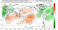
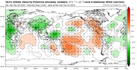
Have the models ever handled the MJO wrong in our favor? Seems like if the models are wrong it’s always in the way of being wrong about cold and never warm. Why is that.They handled the mjo wrong the gfs from last Sunday was rolling right into p8/1View attachment 146698
Now it's just a mess with really the most legit signal over the MC
View attachment 146699
I wonder if that means I could get some tickets??The race has been rescheduled to 4pm tomorrow.
Yes but not in the last half decade.Have the models ever handled the MJO wrong in our favor? Seems like if the models are wrong it’s always in the way of being wrong about cold and never warm. Why is that.
I have a number of theories if you are really interested to hear it bc otherwise it's a tldr post
That’s what they get for stealing our precip
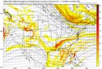
Somebody would have had a chance. WNC could have got buried. Better problem to have than dry upper 20’sIf this shortwave had less kicker and more amplitude we would be worried about lack of a high pressure and warm noses this morningView attachment 146697
Yes I’m really interested actuallyYes but not in the last half decade.
I have a number of theories if you are really interested to hear it bc otherwise it's a tldr post
I'd certainly love to hear it because I'm at a complete loss how it avoids the good phases during winter everytime regardless of Enso or SST's etc. What's going on with the Pac is past the point of ridiculousYes but not in the last half decade.
I have a number of theories if you are really interested to hear it bc otherwise it's a tldr post
Told the Familia on way home from church, there was the second big chance we missed out on seeing a good snow this winter. Other than a fluke curveball, it'll be next winter at the earliest before we have another shot.Yep. 30 degrees with a thick cloud deck is crazy. Torture
For me gonna go ahead and make the garden bigger, adding another raised bed and bout time to start the seedlings inside.
I'm heading down there in 9 days. Hoping for some nice weather to hit the Disney parks.
You can get Daytona 500 tickets for like 40$ today! Y’all come on down
Here today! Pouring rain, but tomorrow through Saturday looks delightful! Saw some 80s for the week you’re coming , enjoy!I'm heading down there in 9 days. Hoping for some nice weather to hit the Disney parks.
Drizzle Snizzle
Member
There's definitely been a lot more cold days this winter than last winter.
BHS1975
Member
I'd certainly love to hear it because I'm at a complete loss how it avoids the good phases during winter everytime regardless of Enso or SST's etc. What's going on with the Pac is past the point of ridiculous
Does it have to do with the large area of positive SST anomalies in the NPAC?
Sent from my iPhone using Tapatalk
In AK, yesThere's definitely been a lot more cold days this winter than last winter.
Yeah this is true. After the cold snap at Christmas last year, it was pretty much a torch fest the rest of the way.There's definitely been a lot more cold days this winter than last winter.
The sun just feels more powerful now than it did a month ago. Clock is ticking 


