- Joined
- Jan 23, 2021
- Messages
- 4,602
- Reaction score
- 15,197
- Location
- Lebanon Township, Durham County NC
Someone was fixing to have a very merry christmas at the end of the 6z GFS
perfect track
Fun killerCutter at verification
Still waiting on the torch, apart from last weekend and this coming one it’s been pretty average. Def not December 2015 likeNightTorch™
I saw so many 2015 comparisons and this isn’t even close.Still waiting on the torch, apart from last weekend and this coming one it’s been pretty average. Def not December 2015 like
Jimmy bro I think it’s time you took a finance 101 course bro! You keep blowing all your thousands of dollars in stock earnings on blow, slots , poker, booze, and hookers. This is not the way!441 was still closed this morning so we took 40 all the way. Hugging the concrete barriers the whole way. Chilly up here but not near as cold as it was last year. Somebody send some money cause dad is busted already.
Commonwealth special.View attachment 138386
I just got NAMed

The bright side…..bring on the lounge chairs and cooler full of beer!!!RIP winter 23/24
There's a first time for everything!SDs house come mid January! Pattern is loaded! View attachment 138392
We will be. But it'll still be 2 weeks out. I've noticed a pattern for the last, oh I don't know, the last 5 years?We are cycling vibes. Last week we had great vibes & this week we've went back to low vibes. Hopefully next week we are back to good vibes.
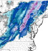
Yep, and most of Virginia gets snow on the ground.View attachment 138394
NC mountains!!
Yeah we just sorta have to wait and be patient for the pattern to change.I’m just glad we can finally stop hearing about these phantom patterns that will never happen again earlier then later.
Seen this movie before, usually doesn’t have a good ending. It’d be cool to be on floodlight watch again thoughTrying hard to briefly transition to snow even down into the northern NC piedmont at the end of the NAM run overnight Sunday
View attachment 138395
To be fair, most of the southeast averages pretty close to 0 now.Bastardi keeps honking how the SE will be one of the best areas to be above average snow this winter, except he doesn't tell you it will mainly be the mountains
I’m afraid that significant snows will only be a once in a decade occurrence for Atlanta from now on. Atlanta snow climo is probably the same as what South Georgia’s was 50 years ago.To be fair, most of the southeast averages pretty close to 0 now.
Roxboro specialTrying hard to briefly transition to snow even down into the northern NC piedmont at the end of the NAM run overnight Sunday
View attachment 138395
You say this every year.I’m afraid that significant snows will only be a once in a decade occurrence for Atlanta from now on. Atlanta snow climo is probably the same as what South Georgia’s was 50 years ago.
I’m afraid that significant snows will only be a once in a decade occurrence for Atlanta from now on. Atlanta snow climo is probably the same as what South Georgia’s was 50 years ago.
Come on. You've been posting long enough to know better. ?I swear I didn’t expect bittercasting this soon
Winter cancel…sooner we accept it the betterI swear I didn’t expect bittercasting this soon
Winter cancel…sooner we accept it the better
