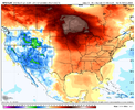
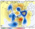
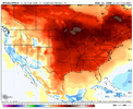
gfs was a continuation of very positive trends we've seen today.
basically an 8 yard run down the middle on first down
tbh should this late phase scenario be borne out though it definitely favors i95 east
While you are certainly correct, it does snow in that area. I didn't say it never snows there, just stated it misses more often than not even in great winters and one shouldn't expect snow every year. Based on your response you agree with that and have your expectations in check. That line between at least seeing snow fall every year and going years at a time without any definitely sets up somewhere near that I20 corridor.I reside in the area that you referenced as being the "sixth" region. In fact, my location is sixty miles SE of Macon and I can assure you that even this far South isn't devoid of winter weather events. During the last decade, we had four separate occasions that met the criteria of being some type of winter storm. While I absolutely do not expect to see snow/sleet/freezing rain every single winter, it is absolutely not correct to assert that anyone south of the cities you listed under number six to see wintry precipitation during any cold weather month. The old rule used to be that any time there was snow breaking out between the I-10 and I-20 corrider in Louisiana, that the chances of it making it to the Southern half of Georgia were extermely high in terms of plausibility. However, that is no longer accurate and I think that anyone south of Atlanta in Georgia and the lower half of South Carolina (excluding those that got crushed in January 2018) has a right to complain about how things have turned out lately way more than most. If one wants to truly draw a line in Georgia in which your chances of seeing some type of frozen precipiation dramatically drop, it would be a SW to NE line from slightly below Albany to Tifton to Baxley and upwards to Statesboro. Anything on the other half of that line most definitely has a chance at seeing at least something measurable each winter.
I’m confused. What about that run was big and worthy of get your popcorn ready?Going to be big
The 18z GFS has nothing of interest for us. The eastern parts of both Carolinas may get something if this run is right, but upstate SC is left out.I’m confused. What about that run was big and worthy of get your popcorn ready?
I'm concerned about drought, what's your thoughts on this?The end of the 18z GFS is going to be a lot warmer too it looks like.
The hockey stick pattern can’t crash and burn!?The end of the 18z GFS is going to be a lot warmer too it looks like.
Is that good?
Yeah…for our grass to grow.Is that good?
Yes. Precip won't be a problem.NW trend will save us, right? Right?
11-16th? Last three days? Somebody can't count
When do you expect the state of emergency to be declared?Somebody better call duke energy to go down to the downeast counties for the blizzard and the farmers to get them to start planting bc the 18z gfs said so
1000 people impacted by this and 10 million hogsSomebody better call duke energy to go down to the downeast counties for the blizzard and the farmers to get them to start planting bc the 18z gfs said so
I would assume they are just waiting on the 18z navgem. @roycooper thoughts?When do you expect the state of emergency to be declared?
But still saying the same thing everyday. We get precip but no cold!Also, Brick is dead. RIP.
What of the world famous Duplin county wineries. Will they survive this?1000 people impacted by this and 10 million hogs
Not too late for folks to cancel or move their wedding before they are stuck in Autreyville for 2 weeksWhat of the world famous Duplin county wineries. Will they survive this?
Taylor Swift changes lives!
We are , what do you mean if we wereImagine the vibe in here if we were tracking a Sunday snowstorm right now
Imagine being marooned in Duplin County.Not too late for folks to cancel or move their wedding before they are stuck in Autreyville for 2 weeks
blockedWe are , what do you mean if we were
18z Euro was stronger with the southern low, precip field further north at hr90. These globals are going to start jackpotting the SW mountains/foothills soon I think. 18z GFS had a little spot of snow there.
The thing is if that band makes it up there, it could pivot in the same spot for 12-18 hours and drop 2-3 inches of liquid. The upside potential while very unlikely is through the roof there.
Also worth noting the highest GEFS snow mean for anybody is that area of the southern mountains around Brevard
The snow got closer to WilmingtonI’m confused. What about that run was big and worthy of get your popcorn ready?