My gut says 0z tonight
-
Hello, please take a minute to check out our awesome content, contributed by the wonderful members of our community. We hope you'll add your own thoughts and opinions by making a free account!
You are using an out of date browser. It may not display this or other websites correctly.
You should upgrade or use an alternative browser.
You should upgrade or use an alternative browser.
Misc Winter Weather Support Group
- Thread starter RBR71
- Start date
- Joined
- Jan 5, 2017
- Messages
- 3,773
- Reaction score
- 5,983
Well at least NC doesn't get rain on the Euro. Ya'll need a break, right?
SnowNiner
Member
The omega ridge sliding east is not what we want...that just drags the warm air where we don't want it. Only way this will work is if we get some of the n/s energy injected in and that is moving the wrong way. We trying to make lemonade and we got no lemons.
View attachment 144096View attachment 144097
That 50/50 will be in Europe by Wednesday. Geez. Whatever. On to Mid February.
Looking forward to a classic, simple western and Alaskan ridge again if we can get it. The blocking and 50/50 dynamic doesn't seem to be working.
That 50/50 will be in Europe by Wednesday. Geez. Whatever. On to Mid February.
Looking forward to a classic, simple western and Alaskan ridge again if we can get it. The blocking and 50/50 dynamic doesn't seem to be working.
If we had mediocre cold with a mediocre high pressure to our north we would have been sitting pretty. I do think someone gets snow...probably areas north/west.
Nothing worksThat 50/50 will be in Europe by Wednesday. Geez. Whatever. On to Mid February.
Looking forward to a classic, simple western and Alaskan ridge again if we can get it. The blocking and 50/50 dynamic doesn't seem to be working.
Webberweather53
Meteorologist
We blew it (again).
Finally pulled the trigger and migrated over from AmericanWx. Model disco over here is 100x better, should have made the jump sooner
For those taking notes at home, I’m officially pulling the plug on this one.
What kind of plug are we talking about here.For those taking notes at home, I’m officially pulling the plug on this one.
NBAcentel
Member
Snow drought begets snow drought
Kitty Bump
Member
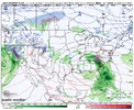
It not a deal barker yet but you 50500 low moving up the Ne coats TO fast. it really hauling you as.The trend continues. @Kitty Bump thoughts?View attachment 144056
You needing to cash you chicks with thq spider modle the gsf hot grabage. !@
You ca,.n seeing fro youself to sitt

When we lose both the NAVGEM and the JMA, you know it's time to hang it up, lol.


Triplephase93
Member
This going to end up being a Mountain only event if the Precip even makes it there.
Kitty Bump
Member
It a much bitter update to found here:It not a deal barker yet but you 50500 low moving up the Ne coats TO fast. it really hauling you as.
You needing to cash you chicks with thq spider modle the gsf hot grabage. !@
You ca,.n seeing fro youself to sitt
View attachment 144111
x.com
SnowNiner
Member
Snow drought begets snow drought
From now on I need 2022 conditions to get confident. Tall western ridge with high pressure spilling down the Midwest and east, cold. No more of this Atlantic blocking pv crud. Persistence forecasting.
you used the NAVGEM to illustrate your point ?
JHS
Member
My call for a shutout for most of us this winter looks really good now.
NBAcentel
Member
I’m Peter peckered out, there’s been 3 trackable events that have trended to garbage here this winter. The snow drought is getting to unbelievable territory. My optimism is going down exponentially
- Joined
- Jan 5, 2017
- Messages
- 3,773
- Reaction score
- 5,983
It's going to advect all that cold air in from the Bermuda Triangle! It's gonna be epic.
- Joined
- Jan 5, 2017
- Messages
- 3,773
- Reaction score
- 5,983
Take a break, go do something else for a week, and then come back and you will see your NC snow storm. It's there, you just can't see it yet.I’m Peter peckered out, there’s been 3 trackable events that have trended to garbage here this winter. The snow drought is getting to unbelievable territory. My optimism is going down exponentially
I’m with you Fro. It’s starting to hurt. Good chance we’re in the same boat next year. Gambler’s fallacy would be to think we’re somehow extra overdue for a storm when in reality our odds will be just as bad later this month as they were the previous February and the February before that. It just doesn’t want to snow here for some reason.I’m Peter peckered out, there’s been 3 trackable events that have trended to garbage here this winter. The snow drought is getting to unbelievable territory. My optimism is going down exponentially
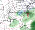
Benchmark surface low position on the JMA while the 850 line is in Pennsylvania. ? Maybe rates will overcome? ?When we lose both the NAVGEM and the JMA, you know it's time to hang it up, lol.


It been bitter @ 17z jest y_ ou weight in sea’
Sent from my iPhone using Tapatalk
Sent from my iPhone using Tapatalk
I’d rather it cut than go off the Atlantic coast and it still rain because cold air doesn’t exist anymore in the Southeast except when it’s dry.
ATLwxfan
Member
I’m Peter peckered out, there’s been 3 trackable events that have trended to garbage here this winter. The snow drought is getting to unbelievable territory. My optimism is going down exponentially
Major snow melting in the plains and Great Lakes also doesn’t bode well. Places like Minneapolis facing their lowest snow totals in decades.
Sent from my iPhone using Tapatalk
Heelyes
Member
Kitty Bump
Member
you alwysa calling for a shoutout it needs more to be more patience, and not live to die from the runsMy call for a shutout for most of us this winter looks really good now.
NoSnowJoe
Member
packfan98
Moderator
Any chance we can get a booming NAM run this week? We are getting down to only a few good ensemble members left with that glorious digital snow. I'm going to need this to hang on a few more days!
- Joined
- Jan 5, 2017
- Messages
- 3,773
- Reaction score
- 5,983
I don't think so. This "chance" is going to be gone before it gets within 84 hours.Any chance we can get a booming NAM run this week? We are getting down to only a few good ensemble members left with that glorious digital snow. I'm going to need this to hang on a few more days!
Any chance we can get a booming NAM run this week? We are getting down to only a few good ensemble members left with that glorious digital snow. I'm going to need this to hang on a few more days!
I still think it’s very possible NC and upstate is still in the game, all the models are close just a little wiggle room here and there it’s a big run again.
Somebody gonna get NAM’d later this week…
Sent from my iPhone using Tapatalk
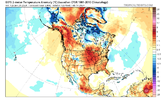
February 5th. That's the day I guess it's still at least a glimmer of hope of maybe a flake or two. More importantly it's also the day Feb 20th will be in view on the ensembles, and if it still looks like this I'm at least walking to the cliff and most likely jumping. There is simply still no cold air showing up. Fab Feb is quickly going down the shitter

Last edited:
Hate to say it, but I am approaching 75% confidence in no substantial Winter weather for my back yard this season.
I hate to be missing out since this was the highest chance since 2010/2014.
I hate to be missing out since this was the highest chance since 2010/2014.


