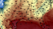
Let’s see it don’t hold backLatest CFS has a Board wide Rocking happy New Years
Eve delight. Very encouraged by the EPS and seeing other guidance sing same tune is encouraging.Maybe we can score one 12/28- Early Jan.
-
Hello, please take a minute to check out our awesome content, contributed by the wonderful members of our community. We hope you'll add your own thoughts and opinions by making a free account!
You are using an out of date browser. It may not display this or other websites correctly.
You should upgrade or use an alternative browser.
You should upgrade or use an alternative browser.
Wintry Winter Discussion 2023/24
- Thread starter Rain Cold
- Start date
Webberweather53
Meteorologist
Is it safe to say tyat everyone's prediction of megatorch December 2015 repeat will most likely be wrong?
Everyone?
You sure about that?
It doesn't look as warm as 2015, which had a ridge rooted over the SE US. This year we have lot of systems cutting through the subtropics that'll keep our temps in check. Lots of upper 50s - maybe 60s type days, perhaps 70F or two thrown in there, but I wouldn't expect the 80s we had in 2015.
SimeonNC
Member
I was being hyperbolic lol. My apologiesEveryone?
You sure about that?
Webberweather53
Meteorologist
I was being hyperbolic lol. My apologies
Just wanted to clear that up because the last few pages of comments @ me would argue I was calling for a megatorch in the SE US because I'm a "warmingsta" or whatever other nonsensical, derogatory, and inaccurate term people like to label me as.
SimeonNC
Member
You're good lol, I was mainly thinking of a lot of posts I've seen over at Americanwx when I made that post.Just wanted to clear that up because the last few pages of comments @ me would argue I was calling for a megatorch in the SE US because I'm a "warmingsta" or whatever other nonsensical, derogatory, and inaccurate term people like to label me as.
As for the argument, I have no skin in it and honestly arguing over stuff like this is pointless.
Webberweather53
Meteorologist
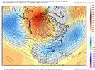
GEFS Extended and ECMWF Weeklies showing a period of western troughing after the first week of January's strong +PNA.
This would be a rather welcome sight in the long run imho. All the barren ground over the Midwest + Great Lakes would get filled in with a deep and cold snow pack, setting the stage for a potential run at some true big dog potential for the US East Coast near the end of January into February.
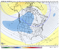
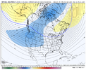
This would be a rather welcome sight in the long run imho. All the barren ground over the Midwest + Great Lakes would get filled in with a deep and cold snow pack, setting the stage for a potential run at some true big dog potential for the US East Coast near the end of January into February.


Webberweather53
Meteorologist
GEFS Extended and ECMWF Weeklies showing a period of western troughing after the first week of January's strong +PNA.
This would be a rather welcome sight in the long run imho. All the barren ground over the Midwest + Great Lakes would get filled in with a deep and cold snow pack, setting the stage for a potential run at some true big dog potential for the US East Coast near the end of January into February.
View attachment 138724
View attachment 138725
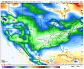
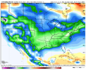
The weekly snow swaths from both of these model suites reinforces this point. While it would hamper things in the shorter-term, we'd be sitting pretty in the long run during our most favorable climo window (late Jan-Feb) if we can get just a little bit of western-central US centric troughing for a week or so.
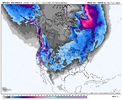
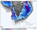
Already talking about the end of Jan beginning of Feb. Dang. I get tired of having a 2 week window at winter.The weekly snow swaths from both of these model suites reinforces this point. While it would hamper things in the shorter-term, we'd be sitting pretty in the long run during our most favorable climo window (late Jan-Feb) if we can get just a little bit of western-central US centric troughing for a week or so.
View attachment 138726
View attachment 138727
J1C1111
Member
Unfortunately, that's the pain of of winter in the southeast almost every year it seems and it's getting worse each year. Hang in there. I know your pain. We have such a short window every year outside the mountains. I've never went 2 years in a row in my 41 years living here since 81 without any snow. Will see. Always a waiting game to time everything up just right.Already talking about the end of Jan beginning of Feb. Dang. I get tired of having a 2 week window at winter.
tennessee storm
Member
Yeah so true …. Welcome to the south . Being a big weather freak as I am , I love winter storms just as much as a severe wx outbreak . I just have become jaded with winter last few yearsUnfortunately, that's the pain of of winter in the southeast almost every year it seems and it's getting worse each year. Hang in there. I know your pain. We have such a short window every year outside the mountains. I've never went 2 years in a row in my 41 years living here since 81 without any snow. Will see. Always a waiting game to time everything up just right.
NCSNOW
Member
6z Operational GFS joins the CFS choir. Pattern flip 28th. Snow in NC 29th and a big dog rolling in 1/1-1/2. The Bull City Ping alert from yesterday is getting louder. Maybe 1/29-1/7 is legit. We shall see over the next week or so.
Last edited:
Ron Burgundy
Member
Big dog for the I-40 crowd. Us I-20 folks just get wet verbatim. Long time to go tho6z Operational GFS joins the CFS choir. Pattern flip 28th. Snow in NC 29th and a big dog rolling in 1/1-1/2. The Bull City Ping alert from yesterday is getting louder. Maybe 1/29-1/7 is legit. We shall see over the next week or so.
Yeah a big dog for the northeast. 90 percent of this board looked like rain to me.6z Operational GFS joins the CFS choir. Pattern flip 28th. Snow in NC 29th and a big dog rolling in 1/1-1/2. The Bull City Ping alert from yesterday is getting louder. Maybe 1/29-1/7 is legit. We shall see over the next week or so.
Have to watch the evolution of ridging initially across Central Canada that begins to retrograde as we get into Christmas and new years. If we can get enough amplitude there we can get some cross polar flow and start establishing some cold into the Hudson Bay region that could be enough to tap into our region around or after the new year. The 6z gfs pinched off a ridge north of barrow and started the process with a nice string of cold highs through Canada into the US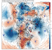
The eps wasn't as enthusiastic
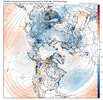
Be careful with the means and the constant blue heights and blue 850s over the SE, the pattern is likely to be somewhat active so that spreads on the means and looks super impressive but the reality is likely more choppy. With no good suppression mechanism you have to have concen in that 12/27-1/5 period that things amp and lift so I would think initial or ending winter precipitation is favored minus a better chance of an all snow event from OKC to Mem to Ric.
We probably hit the apex of this first shot of winter 1/5-12 especially if we can get a tall western ridge and draw cold/pv into the Hudson Bay region. This would be imo when we could get a significant system for a larger part of the region.
As retrogression continues the pattern should start to transition to some level of trough to our west and maybe a SER reflection, this is fine. We are likely to start going back into a more blocky better pattern 1/25-2/1.
I still think things are going as expected aside from some timing differences from my own thoughts.

The eps wasn't as enthusiastic

Be careful with the means and the constant blue heights and blue 850s over the SE, the pattern is likely to be somewhat active so that spreads on the means and looks super impressive but the reality is likely more choppy. With no good suppression mechanism you have to have concen in that 12/27-1/5 period that things amp and lift so I would think initial or ending winter precipitation is favored minus a better chance of an all snow event from OKC to Mem to Ric.
We probably hit the apex of this first shot of winter 1/5-12 especially if we can get a tall western ridge and draw cold/pv into the Hudson Bay region. This would be imo when we could get a significant system for a larger part of the region.
As retrogression continues the pattern should start to transition to some level of trough to our west and maybe a SER reflection, this is fine. We are likely to start going back into a more blocky better pattern 1/25-2/1.
I still think things are going as expected aside from some timing differences from my own thoughts.
packfan98
Moderator
Looks like a good setup for a classic Southern Slider...
tennessee storm
Member
And it begin lol…. Very true . We should be used to it at least

