-
Hello, please take a minute to check out our awesome content, contributed by the wonderful members of our community. We hope you'll add your own thoughts and opinions by making a free account!
You are using an out of date browser. It may not display this or other websites correctly.
You should upgrade or use an alternative browser.
You should upgrade or use an alternative browser.
Wintry Winter 2024-25 Discussion
- Thread starter SD
- Start date
Nice. With an mjo 7/8 in that time frame it would be a pond pattern just screaming for ducks to land.Checking in on the last 10 runs of the CFS for January. No way this can fail
View attachment 155605
View attachment 155606
It's really nice. It would be great to get this sequence to show up in the model the last 10 days of December, since I think that's when its predictive skill is the best.Checking in on the last 10 runs of the CFS for January. No way this can fail
View attachment 155605
View attachment 155606
Checking in on the last 10 runs of the CFS for January. No way this can fail
View attachment 155605
View attachment 155606

dsaur
Member
I'm all in for frozen on or about the 1st. I've seen it before several times, and I'll see it again. Granted it was in the 70's I think, may the 60's, and in Atl...but it could happen again...and somewhere else! I had a white Xmas one time, and that broke climo's back....but climo says the 1st is fine.It's really nice. It would be great to get this sequence to show up in the model the last 10 days of December, since I think that's when its predictive skill is the best.
If you ever want to see 11 straight days of SE Winter Weather Glory. Go play the loop on the 0Z CFS from Jan1-Jan11. Im talking frozen for everyone multiple storms and long lasting Artic Plunge to go with it. This would be the digital Fantasy/ Make a wish to verify just once for a CFS run to come true check to cash in.
I watch the CFS all the way out daily when pattern chasing, trying to see if there's any consistent clues its spitting out/seeing. It's been honking for early Jan glory potential several times now with a nice press of Cold. Yes its the CFS but I have noticed if its advertising something consistently over time, and the Teleconnection outlooks look like they would support such, usually it is right more than its wrong with the pattern, obviously not with the exact wx.
I watch the CFS all the way out daily when pattern chasing, trying to see if there's any consistent clues its spitting out/seeing. It's been honking for early Jan glory potential several times now with a nice press of Cold. Yes its the CFS but I have noticed if its advertising something consistently over time, and the Teleconnection outlooks look like they would support such, usually it is right more than its wrong with the pattern, obviously not with the exact wx.
To be fair that’s all these models do during winter is honk for winter weather in fantasy land. I hope it’s right for once.If you ever want to see 11 straight days of SE Winter Weather Glory. Go play the loop on the 0Z CFS from Jan1-Jan11. Im talking frozen for everyone multiple storms and long lasting Artic Plunge to go with it. This would be the digital Fantasy/ Make a wish to verify just once for a CFS run to come true check to cash in.
I watch the CFS all the way out daily when pattern chasing, trying to see if there's any consistent clues its spitting out/seeing. It's been honking for early Jan glory potential several times now with a nice press of Cold. Yes its the CFS but I have noticed if its advertising something consistently over time, and the Teleconnection outlooks look like they would support such, usually it is right more than its wrong with the pattern, obviously not with the exact wx.
tennessee storm
Member
Yeah. That’s why it’s called fantasy land … just a fantasyTo be fair that’s all these models do during winter is honk for winter weather in fantasy land. I hope it’s right for once.
Only 3 to 4 weeks out. Book it!If you ever want to see 11 straight days of SE Winter Weather Glory. Go play the loop on the 0Z CFS from Jan1-Jan11. Im talking frozen for everyone multiple storms and long lasting Artic Plunge to go with it. This would be the digital Fantasy/ Make a wish to verify just once for a CFS run to come true check to cash in.
I watch the CFS all the way out daily when pattern chasing, trying to see if there's any consistent clues its spitting out/seeing. It's been honking for early Jan glory potential several times now with a nice press of Cold. Yes its the CFS but I have noticed if its advertising something consistently over time, and the Teleconnection outlooks look like they would support such, usually it is right more than its wrong with the pattern, obviously not with the exact wx.
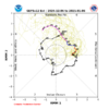
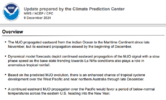
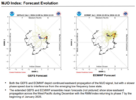
Euro Wk brings the MJO signal to Phase 7 with sufficient amp by day 20 (Dec 30). The black ensemble mean line weakens the signal out past day 20 (common to an extent with it being an extended ensemble of 100 members)


GolfishardIknowit70
Member
That's interesting that it brings it into phase 7 and then moves it quickly into the cod if it's to be believedEuro Wk brings the MJO signal to Phase 7 with sufficient amp by day 20 (Dec 30). The black ensemble mean line weakens the signal out past day 20 (common to an extent with it being an extended ensemble of 100 members)

We need it to have staying power so the cold will eventually bleed east. Man We're still weeks away
When I hear “Bleed East” I have nightmares of Dallas to Little Rock to Memphis to Nashville down to Huntsville getting Winter weather at 5-15° while the Carolinas get a cool rain.We need it to have staying power so the cold will eventually bleed east. Man We're still weeks away
Webberweather53
Meteorologist
Whut
Whut
Man that’s awesome.
So basically the same areas as the last three Winters.
Really neat & exciting.
I’m droolingMan that’s awesome.
So basically the same areas as the last three Winters.
Really neat & exciting.
Webberweather53
Meteorologist
Man that’s awesome.
So basically the same areas as the last three Winters.
Really neat & exciting.
I have a lot of concerns w/ this outlook, not the least of which is highlighting above normal snow in places like Phoenix (where it never snows). I think BAM is overcorrecting for December.
He’s definitely setting himself up for a Major fail or Major win.I have a lot of concerns w/ this outlook, not the least of which is highlighting above normal snow in places like Phoenix (where it never snows). I think BAM is overcorrecting for December.
Let’s hope for a major fail, but the way the past few years have went expect a major win.He’s definitely setting himself up for a Major fail or Major win.
Webberweather53
Meteorologist
I think my timeline of our best window to get snow this winter being early to mid-January is definitely bit early given the preceding warmth from the +EPO. Probably leaning towards the 2nd-3rd week of January (January 10th - MLK Day or so) is probably about right. I could see a good pattern for us linger deeper into late January, but I have some concerns about the SE US ridge the closer we get to February.
Big swath lines always make me chuckle a bit. Coastal Ga. south of Savannah to wide ranges in northern Mexico? Yeah, I definitely won't look for specifics. Meanwhile, it's light outside today. Don't pin me on any detail here.I have a lot of concerns w/ this outlook, not the least of which is highlighting above normal snow in places like Phoenix (where it never snows). I think BAM is overcorrecting for December.
Webberweather53
Meteorologist
Of course I'm not a met, but it looks like he's thinking we'll see a prominent +PNA.
Not a met like you, but know enough that this doesn't look good going into the new year. Hopefully (as you stated) this allows a reset towards the middle of January.
View attachment 155989
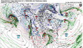
Naturally, during this transition period away from a warmer pattern to a cooler one, with an initially strong jet stream that then retracts, that usually implies an active storm track w/ rather strong cyclones (which is needed to use up the background momentum from the jet stream). Also may lead to severe weather for parts of the SE US at some point.
We'll probably need to see 1 or more massive cyclones to occlude near/over the Lakes & SE Canada to help restore the +TNH pattern.
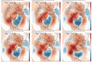
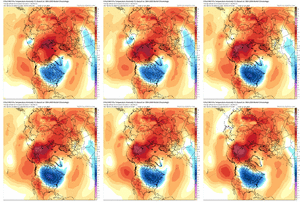
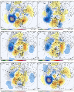
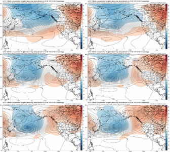
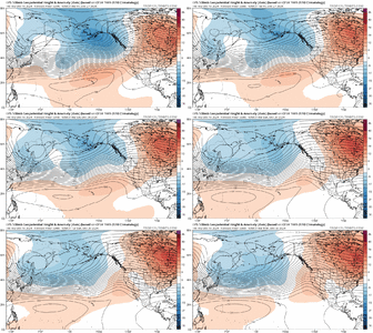
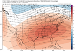
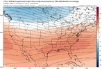
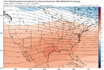
Today's Euro Weekly run for:
Dec 24 - Jan 1
Jan 1 - Jan 8
Jan 8 - 15


Dec 24 - Jan 1
Jan 1 - Jan 8
Jan 8 - 15


packfan98
Moderator
That's a pretty fast turn around for the first week of January. Do you recall how that compare to prior runs?Today's Euro Weekly run for:
Dec 24 - Jan 1
Jan 1 - Jan 8
Jan 8 - 15


Trend of a little slower to flip in early Jan, but trend of a little colder after flippingThat's a pretty fast turn around for the first week of January. Do you recall how that compare to prior runs?
tennessee storm
Member
Severe weatherNot a met like you, but know enough that this doesn't look good going into the new year. Hopefully (as you stated) this allows a reset towards the middle of January.
View attachment 155989
What's the over /under on the date we start discussing Fab Feb will save us/ might as well punt January as MJO will finally be in favorable phase by then etc?
I'll go with New Years Day.
If we are all sitting in the recliner watching Football and the ensembles/weeklies, World Famous CFS are spitting out PAC Garbage still on NYD, then that's usually when we start pitching our last horseshoe.
We should be tracking something on the models come NYD, if what's being advertised now verifies.
severestorm
Member
severestorm
Member
lexxnchloe
Member
GoDuke
Member
How much of our tax dollars is wasted on this model?
lexxnchloe
Member
87 million twice a day every dayHow much of our tax dollars is wasted on this model?
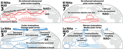
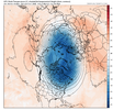
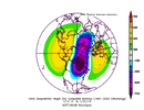
I was wondering if Judah C was going to mention this in his blog yesterday, but there is a Canadian Warming showing up in the strat charts in late Dec (common with this type of Super El Nino look coming up of big Aleutian Low / Extended & Poleward Pac Jet).
And here is what he said about the Canadian warming (he has mentioned / shown this in past years)..."What is also interesting about Canadian warmings they almost always transition to another PV disruption, either a stretched PV or the larger sudden stratospheric warming."
I think the SSW is highly unlikely in Jan, but the stretched PV, in concert with a retracted Pac Jet and MJO 7-8-1-2 could help us with the pattern in Jan as currently shown on the Euro Weeklies and GEFS Ext runs.
We'll see....we're going to be coming off a rough stretch here to end the year and into early Jan. Some things may be lining up for a flip to a better pattern, but always flies in the ointment poised to wreck the party. Getting the Pac Jet to back off is step 1. In a perfect world, the Pac Jet backs off, then the MJO makes a good and slow 7-8-1-2 pass and doesn't allow the Pac Jet to retreat to the west too much and anchors it in place to support -EPO / +PNA patterns. A substantial -AO / -NAO pattern is probably a stretch, but maybe some bootleg stuff there to help
Potential problems: Pac Jet remains too strong / MJO thru 7-8-1-2 is quick / Strat PV fails to weaken and stretch
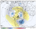
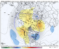


^ I think what happens with the Strat PV is that when there is a Canadian Warming, the center of the PV gets pushed over towards the Siberia side of the pole, and in that location it becomes more unstable / more susceptible to further disruption

