• Hello, please take a minute to check out our awesome content, contributed by the wonderful members of our community. We hope you'll add your own thoughts and opinions by making a free account!

Hurricane Debby

It does, but it also looks like the plots are favoring a bit sharper of a turn back to the north and northwest. All of those plots have a 2nd landfall south of the NC/SC border
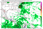
Yeah Georgetown to Cape Fear is the consensus but if it gets further east like the icon then out to lookout needs to be watching.
 
I still think the ICON is right and everything else is too far west. As far as heavy rain goes it'll be along Highway 1 and east for the most part. Charlotte may get .50 out of it and the GSP metro not a drop. Even Columbia SC may get very little out of it.
 
I still think the ICON is right and everything else is too far west. As far as heavy rain goes it'll be along Highway 1 and east for the most part. Charlotte may get .50 out of it and the GSP metro not a drop. Even Columbia SC may get very little out of it.
Must be showing the least rain for the upstate??
 
There’s a reason the NHC isn’t using the ICON. There’s 2 clusters on the spaghetti models. One that landfalls around Beaufort then takes it up 26 and then through the upstate and Piedmont and one that favors the Myrtle Beach landfall and then I95. Take the middle of them and you’re looking at a landfall near Charleston/McClellanville up towards Monroe and Wadesboro.
 
I still think the ICON is right and everything else is too far west. As far as heavy rain goes it'll be along Highway 1 and east for the most part. Charlotte may get .50 out of it and the GSP metro not a drop. Even Columbia SC may get very little out of it.
Good lord this is sad at this point
 
I still think the ICON is right and everything else is too far west. As far as heavy rain goes it'll be along Highway 1 and east for the most part. Charlotte may get .50 out of it and the GSP metro not a drop. Even Columbia SC may get very little out of it.
I’m not saying it’s wrong, because this is such a difficult storm to nail down the track. However, the ICON is on a bit of an island by itself right now with how far north up the coast it makes landfall. You can look at the latest guidance plots that the NHC uses and none of them landfall north of the NC/SC line. We need to remember, we often look at the ICON because it’s available to us, but the NWS doesn’t really give it any weight in their forecast discussions.
 
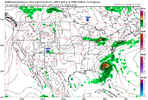
The NAM is about 75-100 miles east of its 18z run. This is headed for the Cape Lookout NC area and on northeast from there.
 
The NAM is about 75-100 miles east of its 18z run. This is headed for the Cape Lookout NC area and on northeast from there.
Ok just stop. You’re just throwing darts and seeing if they’ll stick. Even the ICON that you’re convinced is correct has the storm moving inland NNW in eastern NC and doesn’t make a turn until almost the NC/VA line.
 
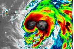
Won’t make it to 120 I was wrong. CAT1 is max potential for Florida. And this also lowers it chances over the Atlantic from becoming a hurricane imo.
I think if it is back over open water for 36 hours, it will become a hurricane again, but I don’t believe it will get anywhere close to the 959mb that the ICON is showing.
 
I think if it is back over open water for 36 hours, it will become a hurricane again, but I don’t believe it will get anywhere close to the 959mb that the ICON is showing.
That’s one reason why I think the Icon is way off. It is wayyyy too strong which favors a more eastern track and thus a much further north landfall.
 
Back
Top