snowc
Member
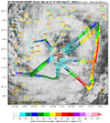
Winds are up in the 30s?
NHC advisory at 2 has Debby at 32.4, 79.1 .. however, Recon center fixed closer to where the UKMET model initialized.12Z UKMET: Whereas the 0Z went in just NE of CHS, the 12Z is a little further NE ~midway between CHS and Georgetown. Then goes NNW to near Charlotte then turns NNE to inland in the NE US:
TROPICAL STORM DEBBY ANALYSED POSITION : 32.0N 79.4W
ATCF IDENTIFIER : AL042024
LEAD CENTRAL MAXIMUM WIND
VERIFYING TIME TIME POSITION PRESSURE (MB) SPEED (KNOTS)
-------------- ---- -------- ------------- -------------
1200UTC 07.08.2024 0 32.0N 79.4W 996 36
0000UTC 08.08.2024 12 32.6N 79.3W 995 32
1200UTC 08.08.2024 24 33.6N 79.5W 997 34
0000UTC 09.08.2024 36 34.7N 80.6W 999 32
1200UTC 09.08.2024 48 37.8N 79.9W 999 31
0000UTC 10.08.2024 60 42.2N 76.6W 996 34
1200UTC 10.08.2024 72 47.1N 70.2W 990 34
0000UTC 11.08.2024 84 49.7N 64.9W 989 37
1200UTC 11.08.2024 96 50.0N 57.0W 992 35
0000UTC 12.08.2024 108 CEASED TRACKING

I know right! My kind of womanWho is sparkles?
.75" for the event so far.

Tornado warning for Sampson County!


Convection really blowing up on north and NW side over land. Much of that as it moves inland and totals will come up fast.
View attachment 149648
Feels like it is taking forever to move on shore.
When is it going to start picking up speed ?It is moving about at the slow speed that has been forecasted.
When is it going to start picking up speed ?
Actually I think the winds are just displaced a good ways from the center (100+ miles)The Wind field must be the smallest on record. It has yet to get above 15 to 20 mph here in Mount Pleasant today.
Gusts to about 30 hereThe Wind field must be the smallest on record. It has yet to get above 15 to 20 mph here in Mount Pleasant today.
You see they added us to an inland TS warning for gusts to 50 tonight........I ain't buying it. Rain has been really piling up last 2 hoursGusts to about 30 here
