?
-
Hello, please take a minute to check out our awesome content, contributed by the wonderful members of our community. We hope you'll add your own thoughts and opinions by making a free account!
You are using an out of date browser. It may not display this or other websites correctly.
You should upgrade or use an alternative browser.
You should upgrade or use an alternative browser.
Tropical TS Beta
- Thread starter Henry2326
- Start date
Brent
Member
BHS1975
Member
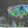
The HWRF has done really well with this storm it hasn't blown it up like it did the actual hurricanes this year and has never been really impressed with it and this is what it looks like at landfall lol
View attachment 49083
Yeah it’s a decent model.
Sent from my iPhone using Tapatalk
Brent
Member
Henry2326
Member
The later you go into Fall with tracks like this (not saying it’s right) the odds of tornadoes are gonna go up when they interact with cold air to the north.
CentralALWX
Member
Beta looks completely different from last night.


Not looking too good this evening.

CentralALWX
Member
CentralALWX
Member
Brent
Member
NEW: Radar shows an eye forming with convection wrapping completely around the center of Tropical Storm #Beta and even a very slow WSW-ly motion. Time will tell how temporary are these trends! Radar imagery from @RadarOmega_WX app pic.twitter.com/dGMfQrwu1B
-- Reed Timmer (@ReedTimmerAccu) September 20, 2020
-- Reed Timmer (@ReedTimmerAccu) September 20, 2020
Henry2326
Member
Henry2326
Member
CentralALWX
Member
CentralALWX
Member
Dry air seems to be helping it run to hurricane status look to it now,
This one I think is gonna surprise people with tornadoes inland
I have to agree. Surprised a how little discussion there is..with poss s/e inland path with tornadoes
Brent
Member
Crazy had an eye feature this afternoon and now...
No it’s common for tropical storms to experience DMIN and DMAX.WELL HECK THAT RAMPED RIGHT BACK UP .. OH I FOR GOT IT IS 2020
No the radar beam does not cover that area of the graphic.WELL FELLAS I THINK THIS THING IS DONE. I JUST DONT SEE IT BOUNCING BACK.
HARDLY ANYTHING ON THE WATER VAPOR SAT
AND NOTHING ON THE CURRENT RADAR
View attachment 49140
See. Some said it was dead poof and rainless!
Brent
Member
Honestly to me it has the looks of being a sub-tropical storm at this point.
BufordWX
Member
The primary threat with Beta and it’s remnants as time goes on will probably be heavy rain and isolated flooding. The long range Nam has some pretty wet weather from Arkansas/Louisiana into Mississippi and into Georgia for the second half of the week. Areas further east will probably have a little higher risk given the already saturated soils from Sally.

Brent
Member
Getting close to "landfall" between Port O'Connor and Palacios
View attachment 49178
That will make an amazing 9 CONUS landfalls already and with a few more quite possible. I mean 12 total wouldn’t be a shocker at this point. I’d say 10+ is highly likely.
Someone start a inland thread NHC has 2-4” for the Carolinas with flood chance this weekend
This setup actually favors more rain than CAT 3 Sally!! At least for my backyard due to a more favored track/upslope/speed
CentralALWX
Member
Loop of Beta's forecast track.
https://www.nhc.noaa.gov/archive/2020/BETA_graphics.php?product=5day_cone_no_line_and_wind
https://www.nhc.noaa.gov/archive/2020/BETA_graphics.php?product=5day_cone_no_line_and_wind
smast16
Member
Loop of Beta's forecast track.
https://www.nhc.noaa.gov/archive/2020/BETA_graphics.php?product=5day_cone_no_line_and_wind
The first few frames remind me of the old Nokia snake game.
Disgusted by the lack of attention for Beta. Enjoying the rain today from it
The rates are heavier with Beta vs Sally...and it’s warmer. I see some chances of severe tomorrow too down east
I thought Scotty Powell was your arch-nemesis?


