They are trying to say "watch out, further north and stronger".
Hurricane Beryl Discussion Number 27
NWS National Hurricane Center Miami FL AL022024
400 AM CDT Fri Jul 05 2024
Beryl is nearing landfall in the Yucatan Peninsula this morning.
After unexpectedly intensifying some last night against continued
shear, Beryl has plateaued or filled a bit. The last few fixes from
the Air Force Reserve Reconnaissance mission indicated the pressure
rose 9 mb while the peak 700-mb wind in the final NE leg out of
Beryl were down to 102 kt with lower SFMR values. In addition, the
aircraft was no longer reporting an eyewall and the presentation of
Beryl's inner core from radar out of Cancun, Mexico has become more
degraded. On satellite, the hurricane has also become more
amorphous, with a lack of an eye signature on infrared imagery, and
evidence of southerly shear continuing to undercut its outflow. The
initial intensity this advisory was adjusted to 95 kt, which is
still higher than the satellite intensity estimates, out of respect
of the earlier recon data.
The hurricane appears to now be moving more west-northwestward this
morning, estimated at 285/13 kt. Beryl should maintain this
west-northwest heading as it crosses the Yucatan Peninsula today and
emerges over the Gulf of Mexico by tonight. Thereafter, the
subtropical ridge north of Beryl that has been steering it for many
days now will become eroded in the western Gulf of Mexico from a
long-wave trough located over the Central U.S. In addition, an
upper-level low seen retrograding westward in the Gulf of Mexico
could also impart more poleward steering in the western Gulf of
Mexico.
How sharply Beryl turns poleward from 36-72 h will likely
depend on the storm's vertical depth, with a more vertically deep
system more likely to feel the ridge weakness and upper-level f
low.
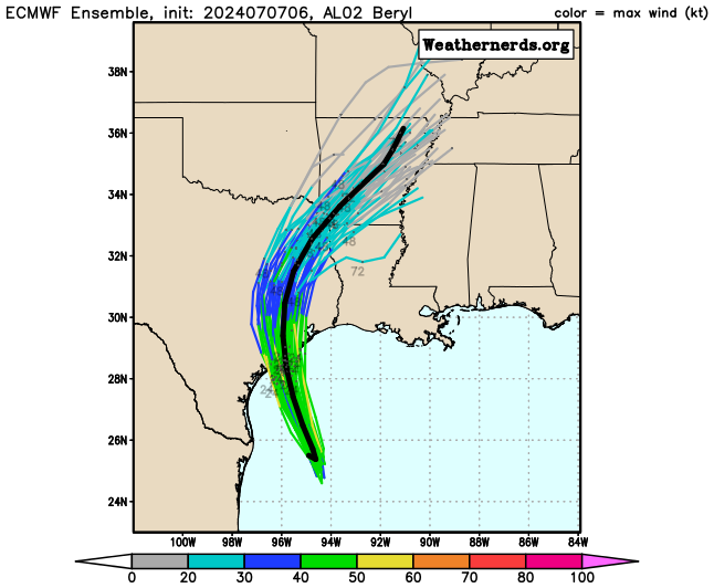
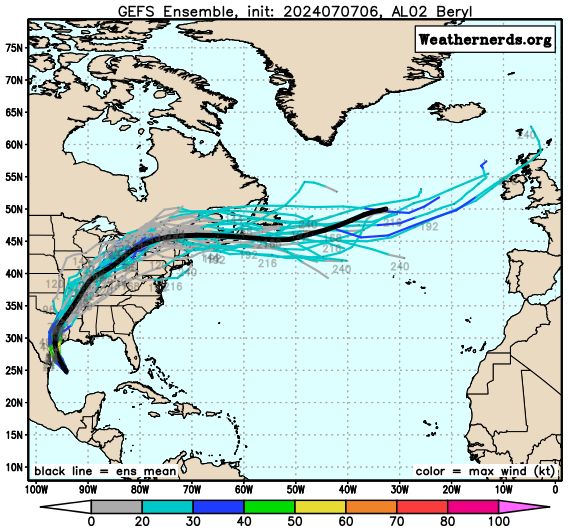
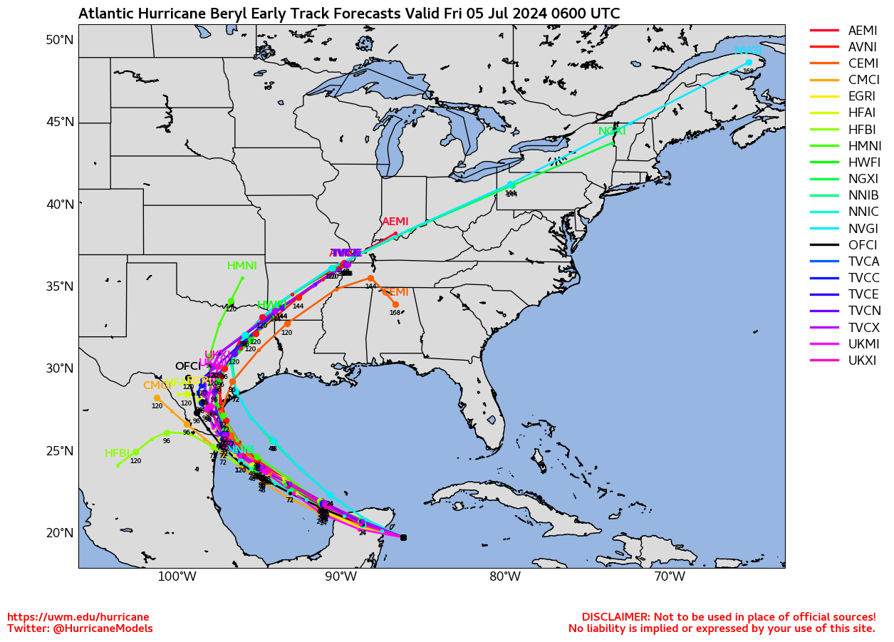
In fact, that scenario has been highlighted by the last few cycles
of the ECMWF ensembles which show stronger solutions on the north
side of the track envelope.
The overall guidance this cycle has also
made a notable shift northward and is a bit slower than earlier, and
the NHC forecast track has been shifted in that direction, quite
close to the consensus aid TVCN. However, it is not quite as far
north as the latest ECMWF or GFS tracks, and further adjustments in
that direction may be necessary later today.
The intensity forecast for the next 24 hours is straightforward, as
the small core of Beryl should quickly weaken over the Yucatan after
it moves inland, likely into a tropical storm before it emerges over
the Gulf of Mexico. However, it is after this period where the
intensity forecast becomes more tricky. It will likely take a bit of
time for Beryl's convective structure to recover in the Gulf of
Mexico, and initially there will still be some residual southerly
shear. However, both the GFS- and ECMWF-based SHIPS guidance shows
shear dropping under 10 kt after 48 hours, while the storm traverses
29-30 C sea-surface temperatures. Such an environment should favor
strengthening, and the raw model output from the GFS and ECMWF
suggests significant deepening as Beryl approaches the coastline of
northeastern Mexico and south Texas. Somewhat surprisingly, the
hurricane-regional models are more subdued and suggest less
intensification this cycle, but these models have been oscillating
between stronger and weaker solutions. The latest NHC intensity
forecast will show a bit more intensification than the prior
advisory, which is on the high end of the intensity guidance, but
more in line with the expected favorable environment as Beryl
approaches landfall.
Users are reminded that the average NHC track error at day 3 is
around 100 miles, and it remains too soon to pinpoint where the
largest impacts will be. However, watches for portions of
northeastern Mexico and South Texas will likely be required later
today.


.gif")