• Hello, please take a minute to check out our awesome content, contributed by the wonderful members of our community. We hope you'll add your own thoughts and opinions by making a free account!

Tropical Tropical Storm Beryl 2024

Meanwhile another dropsonde had 988 mb. So, based on dropsondes, Beryl has not been strengthening over the last 6 hrs.
Also, this last recon center fix was actually a shade E of N though that could easily be just due to a wobble.
 
Hard to say what Beryl means for the rest of the season. The approach to the Texas coast should get it to 75 mph
 
Meanwhile another dropsonde had 988 mb. So, based on dropsondes, Beryl has not been strengthening over the last 6 hrs.
Also, this last recon center fix was actually a shade E of N though that could easily be just due to a wobble.

Drops found a few winds 60-65 on the east side at the surface but everywhere else is 40-50ish at the surface. Not sure it has enough time to rebuild a core that would produce anything more than a small area of hurricane conditions at the surface.


New recon going on now curious to see if there were any changes with this current burst
 
Hard to say what Beryl means for the rest of the season. The approach to the Texas coast should get it to 75 mph

It's July but I will say the record breaking 2020 season also had a Cat 1 into Texas in July

Who really knows though
 
Tropical Storm Beryl Discussion Number 38
NWS National Hurricane Center Miami FL AL022024
1000 PM CDT Sun Jul 07 2024


Radar and satellite trends suggest Beryl is becoming better
organized tonight. Deep convection has increased near the center,
with new convective elements emerging around the northern and
southern portions of the circulation. Tail Doppler Radar data from
the NOAA aircraft suggest the radius of maximum wind has contracted
a bit, and the vortex has become more vertically aligned. However,
the eyewall is open to the west, where there is still some evidence
of dry air in the circulation. The intensity was raised to 60 kt
based on earlier Air Force Reserve Hurricane Hunter flight-level
wind data (66 kt at 700 mb), and the most recent aircraft pass
through the northeast quadrant still supports the 60-kt intensity
for this advisory. The minimum pressure has continued to slowly
fall, with the latest dropsonde data supporting 986 mb.

The environmental and oceanic conditions remain quite favorable for
intensification while Beryl approaches the Texas coast overnight
.
The recent structural changes noted above are expected to allow
Beryl to re-strengthen into a hurricane overnight, and the potential
for significant intensification leading up to landfall is still
indicated by some of the regional hurricane guidance, particularly
the HWRF and HMON
. At this point, time is the greatest limiting
factor as the storm is less than 12 h from landfall. While the 12-h
forecast point shows a 65-kt hurricane inland over Texas, the peak
intensity is expected between now and the 12-h forecast point, and
is thus not explicitly shown in this forecast. After landfall, rapid
weakening is expected while the system moves farther inland.

The long-term motion of Beryl is north-northwestward at about 9 kt,
but recent radar and aircraft fixes have shown a motion just east of
due north. A northward motion overnight is expected to bring the
center of Beryl inland along the middle Texas coast roughly between
Matagorda Bay and Freeport early on Monday morning. The short-term
NHC track forecast is just slightly east of the previous one. After
landfall, Beryl is forecast to accelerate northeastward ahead of a
mid-latitude trough while transitioning to a post-tropical cyclone.
 
Waiting on a few more passes by recon but presentation looks to be getting increasingly better. Things could really get going here, convection not collapsing like we’ve seen the last few days. Good thing it’s not far from landfall don’t wanna know what could’ve been if it had even 1 more day over water.
 
NE WOBBLE?? FROM WHAT IM SEEING IT LOOKS LIKE IT AND IF SO JAMICA BEACH AND GAVLESTON WILL BE LANDFALL AREA

THIS IS WHAT IM SEEING ON THE LATEST IR AND WV SAT IMAGES
 
Apparently this was one of the reasons for upgrade to hurricane:

“These radar echoes were the reasoning for the upgrade of #Beryl. Winds up to 88 mph are being measured at about 10,000 feet aloft. That translates into surface winds of 75 mph, supporting a hurricane.”


Also, the decision may have been influenced by this buoy report:

NOAA buoy 42019 recently reported sustained winds of 60 mph
(97 km/h) and a wind gust of 74 mph (119 km/h). The buoy also
reported a pressure of 992.2 mb (29.30 inches).

In addition, the latest dropsonde showed pressure dropped to 985 mb.
 
Capture.PNG

BULLETIN
Hurricane Beryl Intermediate Advisory Number 38A
NWS National Hurricane Center Miami FL AL022024
100 AM CDT Mon Jul 08 2024

...BERYL STRENGTHENING AS THE CENTER APPROACHES THE MIDDLE TEXAS

COAST...
...CONDITIONS DETERIORATING WITH DANGEROUS STORM SURGE, FLASH

FLOODING, AND STRONG WINDS EXPECTED...

At 100 AM CDT (0600 UTC), the center of Hurricane Beryl was located
near latitude 28.2 North, longitude 95.9 West. Beryl is moving
toward the north-northwest near 10 mph (17 km/h). A turn toward the
north is expected this morning. On the forecast track, the center
of Beryl is expected to make landfall on the middle Texas coast
during the next several hours. Beryl is forecast to turn
northeastward and move farther inland over eastern Texas and
Arkansas late Monday and Tuesday.

Reports from an Air Force Reserve Hurricane Hunter aircraft
and coastal Doppler radar data indicate that maximum sustained
winds have increased to near 80 mph (130 km/h) with higher gusts.
Additional strengthening is expected before the center reaches the
Texas coast. Significant weakening is expected after landfall.

Tropical-storm-force winds extend outward up to 115 miles (185 km)
from the center. A WeatherFlow station at Matagorda, Texas,
recently reported sustained winds of 48 mph (77 km/h) and a wind
gust of 69 mph (111 km/h).

The latest minimum central pressure reported by the Hurricane
Hunter aircraft is 984 mb (29.06 inches)
 
Hurricane Beryl Tropical Cyclone Update
NWS National Hurricane Center Miami FL AL022024
200 AM CDT Mon Jul 8 2024

...BERYL NEARING THE MIDDLE TEXAS COAST...
...200 AM CDT POSITION UPDATE...

Beryl is nearing the middle Texas coast and is expected to make
landfall within the next few hours. Conditions are deteriorating
with dangerous storm surge and flash flooding. Sustained
tropical-storm-force winds and hurricane-force wind gust have
already been reported along the coast.

A WeatherFlow station (XMBG) located at Matagorda Bay recently
reported a sustained wind of 60 mph (96 km/h) and a gust of 75 mph
(120 km/h).

Another position update will be provided at 300 AM CDT (0800 UTC).

SUMMARY OF 200 AM CDT...0700 UTC...INFORMATION
-----------------------------------------------
LOCATION...28.3N 95.9W
ABOUT 20 MI...35 KM SSE OF MATAGORDA TEXAS
ABOUT 100 MI...160 KM ENE OF CORPUS CHRISTI TEXAS
MAXIMUM SUSTAINED WINDS...80 MPH...130 KM/H
PRESENT MOVEMENT...NNW OR 345 DEGREES AT 10 MPH...17 KM/H
MINIMUM CENTRAL PRESSURE...982 MB...29.00 INCHES

$$
Forecaster Kelly
 
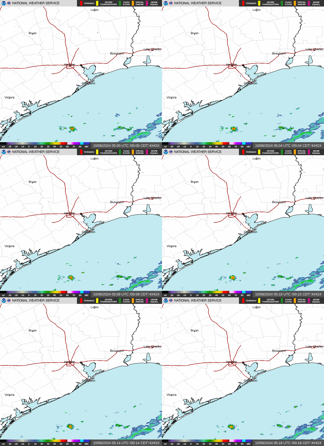
KHGX_loop.gif
 
300 AM CDT Mon Jul 8 2024

...BERYL EXPECTED TO MAKE LANDFALL ALONG MIDDLE TEXAS COAST
WITHIN THE NEXT HOUR OR TWO...
...300 AM CDT POSITION UPDATE...

Beryl is nearing the middle Texas coast and is expected to make
landfall within the next hour or two. Life-threatening storm surge
and heavy rainfall is ongoing across portions of Texas. Sustained
tropical-storm-force winds and hurricane-force wind gust have
already been reported along the coast, these winds will continue to
spread inland.

A NOS station (8773146) located at Matagorda City recently reported
a sustained wind of 68 mph (109 km/h) and a gust of 86 mph (139
km/h).

SUMMARY OF 300 AM CDT...0800 UTC...INFORMATION
-----------------------------------------------
LOCATION...28.4N 96.0W
ABOUT 15 MI...25 KM SSE OF MATAGORDA TEXAS
ABOUT 100 MI...160 KM ENE OF CORPUS CHRISTI TEXAS
MAXIMUM SUSTAINED WINDS...80 MPH...130 KM/H
PRESENT MOVEMENT...NNW OR 345 DEGREES AT 10 MPH...17 KM/H
MINIMUM CENTRAL PRESSURE...982 MB...29.00 INCHES
 
It got down to 979.4 mb at 2:57 CDT.

075700 2830N 09556W 6967 02987 9794 +150 +119 124012 015 019 004 00
 
Back
Top