• Hello, please take a minute to check out our awesome content, contributed by the wonderful members of our community. We hope you'll add your own thoughts and opinions by making a free account!

Tropical Tropical Storm Beryl 2024

Getting closer to being stacked now from what I just read elsewhere. I assume convection has diminished partly due to the recent DMIN (late daytime). Let’s see whether or not it refires closer to DMAX (late night).
It doesn’t seem to me in a much different condition from what was expected for today due to nearby mid-level dry air along with not being stacked due to shear.

Tomorrow was always supposed to be the day for significant (to possibly a period of rapid) strengthening. I could see cat 3 on high end because of a rise of SSTs from 85F where it is to an area of 86-88F to be crossed before landfall. But cat 2 is probably a more reasonable expectation as of now. A strengthening cat 2 would be a beast, itself.

View attachment 148383

Yeah it does seem like another one of those where it's just strengthening as it hits
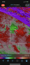
Screenshot_2024-07-06-20-43-22-04_0b2fce7a16bf2b728d6ffa28c8d60efb.jpg
 
Tropical Storm Beryl Advisory Number 34
NWS National Hurricane Center Miami FL AL022024
1000 PM CDT Sat Jul 06 2024

...BERYL FORECAST TO STRENGTHEN TO A HURRICANE AGAIN BEFORE
LANDFALL...
...HURRICANE AND STORM SURGE WARNINGS IN EFFECT FOR PORTIONS OF THE
TEXAS COAST...


SUMMARY OF 1000 PM CDT...0300 UTC...INFORMATION
-----------------------------------------------
LOCATION...24.7N 94.0W
ABOUT 300 MI...485 KM SE OF CORPUS CHRISTI TEXAS
MAXIMUM SUSTAINED WINDS...60 MPH...95 KM/H
PRESENT MOVEMENT...NW OR 310 DEGREES AT 13 MPH...20 KM/H
MINIMUM CENTRAL PRESSURE...993 MB...29.33 INCHES
 
Tropical Storm Beryl Discussion Number 34
NWS National Hurricane Center Miami FL AL022024
1000 PM CDT Sat Jul 06 2024

Beryl has not changed much over the past few hours. Satellite
images still show that the storm has a compact central dense
overcast pattern, and radar and dropsonde data from the NOAA
aircraft indicate that the circulation remains tilted to the
northwest with height. Both the NOAA and Air Force Hurricane Hunter
aircraft have reported a slight drop in minimum pressure to 993 mb,
but the flight-level wind data suggest that the initial intensity is
still around 50 kt.

The storm is moving northwestward at 11 kt on the western periphery
of a mid-level ridge. A turn to the north-northwest with a slight
decrease in forward speed is expected as the system moves toward a
trough over the south-central U.S., taking the core of Beryl to the
middle Texas coast early Monday morning. The shifts in the models
have been decreasing, and the new NHC track forecast is just a touch
to the right of the previous one through landfall. After landfall,
a faster motion to the north and northeast is predicted.

Beryl is currently in an environment of about 10 to 15 kt of
southerly vertical wind shear and surrounded by dry air, especially
on the south side of the circulation. However, the storm is expected
to move into an area of decreasing wind shear, and the global models
show the moisture increasing near the core. In fact, the SHIPS
model shows the shear decreasing to very low levels (less than 5 kt)
just prior to Beryl reaching the coast. These conditions combined
with a diffluent upper-level wind pattern should support notable
strengthening just prior to landfall. In fact, the hurricane
regional models HAFS-A, HAFS-B, HWRF, and HMON all show only gradual
strengthening during the next 12-24 hours, followed by significant
intensification just hours before Beryl makes landfall. Based on
the guidance and large-scale factors, there is a chance of rapid
intensification if Beryl becomes better vertically aligned, and it
is possible that it strengthens more between the 24- and 36-h
predictions.
FORECAST POSITIONS AND MAX WINDS

INIT 07/0300Z 24.7N 94.0W 50 KT 60 MPH
12H 07/1200Z 25.7N 95.1W 60 KT 70 MPH
24H 08/0000Z 27.1N 96.0W 75 KT 85 MPH
36H 08/1200Z 28.8N 96.6W 75 KT 85 MPH...INLAND
48H 09/0000Z 30.7N 96.5W 40 KT 45 MPH...INLAND
60H 09/1200Z 32.6N 95.4W 30 KT 35 MPH...INLAND
72H 10/0000Z 34.5N 93.6W 20 KT 25 MPH...POST-TROP/INLAND
96H 11/0000Z 37.8N 89.0W 20 KT 25 MPH...POST-TROP/INLAND
120H 12/0000Z 41.3N 84.3W 20 KT 25 MPH...POST-TROP/INLAND

$$
Forecaster Cangialosi
 
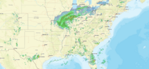
So the 0z GFS brings Beryl almost due North and even gives me some impacts! 5DA964D5-E159-44E8-ABB7-52DC3F364606.png
 
DISCUSSION AND OUTLOOK
----------------------
At 100 AM CDT (0600 UTC), the center of Tropical Storm Beryl was
located near latitude 24.9 North, longitude 94.3 West. Beryl is
moving toward the northwest near 13 mph (20 km/h) and this motion
should continue through today. A turn toward the north-northwest is
expected tonight, with a turn toward the north on Monday. On the
forecast track, the center of Beryl is expected to make landfall on
the Texas coast Monday morning.

Maximum sustained winds remain near 60 mph (95 km/h) with higher
gusts. Strengthening is expected, and Beryl is forecast to become a
hurricane again later today or tonight before it reaches the Texas
coast.

Tropical-storm-force winds extend outward up to 125 miles (205 km)
from the center. NOAA buoy 42002 in the western Gulf of Mexico
recently reported a sustained wind of 36 mph (58 km/h) and a gust of
47 mph (76 km/h).

The minimum central pressure based on observations from the Air
Force reconnaissance aircraft is 995 mb (29.38 inches).
 
Screenshot 2024-07-07 043632.png

Tropical Storm Beryl Discussion Number 35
NWS National Hurricane Center Miami FL AL022024
400 AM CDT Sun Jul 07 2024

The convective structure of Beryl continues to wax and wane, with
some deep convection now attempting to redevelop on the western and
southern side of the circulation, as evident on both GOES-16
satellite and radar imagery out of Brownsville, TX. The Air Force
Hurricane Hunter aircraft that departed the storm a few hours ago
provided a last fix with 700-mb winds of 56 kt in the northeastern
quadrant and a pressure of 995 mb. Since there has not been much
meaningful change to the tropical storm's structure since that time,
the initial intensity will remain 50 kt for this advisory.

Beryl continues to move northwestward, though a little more poleward
than before estimated at 320/10 kt. Over the next 24 hours, Beryl is
expected to turn north-northwestward or even northward before the
system makes landfall along the Texas coast in a little more than 24
hours. The track guidance this cycle has made a shift eastward and
is a little faster, and the NHC track forecast has also shifted in
that direction, in between the latest TCVN and HCCA consensus aids.
It is worth noting that some guidance, such as the GFS and HAFS-A
are even further east. After Beryl moves inland, the latest guidance
shows the system accelerating farther northeastward, ultimately
phasing with a mid-latitude trough over the Ohio Valley while it
transitions into a post-tropical cyclone.

Even though Beryl has not intensified over the past day, vertical
wind shear is in the process of decreasing below 10 kt over the
storm this morning, which should provide it with a 24-30 hour window
to start intensifying as it mixes out the dry air that prevented
persistent organized convection around the core. The fastest rate of
intensification is likely to occur right before landfall, and the
latest intensity forecast still shows Beryl becoming a hurricane
again in 24 hours, with some additional intensification possible
right up until landfall. This forecast is consistent with the
hurricane-regional models that also show the most significant
intensification right before Beryl makes landfall
. There also
remains some potential that Beryl could rapidly intensify before
landfall, with the latest SHIPS-RII suggesting this possibility is
2-3 times above climatology.

It is important to note that the average NHC track error at 24-36
hours is about 30-50 miles and the average intensity error is close
to one category.
Users are reminded to consider these uncertainties
when using the forecast information. Based on changes to the
forecast track this advisory, Hurricane Warnings have been extended
northward up to San Luis Pass.
 
Unfortunately but not surprisingly, DMAX appears to have been a factor leading to strengthening with increased convection collocated with the center. Recon confirms SLP drop to ~990 mb, a rather significant drop overnight.

We’ll see whether or not this increased convection holds as we go toward DMIN late today. With dry air/shear decreasing further and SSTs increasing, I expect it will.

With ~18 more hours over water projected til the ~3AM landfall, an increase in SSTs to ~88F, and another DMAX then being approached, I still think a strengthening cat 2 at landfall is quite possible with an outside chance to just reach cat 3.

IMG_9881.jpeg
 
Last edited:
Beryl looks to be slowing down a lot with a NNE wobble or turn. Gonna be interesting to see how far up the coast she can have over water. New center fix big jump north
 
BULLETIN
Tropical Storm Beryl Advisory Number 36
NWS National Hurricane Center Miami FL AL022024
1000 AM CDT Sun Jul 07 2024

...BERYL BECOMING BETTER ORGANIZED AND FORECAST TO BECOME A
HURRICANE BEFORE LANDFALL...
...PREPARATIONS SHOULD BE RUSHED TO COMPLETION...


SUMMARY OF 1000 AM CDT...1500 UTC...INFORMATION
-----------------------------------------------
LOCATION...25.9N 95.1W
ABOUT 195 MI...315 KM SSE OF MATAGORDA TEXAS
ABOUT 195 MI...310 KM SE OF CORPUS CHRISTI TEXAS
MAXIMUM SUSTAINED WINDS...65 MPH...100 KM/H
PRESENT MOVEMENT...NW OR 325 DEGREES AT 10 MPH...17 KM/H
MINIMUM CENTRAL PRESSURE...992 MB...29.29 INCHES


WATCHES AND WARNINGS
--------------------
CHANGES WITH THIS ADVISORY:

A Storm Surge Warning has issued for the coast of Texas from High
Island to Sabine Pass.

The Storm Surge Watch has been discontinued from the mouth of the
Rio Grande to Baffin Bay, Texas.

The Tropical Storm Watch for the Texas coast east of High Island to
Sabine Pass has been upgraded to a Tropical Storm Warning.

The Hurricane Watch for the Texas coast south of Baffin Bay to
the mouth of the Rio Grande has been discontinued.
 
Tropical Storm Beryl Discussion Number 36
NWS National Hurricane Center Miami FL AL022024
1000 AM CDT Sun Jul 07 2024

Beryl has become better organized this morning. Satellite images
show deep convection becoming more symmetric around the center, and
Brownsville radar has been showing an eyewall forming, although
still open on the northwest side. An Air Force Reserve Hurricane
Hunter aircraft recently reported maximum flight-level winds of 62
kt with the central pressure falling to 992 mb, so the initial wind
speed is raised to 55 kt.

Further intensification is likely as Beryl moves over very warm
waters within light shear conditions. Rapid intensification is a
distinct possibility if the core can become isolated from the dry
air that has been inhibiting intensification during the last day or
so. While there are no changes to the intensity forecast based on
the latest guidance, we are expecting Beryl to be intensifying up
until landfall early Monday, and people should be preparing for the
possibility of a category 2 hurricane landfall.

Beryl continues to move northwestward at 9 kt. The storm
should turn north-northwest this afternoon and make landfall
along the middle Texas coast early on Monday. The new forecast
is very close to the previous one, just a shade to the east. After
Beryl moves inland, the latest guidance still shows the system
accelerating farther northeastward and become a post-tropical
cyclone. This should bring the threat of flash flooding well into
Missouri.
FORECAST POSITIONS AND MAX WINDS

INIT 07/1500Z 25.9N 95.1W 55 KT 65 MPH
12H 08/0000Z 27.1N 95.7W 65 KT 75 MPH
24H 08/1200Z 29.2N 96.2W 75 KT 85 MPH...INLAND
36H 09/0000Z 31.4N 95.7W 35 KT 40 MPH...INLAND
48H 09/1200Z 33.6N 94.2W 25 KT 30 MPH...INLAND
60H 10/0000Z 36.2N 91.7W 25 KT 30 MPH...POST-TROP/INLAND
72H 10/1200Z 38.6N 89.2W 20 KT 25 MPH...POST-TROP/INLAND
96H 11/1200Z 42.8N 83.6W 20 KT 25 MPH...POST-TROP/INLAND
120H 12/1200Z 46.0N 79.0W 20 KT 25 MPH...POST-TROP/INLAND

$$
Forecaster Blake

*Edit: note the forecasted 85 mph as of 7AM CDT is when it has already been inland a few hours thus implying higher forecasted landfalling max winds.
 
Last edited:
Was really hoping for some decent rains here locally in northwest MS but looks like the heaviest amounts may stay west. Hoping we can get a more eastward track after landfall.
 
Back
Top