-
Hello, please take a minute to check out our awesome content, contributed by the wonderful members of our community. We hope you'll add your own thoughts and opinions by making a free account!
You are using an out of date browser. It may not display this or other websites correctly.
You should upgrade or use an alternative browser.
You should upgrade or use an alternative browser.
Tropical Tropical Storm Barry
- Thread starter accu35
- Start date
Well we will not see any rapid intensification at landfall with Barry. Most likely we will have a slowly strengthening high end TS or low end cat 1. Strengthening storms are always worse than a weakening system.
Basically a strengthening low end cat 1 can be as bad as a weakening mid/high end cat 1. But this is all highly variable.
Barry will at MAX be a low end cat one. It would be extremely shocking to see it wrap up and bomb out in the little time it has left
Yeah, I wouldnt count on that senario of a strengthening system being much worse than a weakening system here unless it rapidly organizes. Right now that strong convective burst is the reason for the strengthening which is likely fueled by the northern shear. To see real organization we need to see some sort of banding to start happening.
73 kt flight level winds per the recon.
Brent
Member
Snowflowxxl
Member
Who really cares how strong it is? The big thing here is going to be the flooding. LA and MS already in serious flooding problems, and 1-2 feet of rain is going to make that dramatically worse.
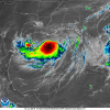
Starting to take on a buzz saw.
That big blow up is still a little misplaced tho
Is that blowup of convection just a wannabe CDO ? Seems kinda like it
Is that blowup of convection just a wannabe CDO ? Seems kinda like it
Yep. Looks good to the glance, but shear fueled.
Another note, this thing will be very hard to track visually with all the little vorts rotating around. One strong one is actually exiting the convective shield pretty fast right now.
Cad Wedge NC
Member
Yep, if that center reforms under the blow-up, this could get nasty real quick. Don't see that happening just yet.Looks impressive but keep in mind that the center is in the red circle, so still very lopsided
View attachment 21059
Brent
Member
Center drifted south between recon passesView attachment 21060
Really shows how broad the center is.
Attachments
Center drifted south between recon passesView attachment 21060
Probably from the intense -80 C convection trying to tug at it
Fountainguy97
Member
Mississippi Canyon,LA (MDJ) ASOS reports gust of 76 knots (87.5 mph) from S @ 1715Z KMDJ 121715Z AUTO 17066G76KT 1 3/4SM BR SCT014 SCT019 27/25 A2943 RMK A01
Henry2326
Member
After Michael, I will never say "never" to the short term forecast.I was shaking my head at the hwrf this morning. But it may have been onto something. This thing is really getting its act together fast now.
View attachment 21057


