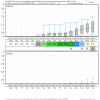
Yeah the criteria I defined for a winter storm was pretty loose but it included storms I mapped, or ones that were identified by NWS RAH, NCSU Climate Office or were cases where at least one of the following reliable, long-term stations recorded at least 1" of snow: Greensboro, Charlotte, Raleigh, or Wilmington to raise the sample size of events. Quite a few winter storms actually didn't make the cut at all, so these are only the storms that occurred when the MJO had amplitude.
When you look at Januarys where the MJO was in phase 7 for at least 3 successive days (1975, 1976, 1977, 1979, 1981, 1983, 1985, 1986, 1992, 2002, 2004, 2008, 2009, 2010, 2011, 2013, 2014, 2015, & 2016)
east-central NC picked up a winter storm a whopping 60% of the time!
Since 1985, the frequency has increased and we've picked up a winter storm nearly 80% of the time (10 of the last 13 cases) when the MJO was in phase 7 in January!!
So, now you can see why I'm so upbeat about our chances in the longer term when I see us potentially staring down the barrel of a phase 7 MJO event in early or perhaps mid-January.
A 3 out 4 hit rate is certainly not bad. If we get a phase 7 MJO event next month given the kind of pattern we may be looking at (-EPO/+TNH) I'd be tempted to push all my chips to the center of the table.


