DadOfJax
Member
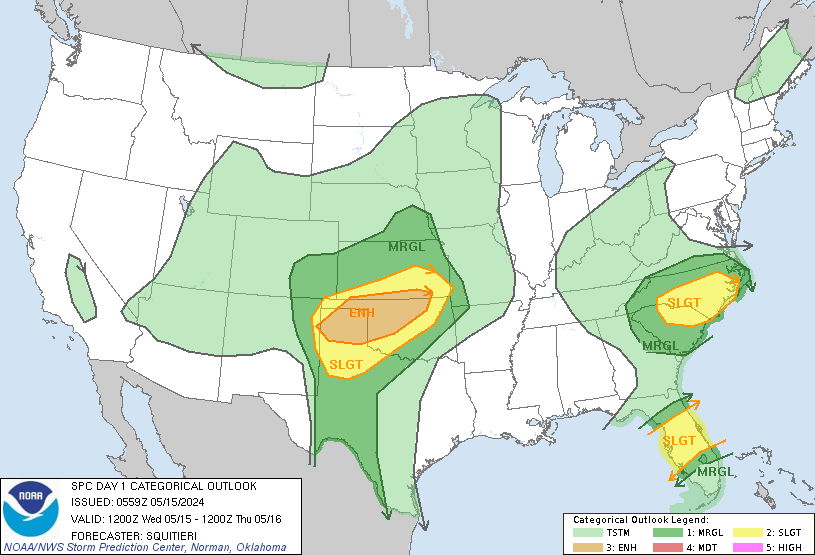
Yet ANOTHER severe bust for AL. While this one isnt as big of one, the local Mets and SPC have a ton of egg to get off their faces this year. Thank goodness for the rain!
and thank goodness for the bust!Yet ANOTHER severe bust for AL. While this one isnt as big of one, the local Mets and SPC have a ton of egg to get off their faces this year. Thank goodness for the rain!
")


Anyone try this yet?
Sent from my iPhone using Tapatalk
I was going to, but those small features for $99/yr with the Spring season almost over, I just couldn't do it.
Who wants a "threat" and let's go from there ...Well as for "threat" overnight into tomm. IMO the main question will be how much the "trash" from MCS today impacts Ga, where the mid levels were not worked over today. As for N/Central AL into TN, those areas will most likely be able to rebound in time.
Thoughts..??
Well as for "threat" overnight into tomm. IMO the main question will be how much the "trash" from MCS today impacts Ga, where the mid levels were not worked over today. As for N/Central AL into TN, those areas will most likely be able to rebound in time.
Thoughts..??
Wasn't like this yesterday...