Right, but the overall synoptic setup really isn’t very supportive of a storm, really not a awesome H5 setup, and really not a great push of cold. I think the best we see is a ZR chance for the mountains. We would need to see huge shifts, and we haven’t seen that lately especially since we’re at a point where the storm is on land, and getting worse.One set of 18z runs is not a reason to give up on a storm. That is beyond pessimistic. You need to have it go in the wrong direction at least 3-4 runs in a row to start throwing this one away
-
Hello, please take a minute to check out our awesome content, contributed by the wonderful members of our community. We hope you'll add your own thoughts and opinions by making a free account!
You are using an out of date browser. It may not display this or other websites correctly.
You should upgrade or use an alternative browser.
You should upgrade or use an alternative browser.
Ostrich December
- Thread starter SETNwx
- Start date
Members
Looks like a lot more ice to rain to me, vs the snow/sleet they were showing earlier, honestly it wouldn’t shock me if areas around 85/north pick up some freezing rain, then we switch over to rain, something similar to that one November 2019 setup
Looks like a lot more ice to rain to me, vs the snow/sleet they were showing earlier, honestly it wouldn’t shock me if areas around 85/north pick up some freezing rain, then we switch over to rain, something similar to that one November 2019 setup
Attachments
-
 3383EED3-4429-4C57-9630-870BF552FCA7.png212.4 KB · Views: 33
 -
 5BEBDFAF-8AD6-4E5D-9CF9-97BAE910A8CD.png227.3 KB · Views: 32
 -
 413ED63B-F39D-483C-9FCB-94A9E2038C0D.png216 KB · Views: 33
 -
 5F5A3AD9-F181-45DB-B96C-D026F6CC50A6.png225.9 KB · Views: 32
 -
 B2D77859-F244-4145-A77A-39B78AD403C0.png230.6 KB · Views: 28
 -
 9A173F6B-0053-49C5-9BED-DFAC068EF915.png228.4 KB · Views: 27
?
On the NAM the same thing is happening, energy in SW farther slightly farther south, and that energy in central Canada further south but the main soon to be 50/50 isn’t as good
Clem282340
Member
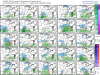
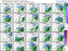
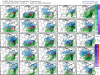
So it not looking good for a winter stormOn the NAM the same thing is happening, energy in SW farther slightly farther south, and that energy in central Canada further south but the main soon to be 50/50 isn’t as goodView attachment 57126
Over land or not we know a lot can change in 5 days. We are still in the game. ?
you can’t predict a winter storm from the NAM 5 days out. It’s better short range like 24 hours. Euro is typically good at this range need it to continue to strengthen cad like most recent run.So it not looking good for a winter storm
The “highway” to Madison, about 30 min out of DBQ @ 2 pm
I can’t remember the last time (if) we got a surprise where we went from modeled rain to snow. I think that every single surprise went from a little snow, to a lot of snow. January 2000, 2018, December 2010 for example. I wouldn’t hold my breath on this one if we’re routing for a southern trend.
iGRXY
Member
I don’t think anyone should’ve been expecting snow from this regardless. Freezing rain and sleet and mostly freezing rain was always going to be the likely scenario and that is still very much in play.
Icon looks better already 
L
Logan Is An Idiot 02
Guest
Oh yeah for sure. Once it trends rain it doesn't trend backI can’t remember the last time (if) we got a surprise where we went from modeled rain to snow. I think that every single surprise went from a little snow, to a lot of snow. January 2000, 2018, December 2010 for example. I wouldn’t hold my breath on this one if we’re routing for a southern trend.
Sent from my Pixel 3 using Tapatalk
I think jan 2016 several models had rain/freezing rain but it ended up trending colder and had more IP insteadI can’t remember the last time (if) we got a surprise where we went from modeled rain to snow. I think that every single surprise went from a little snow, to a lot of snow. January 2000, 2018, December 2010 for example. I wouldn’t hold my breath on this one if we’re routing for a southern trend.
YepI think jan 2016 several models had rain/freezing rain but it ended up trending colder and had more IP instead
Attachments
iGRXY
Member
CAD generally trends colder. Especially when it comes to Ice. One thing I’m noticing is models trying to run out LP into the CAD and that just isn’t going to happen. Seen that happen too many times just for it to trend back to more ice from 72 hrs inI think jan 2016 several models had rain/freezing rain but it ended up trending colder and had more IP instead
Yeah, but that happens with most every major Miller B setup. ZR is always way over modeled, and ends up being mostly sleet. December 2018 did that, and I think February 2014 did as well. Altogether in those setups, they had a very decent shot of winter precip. I just feel like we’re teetering between ZR and Rain.I think jan 2016 several models had rain/freezing rain but it ended up trending colder and had more IP instead
Blue_Ridge_Escarpment
Member
Yeah the LP is going to travel the path of least resistance and that isn’t right up in the middle of cold air.CAD generally trends colder. Especially when it comes to Ice. One thing I’m noticing is models trying to run out LP into the CAD and that just isn’t going to happen. Seen that happen too many times just for it to trend back to more ice from 72 hrs in
You are correct. In fact until within 36 hours out, CLT was expected to get predominantly rain, but the NAM really caught on to the strength of the wedge and the colder thermals the day before and the metro area ended up with a major sleet stormI think jan 2016 several models had rain/freezing rain but it ended up trending colder and had more IP instead


iGRXY
Member
Most likely scenario is the LP is going to move around the CAD and transition to the coast. The lows never make it above I20 before they transition. Now I will say if you’re expecting snow, that’s just likely not going to happen. The Euro from today’s 12z run had 850’s running around 43 degrees but did have 925s slightly below freezing so you could see some sleet but ZR is likely what we are going to see. Precip isn’t very heavy either but a good .6 - .9 looks possible which could really create some issues.Yeah the LP is going to travel the path of least resistance and that isn’t right up in the middle of cold air.