ForsythSnow
Moderator
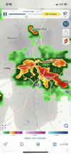
Now that my internet is back I can post a few pictures from Thursday as well as dashcam footage of getting stuck in it. View attachment 135853View attachment 135854
Now that my internet is back I can post a few pictures from Thursday as well as dashcam footage of getting stuck in it. View attachment 135853View attachment 135854
Now that my internet is back I can post a few pictures from Thursday as well as dashcam footage of getting stuck in it. View attachment 135853View attachment 135854
Yeah it threw down for a minute. Wilmington was a mess with lots of poor drainage flooding.I/We received close too 8~10 inches of precipitation these past 3 days.. With MOAR incoming.. Sheesh!
Euro is probably over cooking 850s again but it has widespread 25-26c 850s across NC next Sunday which would correspond to highs well over 100. The setup favors us getting quite hot with the heat ridge in the west getting flattened but expanding east linking to a short duration ridge bridge to the WAR and a decent chunk of higher 850s getting released into the area.
Yeah the gfs is the way out for us with a parade of mcs riding to our north pushing a composite ofb south and eroding the ridge a bit. Given how hot the rdu sensor seems to run its hard to say where the airport ends up but I'd go with like 97 Saturday 99 Sunday. That eps mean that @KyloG posted probably won't be far offGFS has upper 90s which seems more reasonable.
Sent from my iPhone using Tapatalk
Literally everyday for y’all!Wicked outflow boundaryView attachment 135873

40 days til Meteorological Fall!50 days til Meteorological Fall
