ATLwxfan
Member
Literally the worst was being without power in below zero windchills for 48 hours straight.
Touché
Sent from my iPhone using Tapatalk
Literally the worst was being without power in below zero windchills for 48 hours straight.


Horrific for those wanting fall airInterestingly enough it’s not horrific at all with daytime temps for us in the SE.
Several years ago we went 2 days without power (no heat?) middle ofLiterally the worst was being without power in below zero windchills for 48 hours straight.
Horrific for those wanting fall air
No. This was horrific. I’ll take that upper 70s any day over this.

It was supposed to be cloudy with intermittent showers. The weather models suck.I don't get it...?
The pattern flipped like a light switch after that though. I remember it being a pretty cool and rainy fall overall.
-NAO cad
Hey that grass is pretty damn green for your backyard drought
Hey that grass is pretty damn green for your backyard drought
Onset ice
Wake county’s natural hoseIt's called a hose dork.
Let's goooooooooI know your backyard boutta get it Shane

Been a while since I’ve heard about them … maybe they’re run by Facebook lolAre the Bleaklies running late? Anyone know?
Pretty impressive.Areas around Columbus, GA have been getting rocked by rain this morning and it’s still going.View attachment 92044View attachment 92045
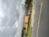
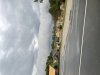
How hard is it to turn left out of your neighborhood?Holy cloud structure .. shelfie in October OKAY! Can even hear the thunder in the distance closing in… it’s fast as hell too View attachment 92078View attachment 92079
Not mine I was driving home to the RAIN CAPITALHow hard is it to turn left out of your neighborhood?